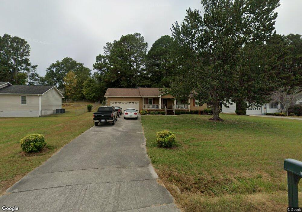
609 Richardson Rd NE Dalton, GA 30721
Estimated Value: $229,773 - $265,000
--
Bed
2
Baths
1,258
Sq Ft
$196/Sq Ft
Est. Value
About This Home
This home is located at 609 Richardson Rd NE, Dalton, GA 30721 and is currently estimated at $246,943, approximately $196 per square foot. 609 Richardson Rd NE is a home located in Whitfield County with nearby schools including Dawnville Elementary School and Coahulla Creek High School.
Ownership History
Date
Name
Owned For
Owner Type
Purchase Details
Closed on
Oct 23, 2020
Sold by
Defore Deborah L
Bought by
Defore Deboral L and Defore Randall C
Current Estimated Value
Home Financials for this Owner
Home Financials are based on the most recent Mortgage that was taken out on this home.
Original Mortgage
$108,500
Outstanding Balance
$73,796
Interest Rate
2.9%
Mortgage Type
New Conventional
Estimated Equity
$173,147
Purchase Details
Closed on
Dec 18, 2001
Sold by
Defore Randall C and Defore Eborah L
Bought by
Defore Deborah L
Purchase Details
Closed on
Jun 1, 1993
Bought by
Defore Randall C and Defore Eborah L
Create a Home Valuation Report for This Property
The Home Valuation Report is an in-depth analysis detailing your home's value as well as a comparison with similar homes in the area
Home Values in the Area
Average Home Value in this Area
Purchase History
| Date | Buyer | Sale Price | Title Company |
|---|---|---|---|
| Defore Deboral L | -- | -- | |
| Defore Deborah L | -- | -- | |
| Defore Randall C | -- | -- |
Source: Public Records
Mortgage History
| Date | Status | Borrower | Loan Amount |
|---|---|---|---|
| Open | Defore Deboral L | $108,500 |
Source: Public Records
Tax History Compared to Growth
Tax History
| Year | Tax Paid | Tax Assessment Tax Assessment Total Assessment is a certain percentage of the fair market value that is determined by local assessors to be the total taxable value of land and additions on the property. | Land | Improvement |
|---|---|---|---|---|
| 2024 | $1,500 | $85,174 | $11,200 | $73,974 |
| 2023 | $1,500 | $57,042 | $6,300 | $50,742 |
| 2022 | $1,080 | $45,159 | $6,300 | $38,859 |
| 2021 | $1,080 | $45,159 | $6,300 | $38,859 |
| 2020 | $1,105 | $45,159 | $6,300 | $38,859 |
| 2019 | $1,118 | $45,159 | $6,300 | $38,859 |
| 2018 | $1,071 | $43,268 | $6,300 | $36,968 |
| 2017 | $1,071 | $43,268 | $6,300 | $36,968 |
| 2016 | $942 | $39,922 | $6,300 | $33,622 |
| 2014 | $876 | $39,922 | $6,300 | $33,622 |
| 2013 | -- | $39,922 | $6,300 | $33,622 |
Source: Public Records
Map
Nearby Homes
- 4363 Bass Dr NE
- 620 Lower Dawnville Rd NE
- 1070 Dawnville Rd NE
- 4685 Mitchell Bridge Rd NE
- 1507 Lynnwood Dr NE
- 4960 Mark Brown Rd NE
- 3871 Miller Dr NE
- 162 Alcoa Dr
- 0 Rollins Ketchum Rd
- 1259 Rollins Ketchum Rd
- 3922 Miller Dr NE
- 5111 Mark Brown Rd NE
- 685 Goswick Rd
- Lot 63 Cherokee Dr NE
- 230 Indian Dr NE
- Lot 30-33 Indian Trail NE
- Lt 30-33 Indian Dr NE
- 111 Arthur St
- 0 Monterey Drve Unit 127837
- 421 Coahulla Creek Dr
- 605 Richardson Rd NE
- 613 Richardson Rd NE
- 601 Richardson Rd NE
- 647 Champagne Trail
- 617 Richardson Rd NE
- 643 Champagne Trail
- 651 Champagne Trail
- 655 Champagne Trail
- 597 Richardson Rd NE
- 659 Champagne Trail
- 701 Vintage Ln
- 131 Walden Way
- 131 Walden Way
- 637 Richardson Rd NE
- 663 Champagne Trail
- 132 Walden Way
- 593 Richardson Rd NE
- 702 Vintage Ln
- 664 Champagne Trail
- 705 Vintage Ln