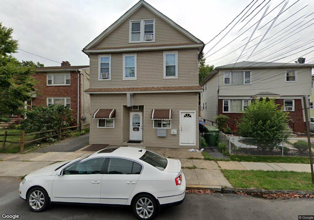
609 Roselle St Unit 1 Linden, NJ 07036
Estimated Value: $807,182
--
Bed
--
Bath
2,256
Sq Ft
$358/Sq Ft
Est. Value
About This Home
This home is located at 609 Roselle St Unit 1, Linden, NJ 07036 and is currently estimated at $807,182, approximately $357 per square foot. 609 Roselle St Unit 1 is a home located in Union County with nearby schools including Number 1, Joseph E. Soehl Middle School, and Linden High School.
Ownership History
Date
Name
Owned For
Owner Type
Purchase Details
Closed on
Jul 13, 2017
Sold by
Seegar Diane C and Estate Of Bernhardt Seeger Jr
Bought by
Northeast Real Estate Partners Llc
Current Estimated Value
Purchase Details
Closed on
Mar 20, 1990
Bought by
Seeger Bernhardt
Create a Home Valuation Report for This Property
The Home Valuation Report is an in-depth analysis detailing your home's value as well as a comparison with similar homes in the area
Home Values in the Area
Average Home Value in this Area
Purchase History
| Date | Buyer | Sale Price | Title Company |
|---|---|---|---|
| Northeast Real Estate Partners Llc | $370,000 | Absolute Titlte Ag Of Nj Ll | |
| Seeger Bernhardt | $150,000 | -- |
Source: Public Records
Tax History Compared to Growth
Tax History
| Year | Tax Paid | Tax Assessment Tax Assessment Total Assessment is a certain percentage of the fair market value that is determined by local assessors to be the total taxable value of land and additions on the property. | Land | Improvement |
|---|---|---|---|---|
| 2025 | $9,929 | $141,200 | $46,000 | $95,200 |
| 2024 | $9,712 | $141,200 | $46,000 | $95,200 |
| 2023 | $9,712 | $141,200 | $46,000 | $95,200 |
| 2022 | $9,763 | $141,200 | $46,000 | $95,200 |
| 2021 | $9,812 | $141,200 | $46,000 | $95,200 |
| 2020 | $9,760 | $141,200 | $46,000 | $95,200 |
| 2019 | $9,727 | $141,200 | $46,000 | $95,200 |
| 2018 | $9,724 | $141,200 | $46,000 | $95,200 |
| 2017 | $8,166 | $121,200 | $46,000 | $75,200 |
| 2016 | $7,910 | $121,200 | $46,000 | $75,200 |
| 2015 | $7,608 | $121,200 | $46,000 | $75,200 |
| 2014 | $7,460 | $121,200 | $46,000 | $75,200 |
Source: Public Records
Map
Nearby Homes
- 534 Monmouth Ave
- 514 E Elm St
- 806 Roselle St
- 510 E Blancke St
- 633 Maple Ave
- 307 Hussa St
- 721 E Curtis St
- 731 Essex Ave
- 901 Clark St
- 201 Hussa St
- 309 Lincoln St
- 812 Lincoln St
- 832 Bergen Ave
- 414 3rd Ave
- 807 Carnegie St
- 812 Washington Ave
- 30 E Henry St
- 1220 Lincoln St
- 226 Pennsylvania Railroad Ave
- 104 E Elizabeth Ave
- 609 Roselle St
- 611 Roselle St
- 601 Roselle St Unit 603
- 557 Monmouth Ave
- 615 Roselle St
- 556 E Elm St
- 570 E Elm St
- 551 Monmouth Ave
- 552 E Elm St
- 552 E Elm St Unit 2
- 549 Monmouth Ave
- 550 E Elm St
- 604 Roselle St
- 608 Roselle St
- 600 Roselle St
- 614 Roselle St
- 526 Roselle St
- 543 Monmouth Ave
- 542 E Elm St Unit 544
- 620 Roselle St