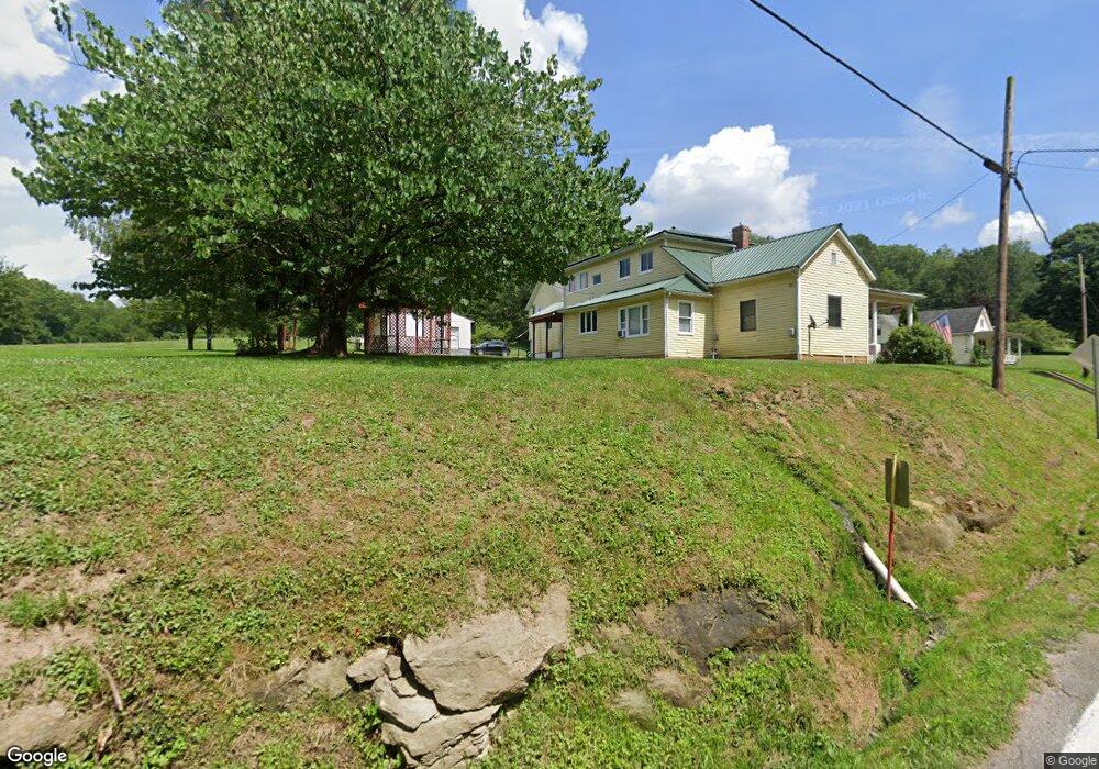
609 Rr 1 Mount Clare, WV 26408
Estimated Value: $174,000 - $183,000
3
Beds
1
Bath
1,144
Sq Ft
$156/Sq Ft
Est. Value
About This Home
This home is located at 609 Rr 1, Mount Clare, WV 26408 and is currently estimated at $178,345, approximately $155 per square foot. 609 Rr 1 is a home located in Harrison County.
Create a Home Valuation Report for This Property
The Home Valuation Report is an in-depth analysis detailing your home's value as well as a comparison with similar homes in the area
Tax History Compared to Growth
Tax History
| Year | Tax Paid | Tax Assessment Tax Assessment Total Assessment is a certain percentage of the fair market value that is determined by local assessors to be the total taxable value of land and additions on the property. | Land | Improvement |
|---|---|---|---|---|
| 2025 | $2,149 | $92,220 | $20,040 | $72,180 |
| 2024 | $2,149 | $88,260 | $20,040 | $68,220 |
| 2023 | $2,025 | $82,680 | $20,040 | $62,640 |
| 2022 | $261 | $42,180 | $17,760 | $24,420 |
| 2021 | $550 | $67,260 | $17,760 | $49,500 |
| 2020 | $545 | $67,260 | $17,760 | $49,500 |
| 2019 | $542 | $67,020 | $17,760 | $49,260 |
| 2018 | $540 | $67,020 | $17,760 | $49,260 |
| 2017 | $522 | $65,700 | $17,760 | $47,940 |
| 2016 | $506 | $64,860 | $17,100 | $47,760 |
| 2015 | $490 | $63,180 | $16,620 | $46,560 |
| 2014 | $479 | $62,220 | $15,720 | $46,500 |
Source: Public Records
Map
Nearby Homes
- 2189 Chub Run Rd
- 7 Mayflower Ln
- 4950 Buckhannon Pike
- 216 Zachs Run Rd
- 82 Robinwood Dr
- 7644 Buckhannon Pike
- 9 Overlook Dr
- 3 Overlook Dr
- 15 Overlook Dr
- 8037 Maple Ave
- 8712 Cost Ave
- 8688 Cost Ave
- 1 Overlook Dr
- 4184 Mount Clare Rd
- 44 Skyview Dr
- 11 Skyview Dr
- 47 Skyview Dr
- 5 Skyview Dr
- 45 Skyview Dr
- 6 Skyview Dr