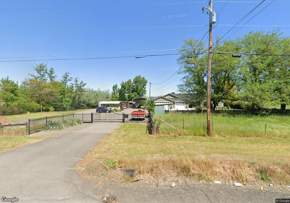
6090 Table Rock Rd Central Point, OR 97502
Estimated Value: $544,000 - $648,102
3
Beds
2
Baths
2,244
Sq Ft
$271/Sq Ft
Est. Value
About This Home
This home is located at 6090 Table Rock Rd, Central Point, OR 97502 and is currently estimated at $607,367, approximately $270 per square foot. 6090 Table Rock Rd is a home located in Jackson County with nearby schools including Sams Valley Elementary School, Scenic Middle School, and Crater High School.
Ownership History
Date
Name
Owned For
Owner Type
Purchase Details
Closed on
Mar 4, 2015
Sold by
Mcmeen James S and Mcmeen Sharon D
Bought by
Mcmeen Loving Trust
Current Estimated Value
Home Financials for this Owner
Home Financials are based on the most recent Mortgage that was taken out on this home.
Original Mortgage
$42,000
Interest Rate
3.57%
Mortgage Type
Unknown
Purchase Details
Closed on
Aug 4, 2011
Sold by
Mcmeen James S and Mcmeen Sharon D
Bought by
Mcmeen James S and Mcmeen Sharon D
Home Financials for this Owner
Home Financials are based on the most recent Mortgage that was taken out on this home.
Original Mortgage
$70,000
Interest Rate
4.46%
Mortgage Type
Credit Line Revolving
Purchase Details
Closed on
Jul 29, 2008
Sold by
Mcmeen James S and Mcmeen Sharon D
Bought by
Mcmeen James S and Mcmeen Sharon D
Create a Home Valuation Report for This Property
The Home Valuation Report is an in-depth analysis detailing your home's value as well as a comparison with similar homes in the area
Home Values in the Area
Average Home Value in this Area
Purchase History
| Date | Buyer | Sale Price | Title Company |
|---|---|---|---|
| Mcmeen Loving Trust | -- | Amerititle | |
| Mcmeen James S | -- | Amerititle | |
| Mcmeen James S | -- | Amerititle | |
| Mcmeen James S | -- | Amerititle | |
| Mcmeen James S | -- | None Available |
Source: Public Records
Mortgage History
| Date | Status | Borrower | Loan Amount |
|---|---|---|---|
| Closed | Mcmeen James S | $42,000 | |
| Closed | Mcmeen James S | $70,000 |
Source: Public Records
Tax History Compared to Growth
Tax History
| Year | Tax Paid | Tax Assessment Tax Assessment Total Assessment is a certain percentage of the fair market value that is determined by local assessors to be the total taxable value of land and additions on the property. | Land | Improvement |
|---|---|---|---|---|
| 2025 | $3,714 | $302,320 | $106,760 | $195,560 |
| 2024 | $3,714 | $293,520 | $103,650 | $189,870 |
| 2023 | $3,591 | $284,980 | $100,630 | $184,350 |
| 2022 | $3,514 | $284,980 | $100,630 | $184,350 |
| 2021 | $3,415 | $276,680 | $97,710 | $178,970 |
| 2020 | $3,315 | $268,630 | $94,860 | $173,770 |
| 2019 | $3,238 | $253,220 | $89,420 | $163,800 |
| 2018 | $3,138 | $245,850 | $86,810 | $159,040 |
| 2017 | $3,064 | $245,850 | $86,810 | $159,040 |
| 2016 | $2,254 | $175,650 | $76,560 | $99,090 |
| 2015 | $2,150 | $175,650 | $76,560 | $99,090 |
| 2014 | $2,098 | $165,580 | $72,170 | $93,410 |
Source: Public Records
Map
Nearby Homes
- 225 Wilson Rd
- 644 Raven
- 6850 Downing Rd Unit 44
- 6850 Downing Rd Unit 65
- 2598 St James Way
- 2035 Rabun Way
- 1729 E Gregory Rd
- 2330 Savannah Dr
- 5156 Peace Ln
- 2248 Evan Way
- 1409 Twin Rocks Dr
- 2225 New Haven Dr
- 1182 E Justice Rd
- 4922 Gebhard Rd
- 4824 Airway Dr Unit 371W06BB410
- 4676 Industry Dr
- 4595 Table Rock Rd
- 705 Mountain Ave
- 6348 Crater Lake Hwy
- 862 Enterprise Dr
- 6134 Table Rock Rd
- 6117 Table Rock Rd
- 6079 Table Rock Rd
- 6103 Table Rock Rd
- 6121 Table Rock Rd
- 6119 Table Rock Rd
- 6035 Table Rock Rd
- 46 Orr Dr
- 35 Orr Dr
- 6198 Table Rock Rd
- 6023 Table Rock Rd
- 64 Orr Dr
- 77 Orr Dr
- 96 Orr Dr
- 5969 Table Rock Rd
- 87 Orr Dr Unit 1
- 87 Orr Dr
- 6240 Table Rock Rd
- 110 Orr Dr
- 6205 Table Rock Rd