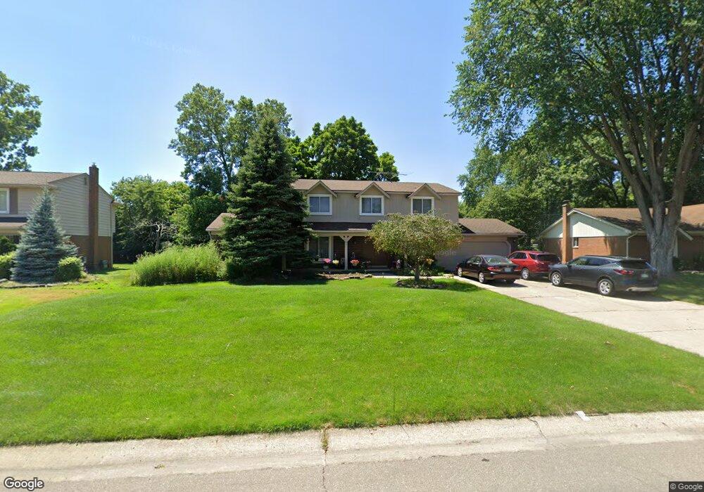
6090 Wynford Dr West Bloomfield, MI 48322
Estimated Value: $400,857 - $473,000
4
Beds
3
Baths
2,075
Sq Ft
$212/Sq Ft
Est. Value
About This Home
This home is located at 6090 Wynford Dr, West Bloomfield, MI 48322 and is currently estimated at $439,964, approximately $212 per square foot. 6090 Wynford Dr is a home located in Oakland County with nearby schools including Sheiko Elementary School, West Bloomfield Middle School, and Bloomfield Maples Montessori.
Ownership History
Date
Name
Owned For
Owner Type
Purchase Details
Closed on
Jul 6, 2000
Sold by
Danuloff Ronald
Bought by
Dallo Nabil
Current Estimated Value
Home Financials for this Owner
Home Financials are based on the most recent Mortgage that was taken out on this home.
Original Mortgage
$26,500
Outstanding Balance
$9,436
Interest Rate
8.16%
Estimated Equity
$430,528
Create a Home Valuation Report for This Property
The Home Valuation Report is an in-depth analysis detailing your home's value as well as a comparison with similar homes in the area
Home Values in the Area
Average Home Value in this Area
Purchase History
| Date | Buyer | Sale Price | Title Company |
|---|---|---|---|
| Dallo Nabil | $265,000 | -- |
Source: Public Records
Mortgage History
| Date | Status | Borrower | Loan Amount |
|---|---|---|---|
| Open | Dallo Nabil | $26,500 |
Source: Public Records
Tax History Compared to Growth
Tax History
| Year | Tax Paid | Tax Assessment Tax Assessment Total Assessment is a certain percentage of the fair market value that is determined by local assessors to be the total taxable value of land and additions on the property. | Land | Improvement |
|---|---|---|---|---|
| 2024 | $2,291 | $156,740 | $0 | $0 |
| 2022 | $2,194 | $139,580 | $32,000 | $107,580 |
| 2021 | $3,334 | $137,290 | $0 | $0 |
| 2020 | $2,150 | $132,690 | $32,000 | $100,690 |
| 2018 | $3,214 | $115,360 | $27,800 | $87,560 |
| 2015 | -- | $90,750 | $0 | $0 |
| 2014 | -- | $83,950 | $0 | $0 |
| 2011 | -- | $77,520 | $0 | $0 |
Source: Public Records
Map
Nearby Homes
- 3035 Parkland Dr
- 6564 Alderley Way
- 6545 Post Oak Dr
- 5764 Bloomfield Glens Rd
- 5622 Powder Horn Dr
- 5780 Swan Lake Ct
- 5815 Bloomfield Glens Rd
- 6151 Orchard Lake Rd Unit 103
- 3104 Spring St
- 6882 Post Oak Dr
- 6145 Orchard Lake Rd Unit 204
- 3865 Stonecrest Rd
- 6843 Leslee Crest Dr
- 5415 Fairway Ln
- 5321 Fairway Ln Unit 7
- 5881 Naneva Ct
- 6222 Pepper Hill St
- 5312 Cambourne Place
- 4161 Breckenridge Dr
- 7251 N Briarcliff Knoll Dr
- 6072 Wynford Dr
- 6108 Wynford Dr
- 6205 Northfield Rd
- 6233 Northfield Rd
- 6054 Wynford Dr
- 6093 Wynford Dr
- 6126 Wynford Dr
- 6119 Wynford Dr
- 6063 Wynford Dr
- 6185 Northfield Rd
- 6036 Wynford Dr
- 6045 Wynford Dr
- 6265 Northfield Rd
- 6141 Wynford Dr
- 6144 Wynford Dr
- 6078 Ledgeway Dr
- 6222 Northfield Rd
- 6096 Ledgeway Dr
- 6060 Ledgeway Dr
- 6200 Northfield Rd