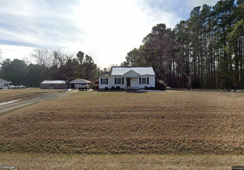
6093 Nc Highway 96 Oxford, NC 27565
Estimated Value: $176,000 - $252,000
--
Bed
1
Bath
1,155
Sq Ft
$186/Sq Ft
Est. Value
About This Home
This home is located at 6093 Nc Highway 96, Oxford, NC 27565 and is currently estimated at $214,314, approximately $185 per square foot. 6093 Nc Highway 96 is a home located in Granville County with nearby schools including West Oxford Elementary School, Northern Granville Middle School, and J.F. Webb High School.
Ownership History
Date
Name
Owned For
Owner Type
Purchase Details
Closed on
Jan 30, 2017
Sold by
Tatum William Byron
Bought by
Myers Annette P
Current Estimated Value
Purchase Details
Closed on
Mar 2, 2012
Sold by
Gresham Douglas Neil and Gresham Catherine Lynn
Bought by
Tatum William Byron
Home Financials for this Owner
Home Financials are based on the most recent Mortgage that was taken out on this home.
Original Mortgage
$80,750
Interest Rate
3.9%
Mortgage Type
New Conventional
Create a Home Valuation Report for This Property
The Home Valuation Report is an in-depth analysis detailing your home's value as well as a comparison with similar homes in the area
Home Values in the Area
Average Home Value in this Area
Purchase History
| Date | Buyer | Sale Price | Title Company |
|---|---|---|---|
| Myers Annette P | $109,000 | None Available | |
| Tatum William Byron | $85,000 | None Available |
Source: Public Records
Mortgage History
| Date | Status | Borrower | Loan Amount |
|---|---|---|---|
| Previous Owner | Tatum William Byron | $80,750 |
Source: Public Records
Tax History Compared to Growth
Tax History
| Year | Tax Paid | Tax Assessment Tax Assessment Total Assessment is a certain percentage of the fair market value that is determined by local assessors to be the total taxable value of land and additions on the property. | Land | Improvement |
|---|---|---|---|---|
| 2025 | $939 | $118,937 | $25,784 | $93,153 |
| 2024 | $939 | $118,937 | $25,784 | $93,153 |
| 2023 | $934 | $72,066 | $14,995 | $57,071 |
| 2022 | $746 | $72,066 | $14,995 | $57,071 |
| 2021 | $697 | $72,066 | $14,995 | $57,071 |
| 2020 | $697 | $72,066 | $14,995 | $57,071 |
| 2019 | $697 | $72,066 | $14,995 | $57,071 |
| 2018 | $697 | $72,066 | $14,995 | $57,071 |
| 2016 | $788 | $65,566 | $15,052 | $50,514 |
| 2015 | $621 | $62,231 | $15,052 | $47,179 |
| 2014 | $614 | $62,231 | $15,052 | $47,179 |
| 2013 | -- | $59,760 | $15,052 | $44,708 |
Source: Public Records
Map
Nearby Homes
- 6049 Mulberry Ln
- 6063 N Carolina 96
- 2665 Bodie Currin Rd
- 2605 Joe Pruitt Rd
- 616 Roxboro Rd
- 127 Daniel St
- 200 W Westbury Dr
- 103 Alston Ct
- 609 N Country Club Dr
- 204 Cardinal Ct
- 206 Cardinal Ct
- 316 Keeneland Dr
- 735 Baker St
- 6035 Mary Lee Dr
- 722 Baker St
- 611 College St
- 511 Broad St
- 6527 U S 15
- 410 College St
- 96 North St
- 6093 State Highway 96
- 6089 Nc Highway 96
- 6094 Nc Highway 96
- 6054 Mulberry Ln
- 6063 Nc 96 Hwy
- Lot 44 Mulberry Ln
- Lot 42 Mulberry Ln
- Lot 43 Mulberry Ln
- Lot 39 Mulberry Ln
- lot 40 Mulberry Ln
- 6052 Mulberry Ln
- LOT 46 Mulberry Ln
- LOT 45 Mulberry Ln
- 6051 Mulberry Ln
- 6047 Mulberry Ln
- 6052 Mulberry Ln Unit 44
- 6051 Mulberry Ln Unit 40
- 6047 Mulberry Ln Unit 42
- 6050 Mulberry Ln Unit 43
- Lot 43 Mulberry Ln Unit 43