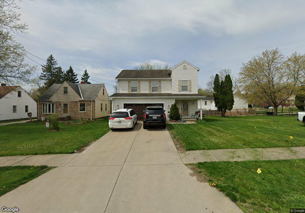
6094 Dunham Rd Maple Heights, OH 44137
Estimated Value: $238,000 - $282,550
3
Beds
3
Baths
2,026
Sq Ft
$132/Sq Ft
Est. Value
About This Home
This home is located at 6094 Dunham Rd, Maple Heights, OH 44137 and is currently estimated at $266,888, approximately $131 per square foot. 6094 Dunham Rd is a home located in Cuyahoga County with nearby schools including Abraham Lincoln Elementary School, Rockside/ J.F. Kennedy School, and Barack Obama School.
Ownership History
Date
Name
Owned For
Owner Type
Purchase Details
Closed on
Jul 21, 2000
Sold by
Alai Mario A
Bought by
Woods Cynthia and Carr Candace
Current Estimated Value
Home Financials for this Owner
Home Financials are based on the most recent Mortgage that was taken out on this home.
Original Mortgage
$147,600
Outstanding Balance
$49,327
Interest Rate
8.31%
Estimated Equity
$217,561
Purchase Details
Closed on
Mar 26, 1999
Sold by
Mahoney Chris and Gaul Francis E
Bought by
Alai Mario A
Purchase Details
Closed on
Jul 11, 1990
Sold by
Fancourt Phyllis
Bought by
Mahoney Chris
Purchase Details
Closed on
Jan 1, 1989
Bought by
Fancourt Phyllis
Create a Home Valuation Report for This Property
The Home Valuation Report is an in-depth analysis detailing your home's value as well as a comparison with similar homes in the area
Home Values in the Area
Average Home Value in this Area
Purchase History
| Date | Buyer | Sale Price | Title Company |
|---|---|---|---|
| Woods Cynthia | $164,000 | -- | |
| Alai Mario A | $5,107 | -- | |
| Mahoney Chris | $9,000 | -- | |
| Fancourt Phyllis | -- | -- |
Source: Public Records
Mortgage History
| Date | Status | Borrower | Loan Amount |
|---|---|---|---|
| Open | Woods Cynthia | $147,600 |
Source: Public Records
Tax History
| Year | Tax Paid | Tax Assessment Tax Assessment Total Assessment is a certain percentage of the fair market value that is determined by local assessors to be the total taxable value of land and additions on the property. | Land | Improvement |
|---|---|---|---|---|
| 2025 | $8,009 | $93,800 | $7,455 | $86,345 |
| 2024 | $8,539 | $93,800 | $7,455 | $86,345 |
| 2023 | $6,003 | $53,240 | $6,020 | $47,220 |
| 2022 | $5,186 | $53,240 | $6,020 | $47,220 |
| 2021 | $5,560 | $53,240 | $6,020 | $47,220 |
| 2020 | $5,032 | $43,650 | $4,940 | $38,710 |
| 2019 | $5,016 | $124,700 | $14,100 | $110,600 |
| 2018 | $4,886 | $43,650 | $4,940 | $38,710 |
| 2017 | $5,102 | $43,650 | $4,340 | $39,310 |
| 2016 | $4,936 | $43,650 | $4,340 | $39,310 |
| 2015 | $4,742 | $43,650 | $4,340 | $39,310 |
| 2014 | $4,742 | $45,010 | $4,480 | $40,530 |
Source: Public Records
Map
Nearby Homes
- 6089 Dunham Rd
- 6045 Dunham Rd
- 15401 Walvern Blvd
- 15405 Turney Rd
- 14956 Carol Dr
- 15513 Walvern Blvd
- 15522 Turney Rd
- 15701 Walvern Blvd
- 5948 Dunham Rd
- 15712 Mendota Ave
- 15521 Corkhill Rd
- 14357 Turney Rd
- 16014 Turney Rd
- SL15 Rocky Top Ct
- 14808 James Ave
- 15 Rockytop Ct
- 14320 Janice Dr
- 6378 Valley Ranch Dr
- 6372 Valley Ranch Dr
- 13810 Martin Dr
- 6098 Dunham Rd
- 6100 Dunham Rd
- 6096 Dunham Rd
- 6102 Dunham Rd
- 15000 Carol Dr
- 6106 Dunham Rd
- 14992 Carol Dr
- 14988 Carol Dr
- 6101 Dunham Rd
- 6110 Dunham Rd
- 15201 Shirley Ave
- 14901 Turney Rd
- 6090 Dunham Rd
- 14984 Carol Dr
- 6093 Dunham Rd
- 6086 Dunham Rd
- 15205 Shirley Ave
- 15003 Turney Rd
- 15214 Walvern Blvd
- 6120 Dunham Rd
Your Personal Tour Guide
Ask me questions while you tour the home.