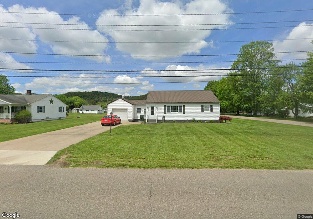
6097 E State Rd Newcomerstown, OH 43832
Estimated Value: $142,000 - $184,720
2
Beds
1
Bath
1,261
Sq Ft
$133/Sq Ft
Est. Value
About This Home
This home is located at 6097 E State Rd, Newcomerstown, OH 43832 and is currently estimated at $167,680, approximately $132 per square foot. 6097 E State Rd is a home located in Tuscarawas County with nearby schools including West Elementary School, East Elementary School, and Newcomerstown Middle School.
Ownership History
Date
Name
Owned For
Owner Type
Purchase Details
Closed on
Jun 17, 2010
Sold by
Rieger Susan L
Bought by
Little Brian A and Little Harriett J
Current Estimated Value
Home Financials for this Owner
Home Financials are based on the most recent Mortgage that was taken out on this home.
Original Mortgage
$101,500
Outstanding Balance
$67,243
Interest Rate
5.05%
Mortgage Type
New Conventional
Estimated Equity
$100,437
Purchase Details
Closed on
Jul 14, 2000
Sold by
Ray Edward E
Bought by
Yanai Andrew P and Yanai Doris J
Purchase Details
Closed on
May 15, 1991
Sold by
Park Lola M
Bought by
Ray Edward E
Create a Home Valuation Report for This Property
The Home Valuation Report is an in-depth analysis detailing your home's value as well as a comparison with similar homes in the area
Home Values in the Area
Average Home Value in this Area
Purchase History
| Date | Buyer | Sale Price | Title Company |
|---|---|---|---|
| Little Brian A | $93,900 | Attorney | |
| Yanai Andrew P | $72,000 | -- | |
| Ray Edward E | $50,500 | -- |
Source: Public Records
Mortgage History
| Date | Status | Borrower | Loan Amount |
|---|---|---|---|
| Open | Little Brian A | $101,500 |
Source: Public Records
Tax History
| Year | Tax Paid | Tax Assessment Tax Assessment Total Assessment is a certain percentage of the fair market value that is determined by local assessors to be the total taxable value of land and additions on the property. | Land | Improvement |
|---|---|---|---|---|
| 2024 | $1,588 | $124,110 | $27,750 | $96,360 |
| 2023 | $1,588 | $124,110 | $27,750 | $96,360 |
| 2022 | $1,512 | $43,439 | $9,713 | $33,726 |
| 2021 | $1,267 | $33,674 | $9,069 | $24,605 |
| 2020 | $1,278 | $33,674 | $9,069 | $24,605 |
| 2019 | $1,294 | $33,674 | $9,069 | $24,605 |
| 2018 | $1,129 | $28,410 | $7,650 | $20,760 |
| 2017 | $1,131 | $28,410 | $7,650 | $20,760 |
| 2016 | $1,133 | $28,410 | $7,650 | $20,760 |
| 2014 | $1,119 | $28,000 | $7,770 | $20,230 |
| 2013 | $1,128 | $28,000 | $7,770 | $20,230 |
Source: Public Records
Map
Nearby Homes
- 14098 Washington Ave
- 782 E State St
- 346 N Bridge St
- 4980 Beagle Club Rd
- 750 Cross St
- 771 Cross St
- 298 Mckinley Ave
- 453 Wood Ave
- 60883 U S 36
- 950 Beech St
- 5619 Post Boy Rd
- 3200 Centenary Hill Rd SW
- 5415 Post Boy Rd
- 25495 County Road 103
- 16691 Dog Rd
- 0 Cr-103
- 5043 Frys Valley Rd SW
- 4829 Frys Valley Rd SW
- 20451 Cr 410
- 0 Prider Rd
- 6109 E State Rd
- 14076 Pershing Ave
- 6119 E State Rd
- 6063 E State Rd
- 14061 Lincoln Ave
- 14081 Pershing Ave
- 14068 Pershing Ave
- 6088 E State Rd
- 14060 Pershing Ave
- 14065 Pershing Ave
- 6116 E State Rd
- 0 Pershing Ave Unit 3930359
- 0 Pershing Ave Unit 4244645
- 6068 E State Rd
- 9999 State Route 258 S
- 6047 E State Rd
- 6123 E State Rd
- 6128 E State Rd
- 14062 Wilson Ave
- 14054 Lincoln Ave
Your Personal Tour Guide
Ask me questions while you tour the home.