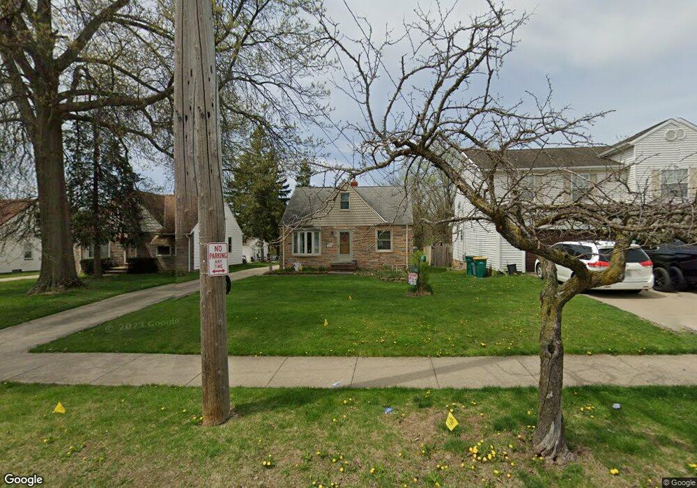
6098 Dunham Rd Maple Heights, OH 44137
Estimated Value: $117,000 - $145,000
2
Beds
1
Bath
1,131
Sq Ft
$118/Sq Ft
Est. Value
About This Home
This home is located at 6098 Dunham Rd, Maple Heights, OH 44137 and is currently estimated at $133,864, approximately $118 per square foot. 6098 Dunham Rd is a home located in Cuyahoga County with nearby schools including Abraham Lincoln Elementary School, Rockside/ J.F. Kennedy School, and Barack Obama School.
Ownership History
Date
Name
Owned For
Owner Type
Purchase Details
Closed on
Oct 7, 2015
Sold by
Estate Of Janet R Hall
Bought by
Norris Susan L
Current Estimated Value
Purchase Details
Closed on
Aug 2, 1993
Sold by
Shampay Charles
Bought by
Norris Susan L
Purchase Details
Closed on
Jun 27, 1989
Sold by
Zuber John
Bought by
Shampay Charles
Purchase Details
Closed on
Jan 13, 1987
Sold by
John Zuber
Bought by
Zuber John
Purchase Details
Closed on
Jun 9, 1982
Sold by
Zuber John and Zuber Mildred
Bought by
John Zuber
Purchase Details
Closed on
Jan 1, 1975
Bought by
Zuber John and Zuber Mildred
Create a Home Valuation Report for This Property
The Home Valuation Report is an in-depth analysis detailing your home's value as well as a comparison with similar homes in the area
Home Values in the Area
Average Home Value in this Area
Purchase History
| Date | Buyer | Sale Price | Title Company |
|---|---|---|---|
| Norris Susan L | -- | Attorney | |
| Norris Susan L | $60,000 | -- | |
| Shampay Charles | $53,900 | -- | |
| Zuber John | -- | -- | |
| John Zuber | -- | -- | |
| Zuber John | -- | -- |
Source: Public Records
Tax History
| Year | Tax Paid | Tax Assessment Tax Assessment Total Assessment is a certain percentage of the fair market value that is determined by local assessors to be the total taxable value of land and additions on the property. | Land | Improvement |
|---|---|---|---|---|
| 2025 | $3,527 | $44,100 | $9,065 | $35,035 |
| 2024 | $3,924 | $44,100 | $9,065 | $35,035 |
| 2023 | $3,064 | $29,510 | $6,930 | $22,580 |
| 2022 | $3,053 | $29,510 | $6,930 | $22,580 |
| 2021 | $3,260 | $29,510 | $6,930 | $22,580 |
| 2020 | $2,967 | $24,190 | $5,670 | $18,520 |
| 2019 | $2,952 | $69,100 | $16,200 | $52,900 |
| 2018 | $2,937 | $24,190 | $5,670 | $18,520 |
| 2017 | $2,921 | $23,490 | $5,010 | $18,480 |
| 2016 | $2,825 | $23,490 | $5,010 | $18,480 |
| 2015 | $2,694 | $23,490 | $5,010 | $18,480 |
| 2014 | $2,694 | $24,230 | $5,150 | $19,080 |
Source: Public Records
Map
Nearby Homes
- 6089 Dunham Rd
- 6045 Dunham Rd
- 15405 Turney Rd
- 14956 Carol Dr
- 15401 Walvern Blvd
- 15522 Turney Rd
- 15513 Walvern Blvd
- 5948 Dunham Rd
- 15712 Mendota Ave
- 15701 Walvern Blvd
- 14357 Turney Rd
- 15521 Corkhill Rd
- SL15 Rocky Top Ct
- 15 Rockytop Ct
- 16014 Turney Rd
- 14808 James Ave
- 14320 Janice Dr
- 6378 Valley Ranch Dr
- 6372 Valley Ranch Dr
- 14750 Schreiber Rd
- 6102 Dunham Rd
- 6094 Dunham Rd
- 6106 Dunham Rd
- 6096 Dunham Rd
- 6100 Dunham Rd
- 15000 Carol Dr
- 6110 Dunham Rd
- 14992 Carol Dr
- 14901 Turney Rd
- 14988 Carol Dr
- 15201 Shirley Ave
- 15003 Turney Rd
- 6101 Dunham Rd
- 14984 Carol Dr
- 6120 Dunham Rd
- 6090 Dunham Rd
- 14891 Turney Rd
- 15205 Shirley Ave
- 6093 Dunham Rd
- 15214 Walvern Blvd
Your Personal Tour Guide
Ask me questions while you tour the home.