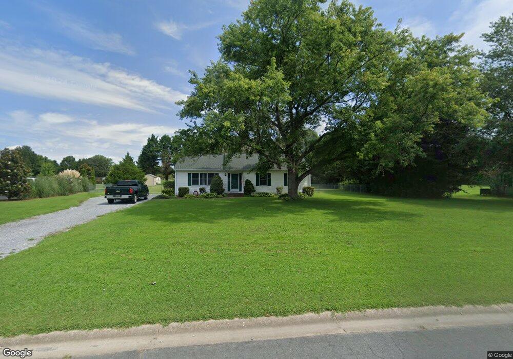
6099 Foxtail Ct Salisbury, MD 21801
South Salisbury NeighborhoodEstimated Value: $234,244 - $278,000
Studio
2
Baths
1,200
Sq Ft
$218/Sq Ft
Est. Value
About This Home
This home is located at 6099 Foxtail Ct, Salisbury, MD 21801 and is currently estimated at $261,561, approximately $217 per square foot. 6099 Foxtail Ct is a home located in Wicomico County with nearby schools including Westside Primary School, Westside Intermediate School, and Salisbury Middle School.
Ownership History
Date
Name
Owned For
Owner Type
Purchase Details
Closed on
Jun 27, 2002
Sold by
Towers Curtis E and Towers Heather A
Bought by
Towers Curtis E
Current Estimated Value
Purchase Details
Closed on
Nov 1, 2000
Sold by
Prandy Eric J
Bought by
Towers Curtis E and Towers Heather A
Purchase Details
Closed on
Aug 31, 1995
Sold by
Benzin Mark C and Benzin Ruth I
Bought by
Prandy Eric J
Create a Home Valuation Report for This Property
The Home Valuation Report is an in-depth analysis detailing your home's value as well as a comparison with similar homes in the area
Home Values in the Area
Average Home Value in this Area
Purchase History
| Date | Buyer | Sale Price | Title Company |
|---|---|---|---|
| Towers Curtis E | -- | -- | |
| Towers Curtis E | $90,000 | -- | |
| Prandy Eric J | $85,900 | -- |
Source: Public Records
Mortgage History
| Date | Status | Borrower | Loan Amount |
|---|---|---|---|
| Closed | Prandy Eric J | -- |
Source: Public Records
Tax History
| Year | Tax Paid | Tax Assessment Tax Assessment Total Assessment is a certain percentage of the fair market value that is determined by local assessors to be the total taxable value of land and additions on the property. | Land | Improvement |
|---|---|---|---|---|
| 2025 | $1,662 | $175,300 | $0 | $0 |
| 2024 | $1,594 | $160,000 | $0 | $0 |
| 2023 | $1,490 | $144,700 | $40,800 | $103,900 |
| 2022 | $1,514 | $142,700 | $0 | $0 |
| 2021 | $1,490 | $140,700 | $0 | $0 |
| 2020 | $1,490 | $138,700 | $36,800 | $101,900 |
| 2019 | $1,444 | $132,233 | $0 | $0 |
| 2018 | $1,383 | $125,767 | $0 | $0 |
| 2017 | $1,315 | $119,300 | $0 | $0 |
| 2016 | -- | $118,367 | $0 | $0 |
| 2015 | $1,275 | $117,433 | $0 | $0 |
| 2014 | $1,275 | $116,500 | $0 | $0 |
Source: Public Records
Map
Nearby Homes
- 26924 Black Horse Run
- 6148 Ayrshire Dr
- 6229 Ayrshire Dr
- 26882 Pratt Rd
- 5991 Hounds Bay Cir
- 27120 Coach House Ln
- 27142 Coach House Ln
- 26947 Pemberton Dr
- 5709 Royal Mile Blvd
- 5686 N Nithsdale Dr Unit N
- 5662 Clydesdale Dr
- 5660 Caledonia Dr
- 27160 Scotland Pkwy
- 5482 Royal Mile Blvd
- 5474 Royal Mile Blvd
- 5461 Loch Ness Terrace
- 6145 Westbrooke Dr
- 5485 Saint Andrews Dr
- 5437 Nithsdale Dr
- 27539 Harness Ln
- 6103 Foxtail Ct
- 6093 Foxtail Ct
- 6137 Trails End Ct
- 6107 Foxtail Ct
- 6140 Trails End Ct
- 6096 Foxtail Ct
- 6301 Ayrshire Dr
- 6297 Ayrshire Dr
- 6141 Trails End Ct
- 6104 Foxtail Ct
- 6111 Foxtail Ct
- 6283 Ayrshire Dr
- 6108 Foxtail Ct
- 26907 Black Horse Run
- 26923 Black Horse Run
- 6313 Ayrshire Dr
- 6319 Ayrshire Dr
- 6271 Ayrshire Dr
- 6277 Ayrshire Dr
- 6265 Ayrshire Dr
Your Personal Tour Guide
Ask me questions while you tour the home.