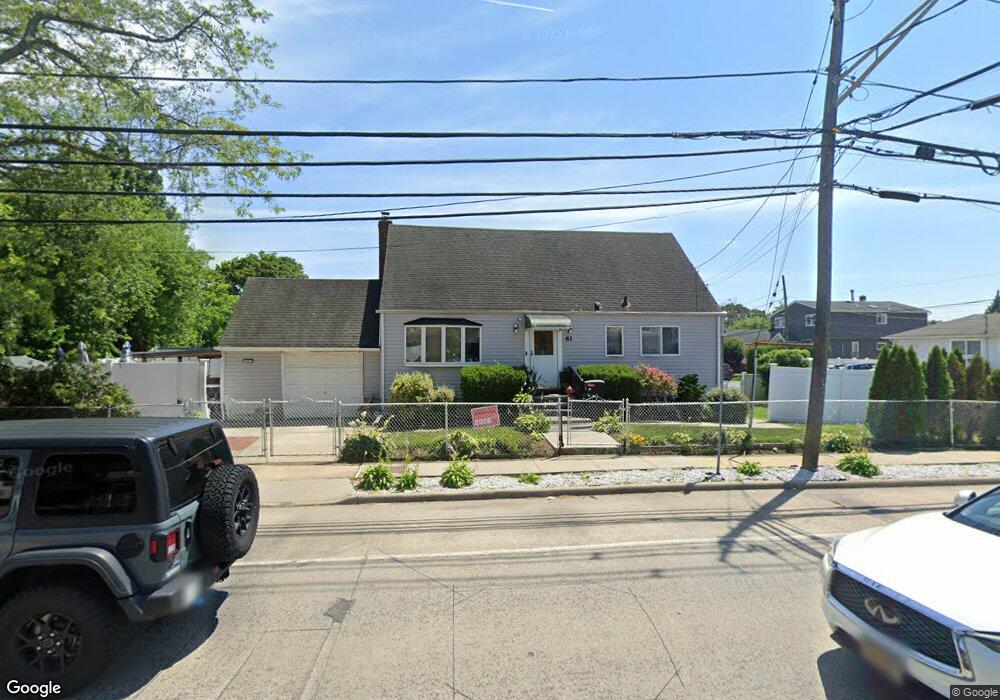
61 Atlantic Ave Freeport, NY 11520
Estimated Value: $605,000 - $621,442
4
Beds
2
Baths
1,313
Sq Ft
$467/Sq Ft
Est. Value
About This Home
This home is located at 61 Atlantic Ave, Freeport, NY 11520 and is currently estimated at $613,221, approximately $467 per square foot. 61 Atlantic Ave is a home located in Nassau County with nearby schools including Columbus Avenue School, Caroline G. Atkinson Intermediate School, and John W Dodd Middle School.
Ownership History
Date
Name
Owned For
Owner Type
Purchase Details
Closed on
Oct 30, 2015
Sold by
Birmingham Maryann
Bought by
Rowe Keith A and Rowe Nissahni R
Current Estimated Value
Home Financials for this Owner
Home Financials are based on the most recent Mortgage that was taken out on this home.
Original Mortgage
$207,475
Outstanding Balance
$163,631
Interest Rate
3.87%
Mortgage Type
New Conventional
Estimated Equity
$449,590
Create a Home Valuation Report for This Property
The Home Valuation Report is an in-depth analysis detailing your home's value as well as a comparison with similar homes in the area
Home Values in the Area
Average Home Value in this Area
Purchase History
| Date | Buyer | Sale Price | Title Company |
|---|---|---|---|
| Rowe Keith A | $215,000 | Ram Abstract Ltd |
Source: Public Records
Mortgage History
| Date | Status | Borrower | Loan Amount |
|---|---|---|---|
| Open | Rowe Keith A | $207,475 |
Source: Public Records
Tax History Compared to Growth
Tax History
| Year | Tax Paid | Tax Assessment Tax Assessment Total Assessment is a certain percentage of the fair market value that is determined by local assessors to be the total taxable value of land and additions on the property. | Land | Improvement |
|---|---|---|---|---|
| 2025 | $7,223 | $335 | $127 | $208 |
| 2024 | $730 | $335 | $127 | $208 |
| 2023 | $7,144 | $344 | $130 | $214 |
| 2022 | $7,144 | $344 | $130 | $214 |
| 2021 | $10,328 | $330 | $125 | $205 |
| 2020 | $6,859 | $420 | $365 | $55 |
| 2019 | $6,181 | $450 | $283 | $167 |
| 2018 | $6,516 | $480 | $0 | $0 |
| 2017 | $7,474 | $621 | $391 | $230 |
| 2016 | $8,405 | $621 | $391 | $230 |
| 2015 | $897 | $621 | $391 | $230 |
| 2014 | $897 | $621 | $391 | $230 |
| 2013 | $848 | $621 | $391 | $230 |
Source: Public Records
Map
Nearby Homes
- 51 Atlantic Ave
- 21 Stillwell Place
- 125 Garfield St
- 121 Garfield St
- 120 Sportsmans Ave
- 142 Gordon Place
- 308 Bedell St
- 252 Arthur St
- 159 Southside Ave
- 177 Sportsmans Ave
- 18 Halsey St
- 5 Sportsmans Ave
- 193 Sportsmans Ave
- 280 Guy Lombardo Ave Unit 5G
- 280 Guy Lombardo Ave Unit 2H
- 61 East Ave
- 208 Sportsmans Ave
- 175 Archer St Unit 1C
- 175 Archer St Unit 3A
- 47 East Ave
- 41 Gordon Place
- 45 Gordon Place
- 55 Atlantic Ave
- 71 Atlantic Ave
- 47 Gordon Place
- 60 Atlantic Ave
- 56 Atlantic Ave
- 55 Gordon Place
- 70 Atlantic Ave
- 44 Gordon Place
- 75 Atlantic Ave
- 52 Atlantic Ave
- 52 Gordon Place
- 208 Bedell St
- 208 Bedell St Unit 1
- 27 Gordon Place
- 79 Atlantic Ave
- 26 Gordon Place
- 57 Gordon Place
- 210 Bedell St