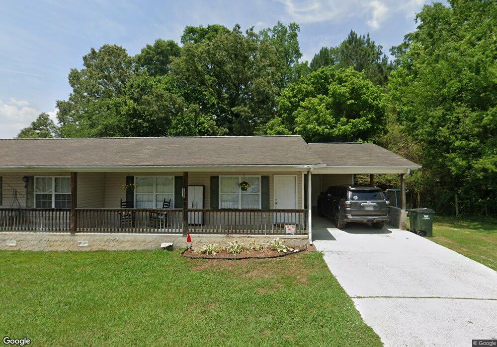
61 Avery Dr Rock Spring, GA 30739
Rock Spring NeighborhoodEstimated Value: $173,000 - $291,000
Studio
2
Baths
1,566
Sq Ft
$141/Sq Ft
Est. Value
About This Home
This home is located at 61 Avery Dr, Rock Spring, GA 30739 and is currently estimated at $220,960, approximately $141 per square foot. 61 Avery Dr is a home located in Walker County with nearby schools including Lafayette High School and Alice M Daley Adventist School.
Ownership History
Date
Name
Owned For
Owner Type
Purchase Details
Closed on
Jul 23, 2007
Sold by
Not Provided
Bought by
Wrd Properties Llc
Current Estimated Value
Purchase Details
Closed on
Jun 28, 2007
Sold by
Not Provided
Bought by
Wrd Properties Llc
Purchase Details
Closed on
Dec 22, 2004
Sold by
Dickinson Robert D and Dickinson Jennifer
Bought by
Dickinson Jennifer
Purchase Details
Closed on
Jul 23, 2003
Sold by
Dickinson Robert D
Bought by
Dickinson Robert D and Dickinson Jennifer
Purchase Details
Closed on
Nov 13, 2002
Bought by
Dickinson Robert D
Create a Home Valuation Report for This Property
The Home Valuation Report is an in-depth analysis detailing your home's value as well as a comparison with similar homes in the area
Home Values in the Area
Average Home Value in this Area
Purchase History
| Date | Buyer | Sale Price | Title Company |
|---|---|---|---|
| Wrd Properties Llc | -- | -- | |
| Wrd Properties Llc | $952,122 | -- | |
| Dickinson Jennifer | -- | -- | |
| Dickinson Robert D | -- | -- | |
| Dickinson Robert D | $30,000 | -- |
Source: Public Records
Tax History
| Year | Tax Paid | Tax Assessment Tax Assessment Total Assessment is a certain percentage of the fair market value that is determined by local assessors to be the total taxable value of land and additions on the property. | Land | Improvement |
|---|---|---|---|---|
| 2025 | $1,725 | $76,956 | $2,890 | $74,066 |
| 2024 | $1,706 | $73,197 | $3,472 | $69,725 |
| 2023 | $1,648 | $68,982 | $2,756 | $66,226 |
| 2022 | $1,559 | $60,364 | $3,016 | $57,348 |
| 2021 | $1,428 | $49,413 | $3,016 | $46,397 |
| 2020 | $1,241 | $40,610 | $3,016 | $37,594 |
| 2019 | $1,262 | $40,610 | $3,016 | $37,594 |
| 2018 | $1,075 | $40,610 | $3,016 | $37,594 |
| 2017 | $1,194 | $40,610 | $3,016 | $37,594 |
| 2016 | $1,194 | $40,610 | $3,016 | $37,594 |
| 2015 | $1,216 | $39,021 | $2,560 | $36,461 |
| 2014 | $1,084 | $39,021 | $2,560 | $36,461 |
| 2013 | $1,075 | $39,021 | $2,560 | $36,461 |
Source: Public Records
Map
Nearby Homes
- 1121 Arnold Rd
- 229 E Turnipseed Rd
- 1909 Old Lafayette Rd
- 42 Hope Dr
- 1902 Long Hollow Rd
- 195 Honeysuckle Dr
- 59 Honeysuckle Dr
- 918 Old Lafayette Rd
- 74 Hanshaw Dr
- 788 Long Hollow Rd
- 190 Vaughn Dr
- 36 Pheonix Cir
- 136 Ginger Lake Dr
- 223 Cooper Rd
- 200 Hunting Ridge Cir
- 140 Fieldstone Commons
- 701 Bicentennial Trail
- 1003 Highway N Old 27
- 797 Roy Bird Rd
- 00 Georgia 95
- 185 Paytn Ln
- 41 Avery Dr
- 54 Avery Dr
- 1395 Arnold Rd
- 14 Avery Dr
- 1351 Arnold Rd
- 1351 Arnold Rd
- 1337 Arnold Rd
- 1319 Arnold Rd
- 8442 N Highway 27
- 12937 N Highway 27
- 7001 N Highway N 27 Hwy
- 0 N Highway 27 Unit RTC2913180
- 0 N Highway 27 Unit RTC2719935
- 9098 N Highway 27
- 8100 N Highway 27
- 17 N Highway 27
- 100 N Highway 27
- 0 N Highway 27
Your Personal Tour Guide
Ask me questions while you tour the home.