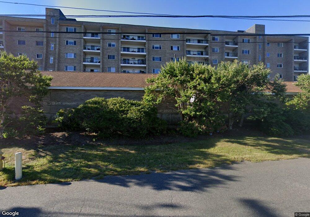
61 Broad Reach Unit T82B North Weymouth, MA 02191
North Weymouth NeighborhoodEstimated Value: $537,001 - $573,000
3
Beds
3
Baths
1,576
Sq Ft
$351/Sq Ft
Est. Value
About This Home
This home is located at 61 Broad Reach Unit T82B, North Weymouth, MA 02191 and is currently estimated at $553,000, approximately $350 per square foot. 61 Broad Reach Unit T82B is a home located in Norfolk County with nearby schools including Wessagusset Elementary School, Abigail Adams Middle School, and Weymouth Middle School Chapman.
Ownership History
Date
Name
Owned For
Owner Type
Purchase Details
Closed on
Mar 26, 2025
Sold by
Flagstaff Rt and Mccue
Bought by
Couper Jane and Couper Jeff
Current Estimated Value
Purchase Details
Closed on
Apr 16, 1998
Sold by
Andover Bk
Bought by
Flagstaff Rt
Home Financials for this Owner
Home Financials are based on the most recent Mortgage that was taken out on this home.
Original Mortgage
$56,700
Interest Rate
7.11%
Mortgage Type
Purchase Money Mortgage
Purchase Details
Closed on
Oct 7, 1997
Sold by
Moreau Richard J
Bought by
Andover Bk
Create a Home Valuation Report for This Property
The Home Valuation Report is an in-depth analysis detailing your home's value as well as a comparison with similar homes in the area
Home Values in the Area
Average Home Value in this Area
Purchase History
| Date | Buyer | Sale Price | Title Company |
|---|---|---|---|
| Couper Jane | $550,000 | None Available | |
| Couper Jane | $550,000 | None Available | |
| Flagstaff Rt | $81,000 | -- | |
| Flagstaff Rt | $81,000 | -- | |
| Andover Bk | $79,000 | -- | |
| Andover Bk | $79,000 | -- |
Source: Public Records
Mortgage History
| Date | Status | Borrower | Loan Amount |
|---|---|---|---|
| Previous Owner | Andover Bk | $56,700 |
Source: Public Records
Tax History Compared to Growth
Tax History
| Year | Tax Paid | Tax Assessment Tax Assessment Total Assessment is a certain percentage of the fair market value that is determined by local assessors to be the total taxable value of land and additions on the property. | Land | Improvement |
|---|---|---|---|---|
| 2025 | $4,711 | $466,400 | $0 | $466,400 |
| 2024 | $4,522 | $440,300 | $0 | $440,300 |
| 2023 | $4,489 | $429,600 | $0 | $429,600 |
| 2022 | $4,504 | $393,000 | $0 | $393,000 |
| 2021 | $4,457 | $379,600 | $0 | $379,600 |
| 2020 | $4,275 | $358,600 | $0 | $358,600 |
| 2019 | $4,324 | $356,800 | $0 | $356,800 |
| 2018 | $4,136 | $330,900 | $0 | $330,900 |
| 2017 | $3,700 | $288,800 | $0 | $288,800 |
| 2016 | $3,538 | $276,400 | $0 | $276,400 |
| 2015 | $3,088 | $239,400 | $0 | $239,400 |
| 2014 | $3,177 | $238,900 | $0 | $238,900 |
Source: Public Records
Map
Nearby Homes
- 61 Broad Reach Unit T62B
- 73 Broad Reach Unit T123C
- 73 Broad Reach Unit M33C
- 73 Broad Reach Unit T41C
- 51 Broad Reach Unit T23A
- 64 Broad Reach Unit 108
- 130 Broad Reach Unit 506
- 130 Broad Reach Unit 305
- 130 Broad Reach Unit 206
- 130 Broad Reach Unit 504
- 10 Shipyard Dr Unit 313
- 141 Hms Stayner Dr Unit 306
- 125 Halsted Dr Unit 125
- 16 Caldwell St
- 160 Hms Stayner Dr
- 160 Hms Stayner Dr Unit 160
- 12 Wolcott St
- 2 Beach Ln
- 2 Langlee Rd
- 16 Beal's Cove Rd Unit E
- 73 Broad Reach Unit T46
- 73 Broad Reach Unit T97C
- 73 Broad Reach Unit T96C
- 73 Broad Reach Unit T95C
- 73 Broad Reach Unit T94C
- 73 Broad Reach Unit T93C
- 61 Broad Reach Unit T93B
- 73 Broad Reach Unit T92C
- 73 Broad Reach Unit T91C
- 61 Broad Reach Unit T91B
- 73 Broad Reach Unit T86C
- 73 Broad Reach Unit T85C
- 73 Broad Reach Unit T84C
- 61 Broad Reach Unit T84B
- 73 Broad Reach Unit T83C
- 61 Broad Reach Unit T83B
- 73 Broad Reach Unit T82C
- 73 Broad Reach Unit T81C
- 61 Broad Reach Unit T81B
- 73 Broad Reach Unit T77C