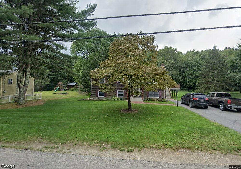
61 Burt St Norton, MA 02766
Estimated Value: $517,208 - $649,000
3
Beds
1
Bath
1,104
Sq Ft
$521/Sq Ft
Est. Value
About This Home
This home is located at 61 Burt St, Norton, MA 02766 and is currently estimated at $575,552, approximately $521 per square foot. 61 Burt St is a home located in Bristol County with nearby schools including L.G. Nourse Elementary School, Henri A. Yelle Elementary School, and Norton Middle School.
Create a Home Valuation Report for This Property
The Home Valuation Report is an in-depth analysis detailing your home's value as well as a comparison with similar homes in the area
Home Values in the Area
Average Home Value in this Area
Tax History
| Year | Tax Paid | Tax Assessment Tax Assessment Total Assessment is a certain percentage of the fair market value that is determined by local assessors to be the total taxable value of land and additions on the property. | Land | Improvement |
|---|---|---|---|---|
| 2025 | $5,759 | $444,000 | $181,200 | $262,800 |
| 2024 | $5,477 | $422,900 | $172,600 | $250,300 |
| 2023 | $5,227 | $402,400 | $162,800 | $239,600 |
| 2022 | $5,058 | $354,700 | $148,000 | $206,700 |
| 2021 | $4,831 | $323,600 | $140,900 | $182,700 |
| 2020 | $4,650 | $314,200 | $136,800 | $177,400 |
| 2019 | $4,393 | $294,800 | $131,600 | $163,200 |
| 2018 | $3,110 | $281,500 | $131,600 | $149,900 |
| 2017 | $3,003 | $266,200 | $131,600 | $134,600 |
| 2016 | $3,968 | $254,200 | $131,600 | $122,600 |
| 2015 | $3,826 | $248,600 | $129,000 | $119,600 |
| 2014 | $3,666 | $238,500 | $122,900 | $115,600 |
Source: Public Records
Map
Nearby Homes
- O Leonard St
- 35 Owen Rd
- 9 Winnecunnet Dr Unit 9
- 46 Newland St
- 39 Cranberry Ln
- 195 E Main St
- 1 Wilbur Terrace Unit 6
- 0 S Washington St Unit 73437419
- 0 Knollwood & 0 Rear Kensington
- 3 Patlena Dr
- 103 King Philip Rd
- 0 Kensington Rd
- 17 Lloyd Cir Unit 36
- 24 Lloyd Cir Unit 34
- 4 Stanley Rd
- 30 Samoset St
- 157 Highland St
- 32 Olde Farm Rd
- 23 Lullaby Ln
- 0 Cobb St
Your Personal Tour Guide
Ask me questions while you tour the home.