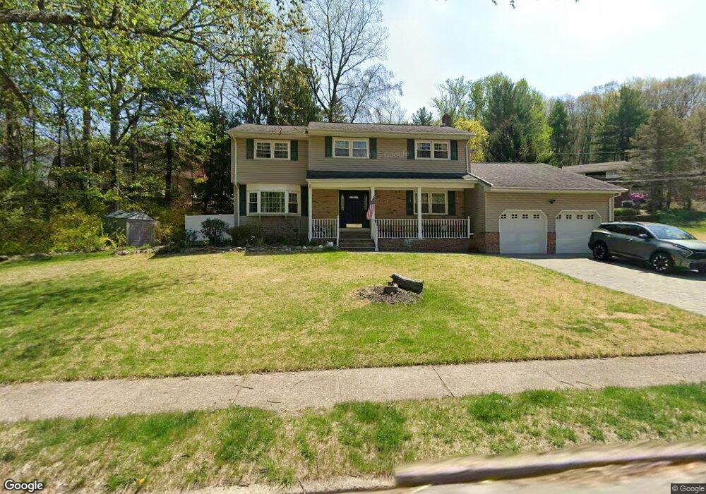
61 Cannonball Rd Wanaque, NJ 07465
Estimated Value: $630,000 - $684,000
4
Beds
3
Baths
2,404
Sq Ft
$274/Sq Ft
Est. Value
About This Home
This home is located at 61 Cannonball Rd, Wanaque, NJ 07465 and is currently estimated at $658,072, approximately $273 per square foot. 61 Cannonball Rd is a home located in Passaic County with nearby schools including Lakeland Reg High School.
Ownership History
Date
Name
Owned For
Owner Type
Purchase Details
Closed on
Nov 8, 2021
Sold by
Schneider Andreas and Coveli Vilma
Bought by
Franko Joseph and Franko Danielle
Current Estimated Value
Home Financials for this Owner
Home Financials are based on the most recent Mortgage that was taken out on this home.
Original Mortgage
$507,478
Outstanding Balance
$465,659
Interest Rate
3.09%
Mortgage Type
FHA
Estimated Equity
$192,413
Purchase Details
Closed on
Aug 11, 1994
Sold by
Titelius Joseph
Bought by
Schneider Andrews
Home Financials for this Owner
Home Financials are based on the most recent Mortgage that was taken out on this home.
Original Mortgage
$110,000
Interest Rate
8.65%
Create a Home Valuation Report for This Property
The Home Valuation Report is an in-depth analysis detailing your home's value as well as a comparison with similar homes in the area
Home Values in the Area
Average Home Value in this Area
Purchase History
| Date | Buyer | Sale Price | Title Company |
|---|---|---|---|
| Franko Joseph | $525,000 | Sage Title & Stlmt Svcs Llc | |
| Schneider Andrews | $200,000 | -- |
Source: Public Records
Mortgage History
| Date | Status | Borrower | Loan Amount |
|---|---|---|---|
| Open | Franko Joseph | $507,478 | |
| Previous Owner | Schneider Andrews | $110,000 |
Source: Public Records
Tax History
| Year | Tax Paid | Tax Assessment Tax Assessment Total Assessment is a certain percentage of the fair market value that is determined by local assessors to be the total taxable value of land and additions on the property. | Land | Improvement |
|---|---|---|---|---|
| 2025 | $13,823 | $320,500 | $117,200 | $203,300 |
| 2024 | $13,548 | $320,500 | $117,200 | $203,300 |
Source: Public Records
Map
Nearby Homes
- 3 Stephens Lake Rd
- 18 Schirra Dr
- 16G Brookside Heights Unit G
- 16 Brookside Heights Unit 16G
- 7B Brookside Heights Unit B
- 50 Roger Ct
- 18 Juniper Terrace
- 1118 Warrens Way
- 1116 Warrens Way
- 2217 Warrens Way
- 450 Skyline Lake Dr
- 32 Grove St
- 3121 Warrens Way
- 3214 Warrens Way
- 3213 Warrens Way
- 5408 Warrens Way
- 5201 Warrens Way
- 4203 Warrens Way Unit 203
- 4203 Warrens Way
- 542 Ringwood Ave
- 62 Cannonball Rd
- 5 Mcatee Ln
- 64 Cannonball Rd
- 60 Cannonball Rd
- 65 Cannonball Rd
- 2 Mcatee Ln
- 7 Mcatee Ln
- 66 Cannonball Rd
- 6 Mcatee Ln
- 58 Cannonball Rd
- 57 Cannonball Rd
- 67 Cannonball Rd
- 8 Mcatee Ln
- 9 Mcatee Ln
- 68 Cannonball Rd
- 56 Cannonball Rd
- 55 Cannonball Rd
- 69 Cannonball Rd
- 48 Wolfe Dr
- 54 Cannonball Rd
Your Personal Tour Guide
Ask me questions while you tour the home.