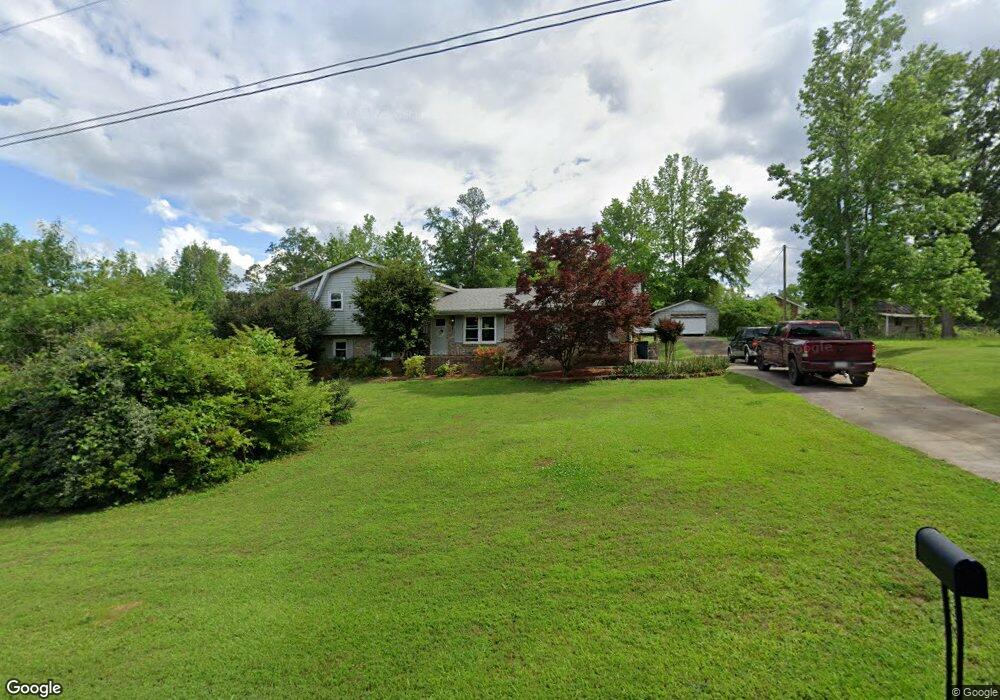
61 Cedar Ln E Newnan, GA 30263
Estimated Value: $304,000 - $348,000
3
Beds
2
Baths
2,028
Sq Ft
$157/Sq Ft
Est. Value
About This Home
This home is located at 61 Cedar Ln E, Newnan, GA 30263 and is currently estimated at $318,876, approximately $157 per square foot. 61 Cedar Ln E is a home located in Coweta County with nearby schools including Ruth Hill Elementary School, Smokey Road Middle School, and Newnan High School.
Ownership History
Date
Name
Owned For
Owner Type
Purchase Details
Closed on
Nov 1, 2012
Sold by
Ward Terry Wayne
Bought by
Ward Patrice Michele
Current Estimated Value
Purchase Details
Closed on
Oct 13, 1994
Sold by
Smallwood Samuel A and Smallwood Cheryl M
Bought by
Ward Terry W and Ward Patrice
Home Financials for this Owner
Home Financials are based on the most recent Mortgage that was taken out on this home.
Original Mortgage
$84,500
Interest Rate
8.46%
Mortgage Type
Purchase Money Mortgage
Purchase Details
Closed on
Feb 29, 1980
Bought by
Smallwood Cheryl M
Create a Home Valuation Report for This Property
The Home Valuation Report is an in-depth analysis detailing your home's value as well as a comparison with similar homes in the area
Purchase History
| Date | Buyer | Sale Price | Title Company |
|---|---|---|---|
| Ward Patrice Michele | -- | -- | |
| Ward Terry W | $84,000 | -- | |
| Smallwood Cheryl M | -- | -- |
Source: Public Records
Mortgage History
| Date | Status | Borrower | Loan Amount |
|---|---|---|---|
| Previous Owner | Ward Terry W | $84,500 |
Source: Public Records
Tax History
| Year | Tax Paid | Tax Assessment Tax Assessment Total Assessment is a certain percentage of the fair market value that is determined by local assessors to be the total taxable value of land and additions on the property. | Land | Improvement |
|---|---|---|---|---|
| 2025 | $1,768 | $119,799 | $22,000 | $97,799 |
| 2024 | $1,565 | $110,519 | $22,000 | $88,519 |
| 2023 | $1,565 | $75,941 | $10,000 | $65,941 |
| 2022 | $1,475 | $64,577 | $10,000 | $54,577 |
| 2021 | $1,406 | $58,082 | $8,000 | $50,082 |
| 2020 | $1,414 | $58,082 | $8,000 | $50,082 |
| 2019 | $985 | $38,446 | $6,000 | $32,446 |
| 2018 | $987 | $38,446 | $6,000 | $32,446 |
| 2017 | $694 | $28,455 | $6,000 | $22,455 |
| 2016 | $688 | $28,455 | $6,000 | $22,455 |
| 2015 | $679 | $28,455 | $6,000 | $22,455 |
| 2014 | $676 | $28,455 | $6,000 | $22,455 |
Source: Public Records
Map
Nearby Homes
- 12 Smokey Ridge Ct
- 50 Hearthstone Dr N
- LOT 2-0 Belk Rd
- 19 Festiva Dr
- 0 Smokey Rd Unit 10495165
- 124 Wallace Gray Cir
- 0 Wallace Gray Cir Unit 10590659
- 13 Midland Park Way
- 37 Westgate Park Ln
- 19 Jericho Way
- 25 Westgate Park Dr
- 56 Fox Hollow Run
- 42 Homesite Jericho Way
- 51 Homesite Jericho Way
- 17 Westgate Park Dr
- 66 Westside School Rd
- 69 Bailey Dr
- 89 Bailey Dr
- 218 Arlington Ct
- 57 Scout Way
- 61 Cedar Ln N
- 73 Cedar Ln N
- 49 Cedar Ln N
- 58 Black Oak Dr
- 15 Red Oak Dr
- 60 Cedar Ln N
- 70 Black Oak Dr
- 37 Cedar Ln N
- 72 Cedar Ln N
- 46 Black Oak Dr
- 48 Cedar Ln N
- 37 Red Oak Dr
- 34 Black Oak Dr
- 36 Cedar Ln N
- 25 Cedar Ln E
- 1 Oak Ct Unit 6
- 22 Black Oak Dr
- 22 Black Oak Dr Unit LOT 125
- 65 Black Oak Dr
- 2 Red Oak Dr