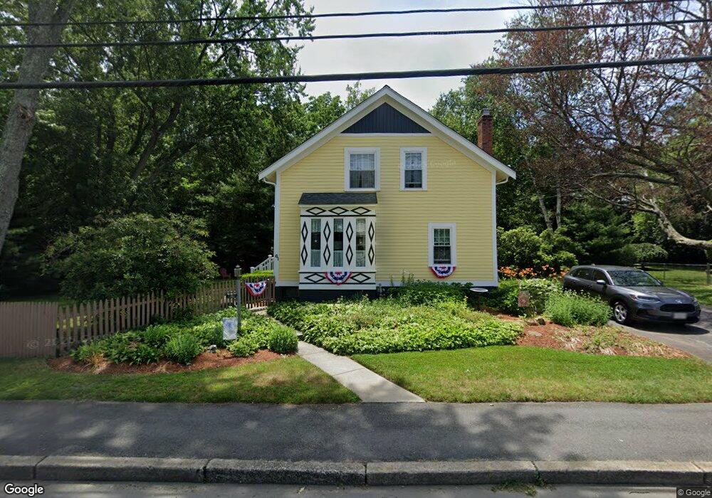
61 Centre St Rumford, RI 02916
Carpenters Corner NeighborhoodEstimated Value: $426,000 - $524,000
3
Beds
2
Baths
1,363
Sq Ft
$336/Sq Ft
Est. Value
About This Home
This home is located at 61 Centre St, Rumford, RI 02916 and is currently estimated at $457,506, approximately $335 per square foot. 61 Centre St is a home located in Providence County with nearby schools including East Providence High School, St Margaret School, and Ocean State Montessori School.
Ownership History
Date
Name
Owned For
Owner Type
Purchase Details
Closed on
Nov 25, 2024
Sold by
Davis John F
Bought by
Davis John F and Kent Monica D
Current Estimated Value
Create a Home Valuation Report for This Property
The Home Valuation Report is an in-depth analysis detailing your home's value as well as a comparison with similar homes in the area
Home Values in the Area
Average Home Value in this Area
Purchase History
| Date | Buyer | Sale Price | Title Company |
|---|---|---|---|
| Davis John F | -- | None Available | |
| Davis John F | -- | None Available | |
| Davis John F | -- | None Available | |
| Davis John F | -- | None Available | |
| Davis John F | -- | None Available | |
| Davis John F | -- | None Available | |
| Davis John F | -- | None Available |
Source: Public Records
Tax History
| Year | Tax Paid | Tax Assessment Tax Assessment Total Assessment is a certain percentage of the fair market value that is determined by local assessors to be the total taxable value of land and additions on the property. | Land | Improvement |
|---|---|---|---|---|
| 2025 | $4,982 | $381,200 | $128,100 | $253,100 |
| 2024 | $4,421 | $288,400 | $106,700 | $181,700 |
| 2023 | $4,257 | $288,400 | $106,700 | $181,700 |
| 2022 | $4,018 | $183,800 | $58,800 | $125,000 |
| 2021 | $3,952 | $183,800 | $54,800 | $129,000 |
| 2020 | $3,784 | $183,800 | $54,800 | $129,000 |
| 2019 | $3,680 | $183,800 | $54,800 | $129,000 |
| 2018 | $3,620 | $158,200 | $56,000 | $102,200 |
| 2017 | $3,539 | $158,200 | $56,000 | $102,200 |
| 2016 | $3,522 | $158,200 | $56,000 | $102,200 |
| 2015 | $3,789 | $165,100 | $51,900 | $113,200 |
| 2014 | $3,789 | $165,100 | $51,900 | $113,200 |
Source: Public Records
Map
Nearby Homes
- 37 Larchmere Dr
- 136 King Philip Rd
- 224 Centre St
- 56 Irving Ave
- 0 Newman Ave Rear
- 125 Roger Williams Ave
- 86 Woodward Ave
- 2 Riverwoods Ct
- 80 E Point Dr Unit 26
- 141 E Point Dr Unit 401
- 141 E Point Dr Unit 105
- 141 E Point Dr Unit 306
- 141 E Point Dr Unit 406
- 141 E Point Dr Unit 207
- 141 E Point Dr Unit 309
- 141 E Point Dr Unit 108
- 141 E Point Dr Unit 209
- 141 E Point Dr Unit 402
- 141 E Point Dr Unit 112
- 141 E Point Dr Unit 110
Your Personal Tour Guide
Ask me questions while you tour the home.