Estimated Value: $274,081 - $322,000
--
Bed
2
Baths
1,932
Sq Ft
$155/Sq Ft
Est. Value
About This Home
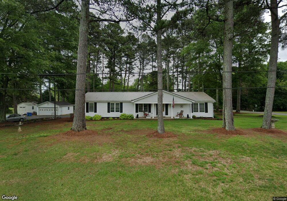
This home is located at 61 Chestnut Dr, Hull, GA 30646 and is currently estimated at $298,770, approximately $154 per square foot. 61 Chestnut Dr is a home located in Madison County with nearby schools including Madison County High School.
Ownership History
Date
Name
Owned For
Owner Type
Purchase Details
Closed on
Aug 27, 2021
Sold by
Fowler H Watson
Bought by
Fowler Betty Jo
Current Estimated Value
Purchase Details
Closed on
Apr 10, 1998
Sold by
Fowler Betty Jo
Bought by
Fowler H Watson
Purchase Details
Closed on
Jan 1, 1976
Bought by
Fowler Betty Jo
Create a Home Valuation Report for This Property
The Home Valuation Report is an in-depth analysis detailing your home's value as well as a comparison with similar homes in the area
Home Values in the Area
Average Home Value in this Area
Purchase History
| Date | Buyer | Sale Price | Title Company |
|---|---|---|---|
| Fowler Betty Jo | -- | -- | |
| Fowler Betty Jo | -- | -- | |
| Fowler H Watson | -- | -- | |
| Fowler Betty Jo | -- | -- |
Source: Public Records
Tax History Compared to Growth
Tax History
| Year | Tax Paid | Tax Assessment Tax Assessment Total Assessment is a certain percentage of the fair market value that is determined by local assessors to be the total taxable value of land and additions on the property. | Land | Improvement |
|---|---|---|---|---|
| 2024 | $2,201 | $102,571 | $15,360 | $87,211 |
| 2023 | $2,957 | $96,871 | $15,360 | $81,511 |
| 2022 | $1,911 | $87,267 | $15,360 | $71,907 |
| 2021 | $1,410 | $64,180 | $12,800 | $51,380 |
| 2020 | $1,603 | $62,162 | $12,800 | $49,362 |
| 2019 | $1,379 | $54,358 | $8,000 | $46,358 |
| 2018 | $1,194 | $48,280 | $8,000 | $40,280 |
| 2017 | $1,286 | $44,678 | $8,000 | $36,678 |
| 2016 | $832 | $38,968 | $8,000 | $30,968 |
| 2015 | $742 | $35,884 | $8,000 | $27,884 |
| 2014 | $839 | $39,139 | $8,000 | $31,139 |
| 2013 | -- | $39,139 | $8,000 | $31,139 |
Source: Public Records
Map
Nearby Homes
- 838 Virginia Ln
- 0 Woodland Creek Place Unit 10421130
- 181 Bedford Dr
- 685 Bedford Dr
- 525 Virginia Ln
- 136 Wellington Dr
- 481 Bedford Dr
- 0 Virginia Ln Unit Lot 15 CL336098
- 0 Virginia Ln Unit LOT 15 10579204
- 540 & 542 Harve Mathis Rd
- 151 Rolling Woods Ln
- 8986 Highway 29 S
- 300 Harve Mathis Rd
- 1329 Spratlin Mill Dr
- 1309 Hull Rd
- 1176 Kimberly Cir
- 336 Old Pittard Rd
- 1077 Glenn Carrie Rd
- 846 Virginia Ln
- 1051 Glenn Carrie Rd
- 882 Virginia Ln
- 1019 Glenn Carrie Rd
- 810 Virginia Ln
- 900 Virginia Ln
- 931 Virginia Ln
- 769 Virginia Ln
- 1131 Virginia Ln
- 999 Glenn Carrie Rd
- 1135 Glenn Carrie Rd
- 926 Virginia Ln
- 796 Virginia Ln
- 85 Woodland Creek Place
- 1080 Glenn Carrie Rd
- 145 Woodland Creek Place
- 977 Glenn Carrie Rd
- 952 Virginia Ln
- 1052 Glenn Carrie Rd