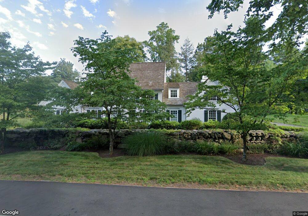
61 Cross Hwy Westport, CT 06880
Coleytown NeighborhoodEstimated Value: $2,432,598 - $2,773,000
4
Beds
4
Baths
3,854
Sq Ft
$677/Sq Ft
Est. Value
About This Home
This home is located at 61 Cross Hwy, Westport, CT 06880 and is currently estimated at $2,609,650, approximately $677 per square foot. 61 Cross Hwy is a home located in Fairfield County with nearby schools including Coleytown Elementary School, Coleytown Middle School, and Staples High School.
Ownership History
Date
Name
Owned For
Owner Type
Purchase Details
Closed on
Oct 4, 2011
Sold by
Voyager Llc
Bought by
Cavaaagh Jan S
Current Estimated Value
Purchase Details
Closed on
Nov 9, 1994
Sold by
Manuel Charles
Bought by
Sdf Llc
Home Financials for this Owner
Home Financials are based on the most recent Mortgage that was taken out on this home.
Original Mortgage
$600,000
Interest Rate
9.25%
Mortgage Type
Unknown
Create a Home Valuation Report for This Property
The Home Valuation Report is an in-depth analysis detailing your home's value as well as a comparison with similar homes in the area
Home Values in the Area
Average Home Value in this Area
Purchase History
| Date | Buyer | Sale Price | Title Company |
|---|---|---|---|
| Cavaaagh Jan S | $1,525,000 | -- | |
| Cavaaagh Jan S | $1,525,000 | -- | |
| Sdf Llc | $800,000 | -- | |
| Sdf Llc | $800,000 | -- |
Source: Public Records
Mortgage History
| Date | Status | Borrower | Loan Amount |
|---|---|---|---|
| Previous Owner | Sdf Llc | $600,000 |
Source: Public Records
Tax History Compared to Growth
Tax History
| Year | Tax Paid | Tax Assessment Tax Assessment Total Assessment is a certain percentage of the fair market value that is determined by local assessors to be the total taxable value of land and additions on the property. | Land | Improvement |
|---|---|---|---|---|
| 2025 | $18,783 | $995,900 | $380,200 | $615,700 |
| 2024 | $18,544 | $995,900 | $380,200 | $615,700 |
| 2023 | $18,275 | $995,900 | $380,200 | $615,700 |
| 2022 | $17,996 | $995,900 | $380,200 | $615,700 |
| 2021 | $17,996 | $995,900 | $380,200 | $615,700 |
| 2020 | $18,632 | $1,115,000 | $399,900 | $715,100 |
| 2019 | $18,799 | $1,115,000 | $399,900 | $715,100 |
| 2018 | $18,799 | $1,115,000 | $399,900 | $715,100 |
| 2017 | $18,799 | $1,115,000 | $399,900 | $715,100 |
| 2016 | $18,799 | $1,115,000 | $399,900 | $715,100 |
| 2015 | $19,478 | $1,076,700 | $311,600 | $765,100 |
| 2014 | $19,316 | $1,076,700 | $311,600 | $765,100 |
Source: Public Records
Map
Nearby Homes
- 26 Hitchcock Rd
- 489 Main St
- 483 Main St
- 17 Clover Ln
- 3 Ln
- 19 Joann Cir
- 3 Country Rd
- 21 Warnock Dr
- 5 Northside Ln
- 7 Brookside Dr
- 3 Hickory Hill Rd
- 26 Cob Dr
- 19A Darbrook Rd
- 118 Roseville Rd
- 116 Roseville Rd
- 7 Wild Rose Rd
- 310 Main St
- 41 Richmondville Ave Unit 104
- 41 Richmondville Ave Unit Duplex 2
- 41 Richmondville Ave Unit 111
- 17 Hockanum Rd
- 62 Cross Hwy
- 18 Hockanum Rd
- 183 Roseville Rd
- 63 Cross Hwy
- 181 Roseville Rd
- 31 Gault Park Dr
- 15 Hockanum Rd
- 64 Cross Hwy
- 12 Hockanum Rd
- 55 Cross Hwy
- 54 Cross Hwy
- 180 Roseville Rd
- 6 Coach Ln
- 66 Cross Hwy
- 11 Daybreak Common
- 3 Daybreak Common
- 2 Hitchcock Rd
- 178 Roseville Rd
- 10 Hockanum Rd