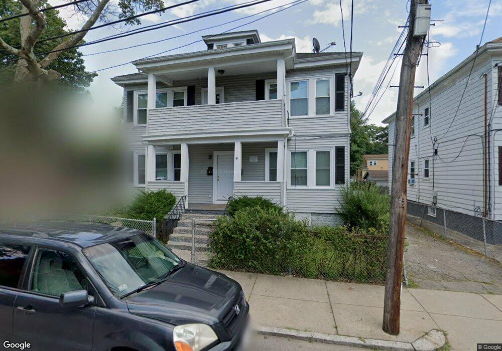
61 Favre St Mattapan, MA 02126
Southern Mattapan NeighborhoodEstimated Value: $719,335 - $940,000
4
Beds
2
Baths
2,652
Sq Ft
$308/Sq Ft
Est. Value
About This Home
This home is located at 61 Favre St, Mattapan, MA 02126 and is currently estimated at $815,584, approximately $307 per square foot. 61 Favre St is a home located in Suffolk County with nearby schools including KIPP Academy Boston Charter School and Berea Seventh-day Adventist Academy.
Ownership History
Date
Name
Owned For
Owner Type
Purchase Details
Closed on
Apr 27, 2010
Sold by
Holness Dorothea E and Us Bk
Bought by
Us Bk
Current Estimated Value
Purchase Details
Closed on
Jul 13, 1992
Sold by
Miller Elsie
Bought by
Holness Winston and Holness Dorothea E
Purchase Details
Closed on
Feb 5, 1988
Sold by
Munroe Florence M
Bought by
Miller Elsie
Purchase Details
Closed on
May 7, 1987
Sold by
Munroe Florence M
Bought by
Miller Elsie
Create a Home Valuation Report for This Property
The Home Valuation Report is an in-depth analysis detailing your home's value as well as a comparison with similar homes in the area
Home Values in the Area
Average Home Value in this Area
Purchase History
| Date | Buyer | Sale Price | Title Company |
|---|---|---|---|
| Us Bk | $305,000 | -- | |
| Holness Winston | $150,000 | -- | |
| Miller Elsie | $50,000 | -- | |
| Miller Elsie | $25,000 | -- |
Source: Public Records
Mortgage History
| Date | Status | Borrower | Loan Amount |
|---|---|---|---|
| Previous Owner | Miller Elsie | $382,500 |
Source: Public Records
Tax History Compared to Growth
Tax History
| Year | Tax Paid | Tax Assessment Tax Assessment Total Assessment is a certain percentage of the fair market value that is determined by local assessors to be the total taxable value of land and additions on the property. | Land | Improvement |
|---|---|---|---|---|
| 2025 | $6,899 | $595,800 | $218,300 | $377,500 |
| 2024 | $5,955 | $546,300 | $196,800 | $349,500 |
| 2023 | $5,535 | $515,400 | $185,700 | $329,700 |
| 2022 | $5,608 | $515,400 | $185,700 | $329,700 |
| 2021 | $4,999 | $468,500 | $168,800 | $299,700 |
| 2020 | $4,540 | $429,900 | $172,200 | $257,700 |
| 2019 | $4,195 | $398,000 | $124,400 | $273,600 |
| 2018 | $3,725 | $355,400 | $124,400 | $231,000 |
| 2017 | $3,620 | $341,800 | $124,400 | $217,400 |
| 2016 | $3,418 | $310,700 | $124,400 | $186,300 |
| 2015 | $3,136 | $259,000 | $106,500 | $152,500 |
| 2014 | $3,017 | $239,800 | $106,500 | $133,300 |
Source: Public Records
Map
Nearby Homes
- 10 Brockton St
- 95 Woodhaven St
- 770 Cummins Hwy Unit 1
- 770 Cummins Hwy Unit 22
- 839-843 Cummins Hwy
- 20 Monterey Ave
- 100 Itasca St
- 231 Itasca St
- 60 and 64 Monterey Ave
- 1465 Blue Hill Ave
- 116 Almont St
- 12 Hiawatha Rd
- 14-14R Kennebec St
- 90 Hollingsworth St
- 48-50 Rockdale St
- 49 Fottler Rd
- 58 Mattapan St
- 10 Itasca St
- 45 1st Ave Unit 111
- 72 Livermore St