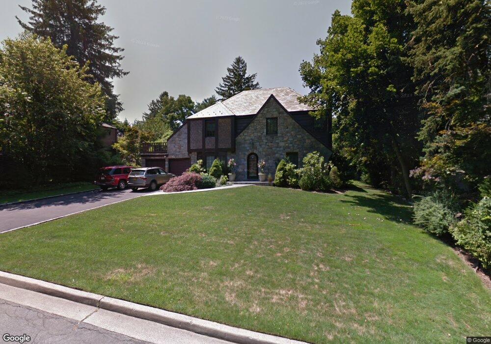
61 Foxcroft Rd Manhasset, NY 11030
Estimated Value: $2,202,996 - $2,517,000
--
Bed
3
Baths
2,650
Sq Ft
$891/Sq Ft
Est. Value
About This Home
This home is located at 61 Foxcroft Rd, Manhasset, NY 11030 and is currently estimated at $2,359,998, approximately $890 per square foot. 61 Foxcroft Rd is a home located in Nassau County with nearby schools including Manhasset Secondary School, St Mary's Elementary School, and Our Lady of Grace Montessori School.
Ownership History
Date
Name
Owned For
Owner Type
Purchase Details
Closed on
Aug 28, 2020
Sold by
Lewinson David and Lewinson Rose
Bought by
Silva Ryan and Silva Megan
Current Estimated Value
Home Financials for this Owner
Home Financials are based on the most recent Mortgage that was taken out on this home.
Original Mortgage
$1,500,000
Outstanding Balance
$1,331,151
Interest Rate
2.9%
Mortgage Type
New Conventional
Estimated Equity
$1,028,847
Purchase Details
Closed on
Feb 10, 1999
Sold by
Executrix Brockmeyer Mary Elle
Bought by
Lewinson David and Lewinson Rose
Create a Home Valuation Report for This Property
The Home Valuation Report is an in-depth analysis detailing your home's value as well as a comparison with similar homes in the area
Home Values in the Area
Average Home Value in this Area
Purchase History
| Date | Buyer | Sale Price | Title Company |
|---|---|---|---|
| Silva Ryan | -- | Chicago Title | |
| Lewinson David | $692,000 | -- |
Source: Public Records
Mortgage History
| Date | Status | Borrower | Loan Amount |
|---|---|---|---|
| Open | Silva Ryan | $1,500,000 |
Source: Public Records
Tax History Compared to Growth
Tax History
| Year | Tax Paid | Tax Assessment Tax Assessment Total Assessment is a certain percentage of the fair market value that is determined by local assessors to be the total taxable value of land and additions on the property. | Land | Improvement |
|---|---|---|---|---|
| 2025 | $24,404 | $1,512 | $808 | $704 |
| 2024 | $7,953 | $1,560 | $833 | $727 |
| 2023 | $23,321 | $1,636 | $874 | $762 |
| 2022 | $23,321 | $1,779 | $854 | $925 |
| 2021 | $24,984 | $1,777 | $853 | $924 |
| 2020 | $23,091 | $2,130 | $1,748 | $382 |
| 2019 | $18,495 | $2,130 | $1,748 | $382 |
| 2018 | $18,495 | $2,130 | $0 | $0 |
| 2017 | $10,983 | $2,130 | $1,748 | $382 |
| 2016 | $17,712 | $2,130 | $1,748 | $382 |
| 2015 | $6,418 | $2,130 | $1,748 | $382 |
| 2014 | $6,418 | $2,130 | $1,748 | $382 |
| 2013 | $6,106 | $2,130 | $1,748 | $382 |
Source: Public Records
Map
Nearby Homes
- 183 Mill Spring Rd
- 20 Mill Spring Rd
- 207 Mill Spring Rd
- 112 Chapel Rd
- 10 Soundview Crest
- 39 Bluebird Hill Ct
- 45 Bristol Dr
- 23 Estates Terrace N
- 43 Bristol Dr
- 117 Eagles Crescent
- 65 Old Mill Rd
- 147 Darters Ln
- 25 The Oaks
- 414 Hunt Ln
- 21 the Glenada
- 17 Evergreen Cir
- 53 Stuart Place
- 50 Eakins Rd
- 1 Sequoia Cir
- 15 The Oaks
- 51 Foxcroft Rd
- 71 Foxcroft Rd
- 41 Sutton Crest
- 35 Sutton Crest
- 60 Foxcroft Rd
- 52 Foxcroft Rd
- 43 Foxcroft Rd
- 70 Foxcroft Rd
- 45 Sutton Crest
- 67 Aldershot Ln
- 27 Sutton Crest
- 42 Foxcroft Rd
- 41 Aldershot Ln
- 42 Sutton Crest
- 168 Rockcrest Rd
- 178 Rockcrest Rd
- 33 Foxcroft Rd
- 158 Rockcrest Rd
- 79 Aldershot Ln
- 34 Sutton Crest