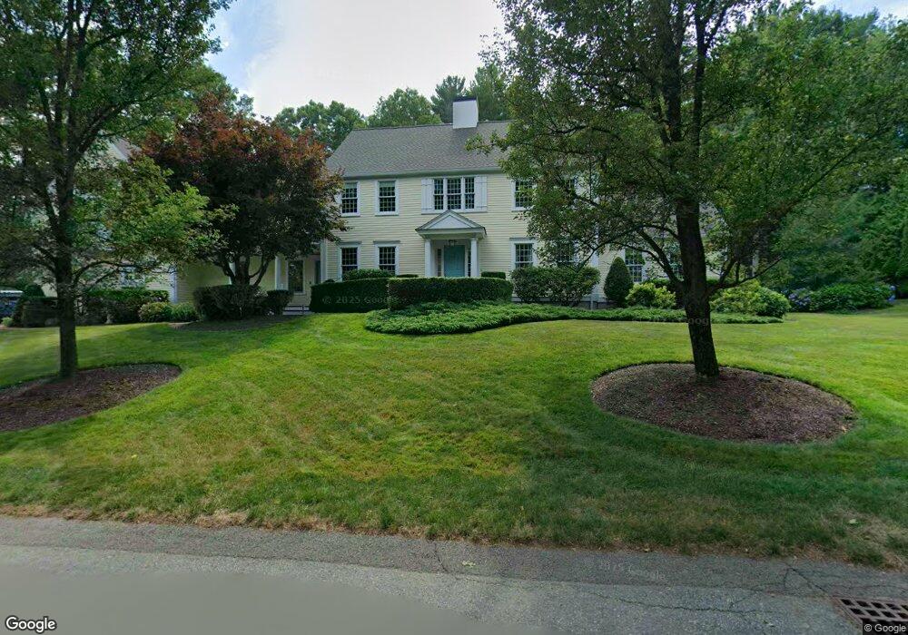
61 Gifford Way Duxbury, MA 02332
Estimated Value: $1,498,000 - $1,948,000
4
Beds
4
Baths
4,432
Sq Ft
$399/Sq Ft
Est. Value
About This Home
This home is located at 61 Gifford Way, Duxbury, MA 02332 and is currently estimated at $1,766,632, approximately $398 per square foot. 61 Gifford Way is a home located in Plymouth County with nearby schools including Chandler Elementary School, Alden School, and Duxbury Middle School.
Ownership History
Date
Name
Owned For
Owner Type
Purchase Details
Closed on
Aug 18, 2017
Sold by
Varano Anthony C and Varano Christine C
Bought by
Varano Ft and Varano
Current Estimated Value
Purchase Details
Closed on
Dec 5, 1995
Sold by
Shamrock Rt
Bought by
Varano Anthony C and Varano Christine C
Create a Home Valuation Report for This Property
The Home Valuation Report is an in-depth analysis detailing your home's value as well as a comparison with similar homes in the area
Home Values in the Area
Average Home Value in this Area
Purchase History
| Date | Buyer | Sale Price | Title Company |
|---|---|---|---|
| Varano Ft | -- | None Available | |
| Varano Ft | -- | None Available | |
| Varano Anthony C | $303,500 | -- | |
| Varano Anthony C | $303,500 | -- |
Source: Public Records
Mortgage History
| Date | Status | Borrower | Loan Amount |
|---|---|---|---|
| Previous Owner | Varano Anthony C | $50,000 | |
| Previous Owner | Varano Anthony C | $245,000 | |
| Previous Owner | Varano Anthony C | $270,000 |
Source: Public Records
Tax History Compared to Growth
Tax History
| Year | Tax Paid | Tax Assessment Tax Assessment Total Assessment is a certain percentage of the fair market value that is determined by local assessors to be the total taxable value of land and additions on the property. | Land | Improvement |
|---|---|---|---|---|
| 2025 | $13,998 | $1,380,500 | $491,400 | $889,100 |
| 2024 | $14,010 | $1,392,600 | $469,600 | $923,000 |
| 2023 | $12,745 | $1,192,200 | $504,100 | $688,100 |
| 2022 | $12,201 | $950,200 | $320,300 | $629,900 |
| 2021 | $12,016 | $829,800 | $308,900 | $520,900 |
| 2020 | $12,644 | $862,500 | $280,200 | $582,300 |
| 2019 | $12,563 | $855,800 | $260,200 | $595,600 |
| 2018 | $12,584 | $830,100 | $245,800 | $584,300 |
| 2017 | $12,163 | $784,200 | $245,800 | $538,400 |
| 2016 | $12,031 | $773,700 | $235,300 | $538,400 |
| 2015 | $11,521 | $738,500 | $200,100 | $538,400 |
Source: Public Records
Map
Nearby Homes
- 62 Teakettle Ln
- 33 Herring Weir Rd
- 225 Lincoln St Unit A3
- 16 Fieldstone Farm Way
- 9 S Pasture Ln
- 15 Fieldstone Farm Way Unit 8
- 15 Lady Slipper Ln
- 184 King Phillips Pathe
- 431 Moraine St
- 676 Franklin St
- 1141 Tremont St
- Two Railroad Ave Unit 9
- Two Railroad Ave Unit 1
- Two Railroad Ave Unit 8
- Two Railroad Ave Unit 2
- The Duplex Plan at The Village at Harlow Brook
- The Chatham Plan at The Village at Harlow Brook
- The Falmouth Plan at The Village at Harlow Brook
- 10 Hawthorn Hill
- 3 Harlow Brook Way Unit 3