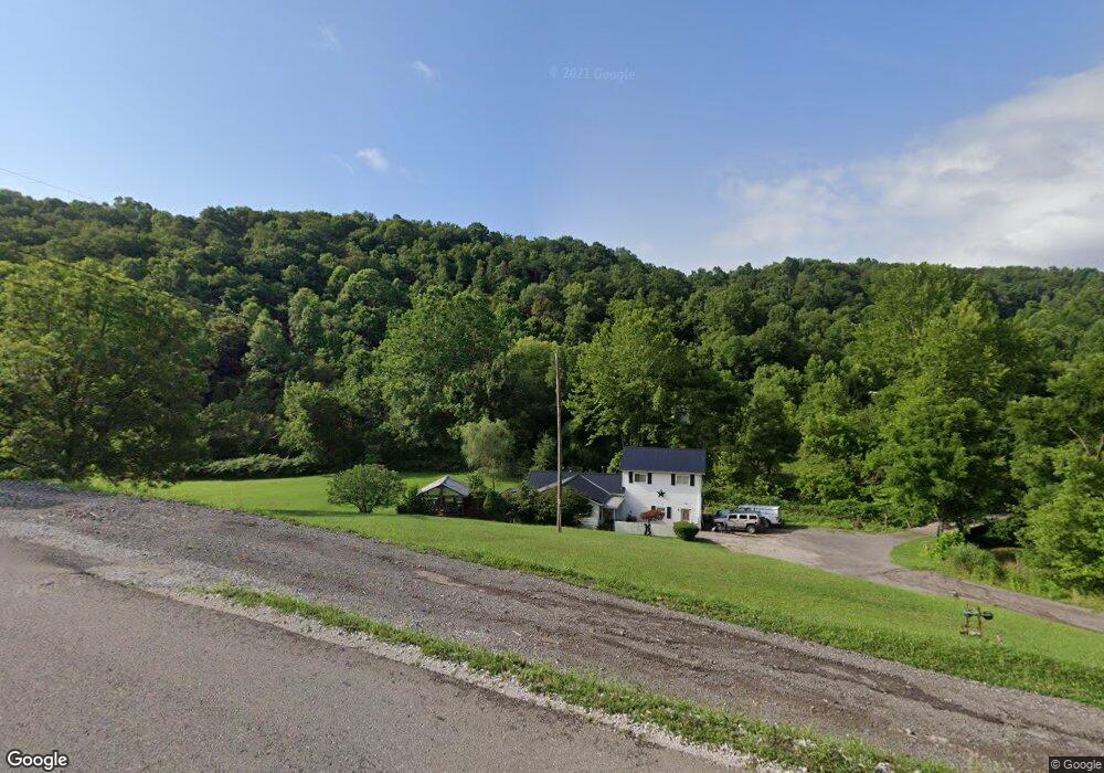
61 Grenfell Rd Saint Albans, WV 25177
Estimated Value: $159,000 - $219,000
3
Beds
1
Bath
1,766
Sq Ft
$101/Sq Ft
Est. Value
About This Home
This home is located at 61 Grenfell Rd, Saint Albans, WV 25177 and is currently estimated at $178,696, approximately $101 per square foot. 61 Grenfell Rd is a home located in Kanawha County with nearby schools including Andrews Heights Elementary School, Hayes Middle School, and Saint Albans High School.
Ownership History
Date
Name
Owned For
Owner Type
Purchase Details
Closed on
Sep 25, 2008
Sold by
Mcewen Thomas
Bought by
Confere Regina Jo
Current Estimated Value
Home Financials for this Owner
Home Financials are based on the most recent Mortgage that was taken out on this home.
Original Mortgage
$117,600
Outstanding Balance
$77,487
Interest Rate
6.41%
Mortgage Type
New Conventional
Estimated Equity
$101,209
Create a Home Valuation Report for This Property
The Home Valuation Report is an in-depth analysis detailing your home's value as well as a comparison with similar homes in the area
Home Values in the Area
Average Home Value in this Area
Purchase History
| Date | Buyer | Sale Price | Title Company |
|---|---|---|---|
| Confere Regina Jo | $147,000 | -- |
Source: Public Records
Mortgage History
| Date | Status | Borrower | Loan Amount |
|---|---|---|---|
| Open | Confere Regina Jo | $117,600 |
Source: Public Records
Tax History Compared to Growth
Tax History
| Year | Tax Paid | Tax Assessment Tax Assessment Total Assessment is a certain percentage of the fair market value that is determined by local assessors to be the total taxable value of land and additions on the property. | Land | Improvement |
|---|---|---|---|---|
| 2025 | $815 | $64,690 | $9,910 | $54,780 |
| 2024 | $815 | $64,630 | $9,670 | $54,960 |
| 2023 | $770 | $61,090 | $9,670 | $51,420 |
| 2022 | $726 | $57,610 | $9,670 | $47,940 |
| 2021 | $642 | $50,950 | $9,670 | $41,280 |
| 2020 | $642 | $50,950 | $9,670 | $41,280 |
| 2019 | $646 | $51,250 | $9,670 | $41,580 |
| 2018 | $574 | $51,250 | $9,670 | $41,580 |
| 2017 | $575 | $51,250 | $9,670 | $41,580 |
| 2016 | $577 | $51,240 | $9,600 | $41,640 |
| 2015 | $576 | $51,300 | $9,600 | $41,700 |
| 2014 | $550 | $49,800 | $9,240 | $40,560 |
Source: Public Records
Map
Nearby Homes
- 2262 Main Dr
- 101 Whitetail Ln
- 8 Cobblestone Ln
- 1514 Strawberry Rd
- 48 Lee Dr
- 2220 Falls Creek Rd
- 20 Bellwood Dr
- 7632 Coal River Rd
- 2518 E Parkview Dr
- 2102 Lith Blvd
- 2102 Woodhill Place
- 0 Ferrell Rd
- 713 High St
- 1636 Ferrell Rd
- 418 Donna Dr
- 105 Sunny Brook Dr
- 525 Wythal Rd
- 2023 Lakewood Dr
- 418 Kanawha St
- 11500 Coal River Rd
- 61 Grenfell Rd
- 452 Browns Creek Rd
- 450-6 Browns Creek Rd
- 453 Browns Creek Rd
- 21 Carmarthen Rd
- 1057 Browns Creek Rd
- 1052 Browns Creek Rd
- 1321 Browns Creek Rd
- 460 Browns Creek Rd
- 1345 Browns Creek Rd
- 459 Angel Fork Rd Unit B
- 1364 Browns Creek Rd
- 1401 Browns Creek Rd
- 99 Dukefield Dr
- 37 Woods Dr
- 1475 Browns Creek Rd
- 61 Wimmerfield Rd
- 638 Woods Dr
- 131 Wimmerfield Rd
- 422 Browns Creek Rd