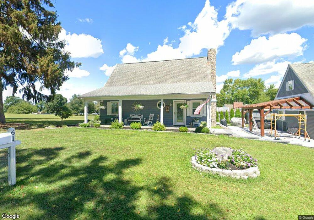
61 Hances Point Rd North East, MD 21901
Estimated Value: $261,000 - $358,000
--
Bed
1
Bath
1,224
Sq Ft
$268/Sq Ft
Est. Value
About This Home
This home is located at 61 Hances Point Rd, North East, MD 21901 and is currently estimated at $327,517, approximately $267 per square foot. 61 Hances Point Rd is a home located in Cecil County with nearby schools including North East Elementary School, North East Middle School, and North East High School.
Ownership History
Date
Name
Owned For
Owner Type
Purchase Details
Closed on
Jun 30, 2017
Sold by
Kondziela John T
Bought by
Warfield Robert T and Warfield Vicki L
Current Estimated Value
Home Financials for this Owner
Home Financials are based on the most recent Mortgage that was taken out on this home.
Original Mortgage
$140,000
Outstanding Balance
$113,359
Interest Rate
3%
Mortgage Type
Adjustable Rate Mortgage/ARM
Estimated Equity
$214,158
Purchase Details
Closed on
Apr 16, 1990
Sold by
Alban Mary
Bought by
Kondziela John T
Home Financials for this Owner
Home Financials are based on the most recent Mortgage that was taken out on this home.
Original Mortgage
$71,250
Interest Rate
10.25%
Create a Home Valuation Report for This Property
The Home Valuation Report is an in-depth analysis detailing your home's value as well as a comparison with similar homes in the area
Home Values in the Area
Average Home Value in this Area
Purchase History
| Date | Buyer | Sale Price | Title Company |
|---|---|---|---|
| Warfield Robert T | $200,000 | Kirsh Title Svcs | |
| Kondziela John T | $95,000 | -- |
Source: Public Records
Mortgage History
| Date | Status | Borrower | Loan Amount |
|---|---|---|---|
| Open | Warfield Robert T | $140,000 | |
| Previous Owner | Kondziela John T | $71,250 |
Source: Public Records
Tax History Compared to Growth
Tax History
| Year | Tax Paid | Tax Assessment Tax Assessment Total Assessment is a certain percentage of the fair market value that is determined by local assessors to be the total taxable value of land and additions on the property. | Land | Improvement |
|---|---|---|---|---|
| 2025 | $2,835 | $260,233 | $0 | $0 |
| 2024 | $2,374 | $246,967 | $0 | $0 |
| 2023 | $1,941 | $233,700 | $128,900 | $104,800 |
| 2022 | $2,670 | $231,700 | $0 | $0 |
| 2021 | $2,616 | $229,700 | $0 | $0 |
| 2020 | $2,686 | $227,700 | $128,900 | $98,800 |
| 2019 | $2,602 | $220,400 | $0 | $0 |
| 2018 | $2,518 | $213,100 | $0 | $0 |
| 2017 | $2,434 | $205,800 | $0 | $0 |
| 2016 | $2,329 | $205,800 | $0 | $0 |
| 2015 | $2,329 | $205,800 | $0 | $0 |
| 2014 | $2,309 | $207,700 | $0 | $0 |
Source: Public Records
Map
Nearby Homes
- 18 Plum Ct
- 9 Plum Ct
- 55 Long Beach Rd
- 15 Sunday Dr
- 619 Bladen St
- 479 Baltimore St
- 22 Edgewater Ave
- 807 Bladen St
- 332 Caroline St
- 0 Edgewater Ave
- 555 Baltimore St
- 572 Baltimore St
- 29 Northeast Ave
- 0 Northeast Ave Unit MDCC2015284
- 21 Heisler Ave
- 230 Mckinneytown Rd
- 605 Shady Beach Rd
- 167 Bridgewood Ave
- 29 Salvation Cir
- 90 Salvation Cir
- 148 Hances Point Rd
- 31 Shelter Cove Rd
- 16 Shelter Cove Rd
- 32 Shelter Cove Rd
- 9 Wingate Rd
- 2 Hances Point Rd
- 9 Sunset Dr
- 15 Sunset Dr
- 25 Sunset Dr
- 33 Sunset Dr
- 1 Sunset Dr
- 5 Hances Point Cove Rd
- 47 Sunset Dr
- 59 Sunset Dr
- 7 Hances Point Cove Rd
- 30 Sylvan Rd
- 230 Riverside Dr
- 127 Riverside Dr
- 137 Riverside Dr
- 115 Riverside Dr