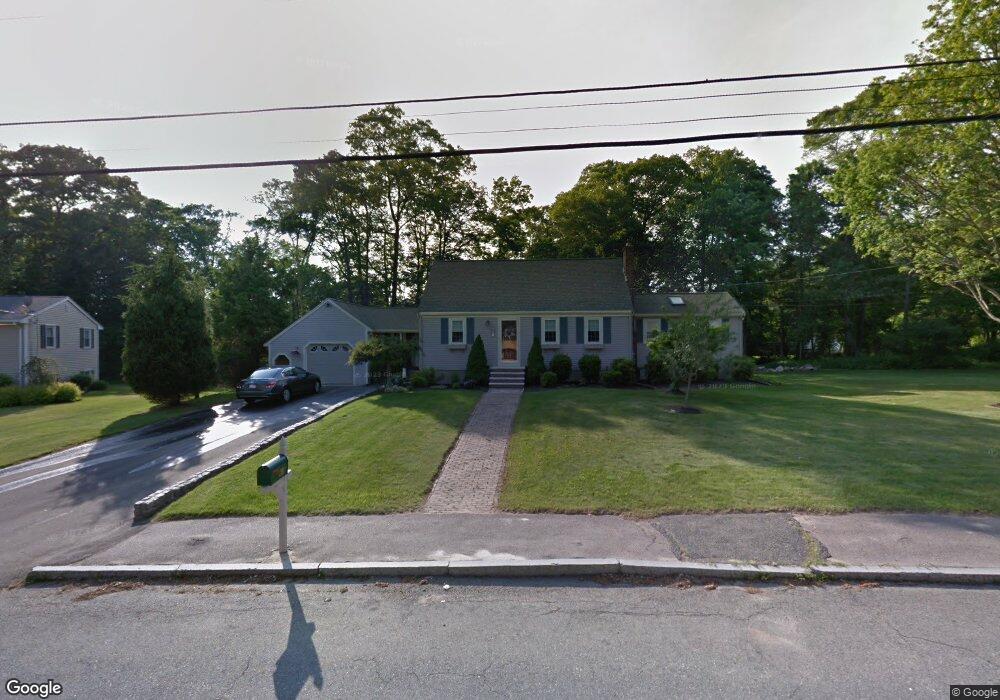
61 Loganberry Dr Abington, MA 02351
Estimated Value: $646,000 - $727,000
4
Beds
2
Baths
2,034
Sq Ft
$335/Sq Ft
Est. Value
About This Home
This home is located at 61 Loganberry Dr, Abington, MA 02351 and is currently estimated at $681,496, approximately $335 per square foot. 61 Loganberry Dr is a home located in Plymouth County with nearby schools including Woodsdale School, Beaver Brook Elementary School, and Abington Middle School.
Ownership History
Date
Name
Owned For
Owner Type
Purchase Details
Closed on
Oct 29, 2004
Sold by
Burns John R and Burns Carolyn M
Bought by
Soulia Eric J and Soulia Susan M
Current Estimated Value
Purchase Details
Closed on
May 3, 2002
Sold by
Bankers Trust Co Of Ca
Bought by
Burns John R and Burns Carolyn M
Home Financials for this Owner
Home Financials are based on the most recent Mortgage that was taken out on this home.
Original Mortgage
$211,000
Interest Rate
7.13%
Mortgage Type
Purchase Money Mortgage
Purchase Details
Closed on
Oct 23, 2001
Sold by
Kelliher Joseph J and Kelliher Mary J
Bought by
Bankers Trust Co Co
Create a Home Valuation Report for This Property
The Home Valuation Report is an in-depth analysis detailing your home's value as well as a comparison with similar homes in the area
Home Values in the Area
Average Home Value in this Area
Purchase History
| Date | Buyer | Sale Price | Title Company |
|---|---|---|---|
| Soulia Eric J | $420,000 | -- | |
| Burns John R | $280,000 | -- | |
| Bankers Trust Co Co | $210,000 | -- |
Source: Public Records
Mortgage History
| Date | Status | Borrower | Loan Amount |
|---|---|---|---|
| Previous Owner | Burns John R | $211,000 |
Source: Public Records
Tax History Compared to Growth
Tax History
| Year | Tax Paid | Tax Assessment Tax Assessment Total Assessment is a certain percentage of the fair market value that is determined by local assessors to be the total taxable value of land and additions on the property. | Land | Improvement |
|---|---|---|---|---|
| 2025 | $7,440 | $569,700 | $255,100 | $314,600 |
| 2024 | $7,748 | $579,100 | $254,000 | $325,100 |
| 2023 | $7,366 | $518,400 | $221,400 | $297,000 |
| 2022 | $7,097 | $466,300 | $185,100 | $281,200 |
| 2021 | $6,585 | $399,600 | $176,500 | $223,100 |
| 2020 | $6,565 | $386,200 | $163,300 | $222,900 |
| 2019 | $6,563 | $377,400 | $163,300 | $214,100 |
| 2018 | $6,560 | $368,100 | $163,300 | $204,800 |
| 2017 | $6,067 | $330,600 | $163,300 | $167,300 |
| 2016 | $5,505 | $307,000 | $149,100 | $157,900 |
| 2015 | $5,090 | $299,400 | $149,100 | $150,300 |
Source: Public Records
Map
Nearby Homes
- 451 Lincoln St
- 332 Hancock St
- 209 Hancock St
- 164 Hancock St
- 840 Hancock St
- 116 Hancock St
- 337 Randolph St
- 14 Kingswood Dr Unit 3
- 257 Rockland St Unit 257
- 676 Bedford St
- 505 Hampton Way Unit 505
- 14 Jamieson St
- 0 Bedford St
- 1210 Washington St
- 333 Groveland St
- 1353 Washington St
- 28 Pratt St
- 193 Linwood St
- 20 Cleverly St Unit B2
- 133 Andrew Ford Way
- 71 Loganberry Dr
- 45 Loganberry Dr
- 60 Loganberry Dr
- 62 Patricia Dr
- 48 Loganberry Dr
- 79 Loganberry Dr
- 82 Patricia Dr
- 70 Loganberry Dr
- 38 Loganberry Dr
- 33 Loganberry Dr
- 82 Loganberry Dr
- 11 Mulberry Dr
- 28 Loganberry Dr
- 91 Loganberry Dr
- 98 Patricia Dr
- 92 Loganberry Dr
- 73 Patricia Dr
- 40 Patricia Dr
- 13 Loganberry Dr
- 91 Patricia Dr