Estimated Value: $273,944 - $326,000
3
Beds
2
Baths
1,957
Sq Ft
$155/Sq Ft
Est. Value
About This Home
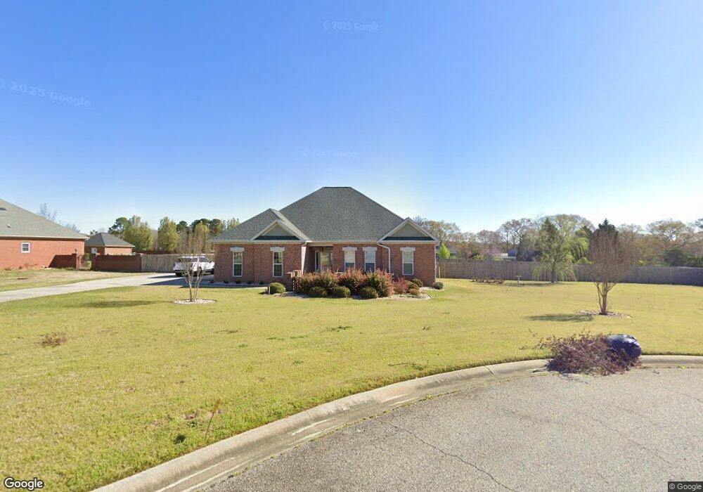
This home is located at 61 Malcolm Ct, Byron, GA 31008 and is currently estimated at $303,986, approximately $155 per square foot. 61 Malcolm Ct is a home located in Peach County with nearby schools including Kay Road Elementary School, Fort Valley Middle School, and Peach County High School.
Ownership History
Date
Name
Owned For
Owner Type
Purchase Details
Closed on
Nov 22, 2010
Sold by
Federal National Mortgage Association
Bought by
Sullivan Franklin L
Current Estimated Value
Home Financials for this Owner
Home Financials are based on the most recent Mortgage that was taken out on this home.
Original Mortgage
$134,400
Outstanding Balance
$88,811
Interest Rate
4.3%
Mortgage Type
New Conventional
Estimated Equity
$215,175
Purchase Details
Closed on
Jul 6, 2010
Sold by
Suntrust Mortgage Inc
Bought by
Federal National Mortgage Association
Purchase Details
Closed on
Nov 20, 2006
Sold by
Cryscorp Inc
Bought by
Story Charles D and Story Charlene
Home Financials for this Owner
Home Financials are based on the most recent Mortgage that was taken out on this home.
Original Mortgage
$29,700
Interest Rate
6.33%
Mortgage Type
New Conventional
Purchase Details
Closed on
Jan 13, 2006
Sold by
H & H Land Development Cor
Bought by
Cryscorp Inc
Purchase Details
Closed on
Jun 15, 2004
Bought by
H & H Land Development Corp
Create a Home Valuation Report for This Property
The Home Valuation Report is an in-depth analysis detailing your home's value as well as a comparison with similar homes in the area
Home Values in the Area
Average Home Value in this Area
Purchase History
| Date | Buyer | Sale Price | Title Company |
|---|---|---|---|
| Sullivan Franklin L | $173,500 | -- | |
| Federal National Mortgage Association | $106,200 | -- | |
| Story Charles D | $198,000 | -- | |
| Cryscorp Inc | $38,900 | -- | |
| H & H Land Development Corp | -- | -- |
Source: Public Records
Mortgage History
| Date | Status | Borrower | Loan Amount |
|---|---|---|---|
| Open | Sullivan Franklin L | $134,400 | |
| Previous Owner | Story Charles D | $29,700 | |
| Previous Owner | Story Charles D | $158,400 | |
| Closed | Cryscorp Inc | $0 |
Source: Public Records
Tax History Compared to Growth
Tax History
| Year | Tax Paid | Tax Assessment Tax Assessment Total Assessment is a certain percentage of the fair market value that is determined by local assessors to be the total taxable value of land and additions on the property. | Land | Improvement |
|---|---|---|---|---|
| 2024 | $2,603 | $97,160 | $9,600 | $87,560 |
| 2023 | $2,587 | $95,760 | $9,600 | $86,160 |
| 2022 | $2,290 | $84,720 | $9,600 | $75,120 |
| 2021 | $2,180 | $70,520 | $9,600 | $60,920 |
| 2020 | $2,280 | $73,720 | $9,600 | $64,120 |
| 2019 | $2,231 | $71,840 | $9,600 | $62,240 |
| 2018 | $2,241 | $71,840 | $9,600 | $62,240 |
| 2017 | $2,251 | $71,840 | $9,600 | $62,240 |
| 2016 | $2,243 | $71,840 | $9,600 | $62,240 |
| 2015 | $2,243 | $71,840 | $9,600 | $62,240 |
| 2014 | $2,243 | $71,840 | $9,600 | $62,240 |
| 2013 | -- | $71,840 | $9,600 | $62,240 |
Source: Public Records
Map
Nearby Homes
- 39 English Ct
- 219 Rowland Cir
- 108 Early Dr
- 109 Early Dr
- 111 Early Dr
- 119 Early Dr
- 115 Early Dr
- 165 Lakeview Rd
- 120 Hawks Place
- 211 Serenity Ct
- 117 Hawks Ridge Trace
- 800 John E Sullivan Rd
- 120 Hawks Ridge Trace
- 127 Hawks Ridge Trace
- 107 Red Tail Cir
- 109 Red Tail Cir
- 199 Red Tail Cir
- 555 Kimberly Dr
- 152 Hawks Ridge Trace
- 24C Sterling Dr
- 37 Malcolm Ct
- 85 Malcom Ct
- 37 Malcom Ct
- 85 Malcolm Ct
- 0 Malcom Ct Unit 3132543
- 64 Malcolm Ct
- 36 Malcom Ct
- 36 Malcolm Ct
- 25 Malcolm Ct
- 84 Malcolm Ct
- 15 Jw Edwards Dr
- 1378 Lakeview Rd Unit 241
- 1378 Lakeview Rd
- 87 Jw Edwards Dr
- 0 Jw Edwards Dr Unit 15B
- 0 Jw Edwards Dr Unit M165607
- 0 Jw Edwards Dr Unit 20041896
- 0 Jw Edwards Dr Unit 222913
- 0 Jw Edwards Dr Unit 9030925
- 0 Jw Edwards Dr Unit M161268