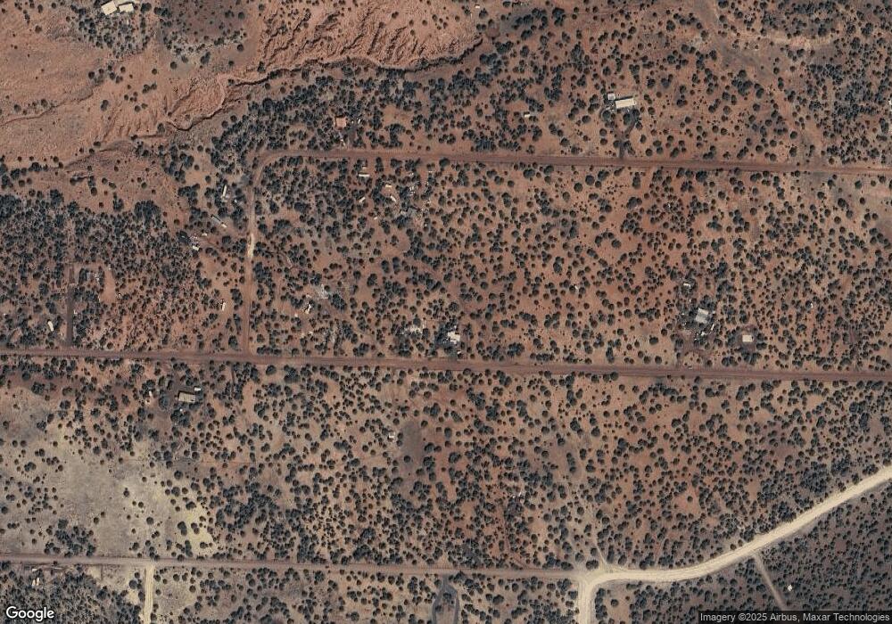
61 Malony Ave Concho, AZ 85924
Estimated Value: $73,000 - $135,000
--
Bed
--
Bath
640
Sq Ft
$151/Sq Ft
Est. Value
About This Home
This home is located at 61 Malony Ave, Concho, AZ 85924 and is currently estimated at $96,499, approximately $150 per square foot. 61 Malony Ave is a home.
Ownership History
Date
Name
Owned For
Owner Type
Purchase Details
Closed on
Apr 9, 2014
Sold by
Caumont Emmanuelle
Bought by
Spencer Dale
Current Estimated Value
Home Financials for this Owner
Home Financials are based on the most recent Mortgage that was taken out on this home.
Original Mortgage
$21,000
Outstanding Balance
$15,952
Interest Rate
4.32%
Mortgage Type
Seller Take Back
Estimated Equity
$80,547
Purchase Details
Closed on
Apr 24, 2012
Sold by
Burger Robert J
Bought by
Caumont Emmanuelle
Purchase Details
Closed on
Apr 20, 2010
Sold by
Grimes Don E
Bought by
Grimes Cecilia
Purchase Details
Closed on
Apr 15, 2010
Sold by
Grimes Cecilia A
Bought by
Burger John A
Create a Home Valuation Report for This Property
The Home Valuation Report is an in-depth analysis detailing your home's value as well as a comparison with similar homes in the area
Home Values in the Area
Average Home Value in this Area
Purchase History
| Date | Buyer | Sale Price | Title Company |
|---|---|---|---|
| Spencer Dale | $41,000 | Pioneer Title Agency Inc | |
| Caumont Emmanuelle | $8,500 | Pioneer Title Agency Inc | |
| Grimes Cecilia | -- | Lawyers Title Of Arizona Inc | |
| Burger John A | $25,000 | Lawyers Title Of Arizona Inc |
Source: Public Records
Mortgage History
| Date | Status | Borrower | Loan Amount |
|---|---|---|---|
| Open | Spencer Dale | $21,000 |
Source: Public Records
Tax History Compared to Growth
Tax History
| Year | Tax Paid | Tax Assessment Tax Assessment Total Assessment is a certain percentage of the fair market value that is determined by local assessors to be the total taxable value of land and additions on the property. | Land | Improvement |
|---|---|---|---|---|
| 2026 | $225 | $2,925 | -- | -- |
| 2025 | $227 | $2,786 | -- | -- |
| 2024 | $227 | $2,653 | $0 | $0 |
| 2023 | $227 | $2,527 | $0 | $0 |
| 2022 | $256 | $2,407 | $0 | $0 |
| 2021 | $224 | $2,292 | $0 | $0 |
| 2020 | $222 | $2,183 | $0 | $0 |
| 2019 | $204 | $2,079 | $0 | $0 |
| 2018 | $226 | $1,980 | $0 | $0 |
| 2017 | $184 | $1,796 | $0 | $0 |
| 2016 | $145 | $1,710 | $0 | $0 |
| 2015 | $97 | $1,710 | $0 | $0 |
| 2014 | $97 | $1,397 | $188 | $1,210 |
Source: Public Records
Map
Nearby Homes
- 0 Show Low Pines Unit 8 Lot 346 -- Unit 346 6751653
- 7 Cr 8277 Rd
- Lot 35 Cr 8281
- 690 Stanford Dr
- 21 County Road 8303 --
- 688 Stanford Dr
- 45 County Rd 8296 --
- Lot 384 Show Low Pines Unit 10
- 54 Schultz Rd
- Lot 460 Lot 461 Cr8301
- 0 8309
- 9974 Appaloosa Trail
- 34 County Road 8308
- 47 County Road 8306
- Lot 122 123
- 182 Irwin Ave
- 0 Irwin Ave Unit 255058
- 0 Bella Vista Unit 256496
- 44 County Rd
- 0 Cr 8065 Unit 256333
- 59 Malony
- 2 Co Rd # 8274 Rd
- 2 Co Rd Unit 8274
- 2 Co Rd # 8274 Rd Unit 8274
- Lot 10 Mark Ln
- Lot 50 Acr 8272 Unit Lot 50 Malony Drive
- 0 Landis and Maloney Ave
- 0 De Grazia Cir
- Lot 52 Maloney Ave Unit CR 8272
- 44 County Road 8271
- Show Low Pines Unit 8 Lot 343
- Show Low Pines Unit 8 Lot 343 -- Unit 343
- TBD Co Rd 8269 Lots 150 & 151 --
- 000 Grazia Cir
- 0 Co Rd 8269 Lots 150 & 151 Unit 254618
- 14 Nassau Ave
- TBD Co Rd 8269 Lot 151 --
- TBD 342 Cr 8976
- - Show Low Pines Unit 9 Lot 282 -- Unit 282
- - Show Low Pines Unit 9 Lot 282 -- Unit 279
