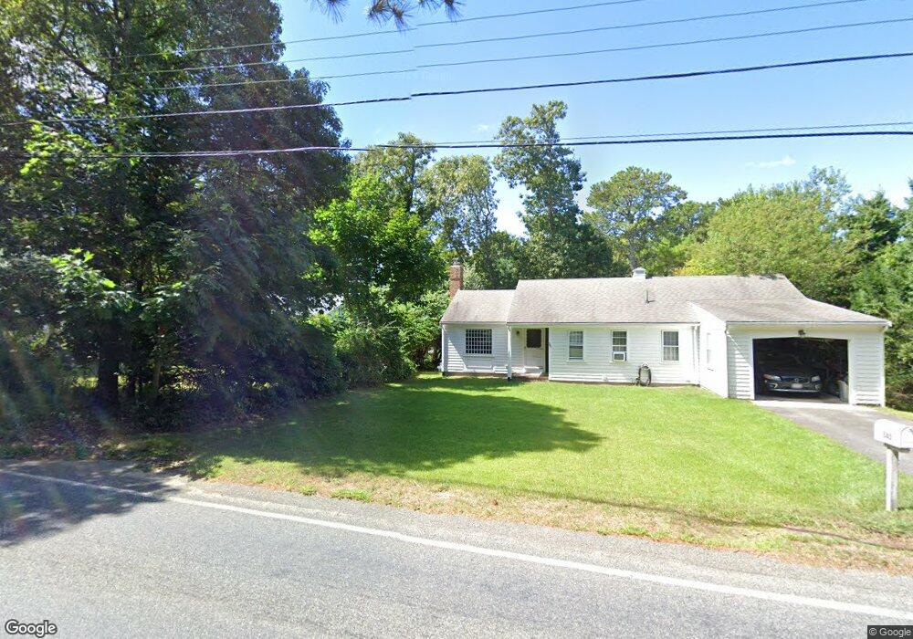
61 Mild Bay Cir Dennis Port, MA 02639
Dennis Port NeighborhoodEstimated Value: $681,000 - $816,000
3
Beds
2
Baths
1,900
Sq Ft
$388/Sq Ft
Est. Value
About This Home
This home is located at 61 Mild Bay Cir, Dennis Port, MA 02639 and is currently estimated at $738,102, approximately $388 per square foot. 61 Mild Bay Cir is a home located in Barnstable County with nearby schools including Dennis-Yarmouth Regional High School and St. Pius X. School.
Ownership History
Date
Name
Owned For
Owner Type
Purchase Details
Closed on
Feb 17, 2023
Sold by
Simonis Michael F
Bought by
M F Simonis Residence T
Current Estimated Value
Purchase Details
Closed on
Apr 8, 2005
Sold by
Simonis Francis J and Simonis Joyce
Bought by
Simonis Michael F
Purchase Details
Closed on
May 26, 2004
Sold by
Dubrow Michele Dempsey and Dubrow Sheldon H
Bought by
Simonis Francis J and Simonis Joyce
Purchase Details
Closed on
Dec 20, 2002
Sold by
Gagne Faith E
Bought by
Dubrow Sheldon H and Dempsey-Dubrow Michele
Create a Home Valuation Report for This Property
The Home Valuation Report is an in-depth analysis detailing your home's value as well as a comparison with similar homes in the area
Home Values in the Area
Average Home Value in this Area
Purchase History
| Date | Buyer | Sale Price | Title Company |
|---|---|---|---|
| M F Simonis Residence T | -- | None Available | |
| Simonis Michael F | -- | -- | |
| Simonis Francis J | $355,000 | -- | |
| Dubrow Sheldon H | $98,500 | -- |
Source: Public Records
Tax History Compared to Growth
Tax History
| Year | Tax Paid | Tax Assessment Tax Assessment Total Assessment is a certain percentage of the fair market value that is determined by local assessors to be the total taxable value of land and additions on the property. | Land | Improvement |
|---|---|---|---|---|
| 2025 | $2,591 | $598,400 | $124,900 | $473,500 |
| 2024 | $2,321 | $528,700 | $127,200 | $401,500 |
| 2023 | $2,266 | $485,200 | $115,600 | $369,600 |
| 2022 | $2,208 | $394,300 | $115,700 | $278,600 |
| 2021 | $2,041 | $338,500 | $102,100 | $236,400 |
| 2020 | $1,926 | $315,800 | $102,100 | $213,700 |
| 2019 | $1,919 | $311,100 | $100,100 | $211,000 |
| 2018 | $1,771 | $279,400 | $95,300 | $184,100 |
| 2017 | $1,718 | $279,400 | $95,300 | $184,100 |
| 2016 | $1,714 | $262,500 | $105,900 | $156,600 |
| 2015 | $1,680 | $262,500 | $105,900 | $156,600 |
| 2014 | $1,683 | $265,100 | $84,700 | $180,400 |
Source: Public Records
Map
Nearby Homes
- 537 Depot St
- 360 Center St
- 11 Lane Rd
- 116 Searsville Rd
- 171 Searsville Rd
- 91 Depot Rd W
- 24 Indian Trail
- 29 Highland St
- 78 Upper County Rd Unit A&B
- 78 Upper County Rd
- 20 Aunt Debbys Rd
- 141 Division St
- 141 Division St
- 9 Country Ln
- 47 Telegraph Rd Unit 1
- 9 Bells Neck Rd Unit 10
- 64 Smith St
- 12 Candlewood Ln Unit 2-9
- 45 Route 28
- 10 Candlewood Ln Unit 2-1
- 15 Mild Bay Cir
- 0 Mild Bay Cir
- 57 Mild Bay Cir
- 17 Mild Bay Cir
- 9 Mild Bay Cir
- 55 Mild Bay Cir
- 21 Mild Bay Cir
- 541 Depot St
- 545 Depot St
- 51 Mild Bay Cir
- 1 Mild Bay Cir
- 29 Mild Bay Cir
- 25 Mild Bay Cir
- 24 Mild Bay Cir
- 66 Mild Bay Cir
- 12 Mild Bay Cir
- 43 Mild Bay Cir
- 35 Mild Bay Cir
- 62 Mild Bay Cir
- 8 Mild Bay Cir