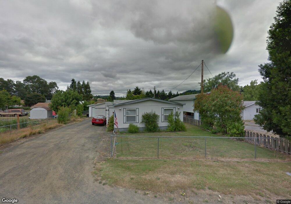
61 NW Snow Ave Winston, OR 97496
Estimated Value: $244,000 - $295,000
3
Beds
2
Baths
1,080
Sq Ft
$243/Sq Ft
Est. Value
About This Home
This home is located at 61 NW Snow Ave, Winston, OR 97496 and is currently estimated at $262,176, approximately $242 per square foot. 61 NW Snow Ave is a home located in Douglas County with nearby schools including Douglas High School.
Ownership History
Date
Name
Owned For
Owner Type
Purchase Details
Closed on
Nov 29, 2016
Sold by
Davis Micah
Bought by
Harrington Mark H
Current Estimated Value
Home Financials for this Owner
Home Financials are based on the most recent Mortgage that was taken out on this home.
Original Mortgage
$122,500
Interest Rate
4.3%
Mortgage Type
VA
Purchase Details
Closed on
Aug 30, 2016
Sold by
Taylor Linda Sue
Bought by
Davis Micah
Home Financials for this Owner
Home Financials are based on the most recent Mortgage that was taken out on this home.
Original Mortgage
$72,000
Interest Rate
3.48%
Mortgage Type
Purchase Money Mortgage
Create a Home Valuation Report for This Property
The Home Valuation Report is an in-depth analysis detailing your home's value as well as a comparison with similar homes in the area
Home Values in the Area
Average Home Value in this Area
Purchase History
| Date | Buyer | Sale Price | Title Company |
|---|---|---|---|
| Harrington Mark H | $122,500 | First American Title | |
| Davis Micah | $65,000 | First American Title |
Source: Public Records
Mortgage History
| Date | Status | Borrower | Loan Amount |
|---|---|---|---|
| Previous Owner | Harrington Mark H | $122,500 | |
| Previous Owner | Davis Micah | $72,000 |
Source: Public Records
Tax History Compared to Growth
Tax History
| Year | Tax Paid | Tax Assessment Tax Assessment Total Assessment is a certain percentage of the fair market value that is determined by local assessors to be the total taxable value of land and additions on the property. | Land | Improvement |
|---|---|---|---|---|
| 2025 | $1,802 | $108,440 | -- | -- |
| 2024 | $1,751 | $105,282 | -- | -- |
| 2023 | $1,702 | $102,216 | $0 | $0 |
| 2022 | $1,651 | $99,239 | $0 | $0 |
| 2021 | $1,607 | $96,349 | $0 | $0 |
| 2020 | $1,560 | $93,543 | $0 | $0 |
| 2019 | $1,523 | $90,819 | $0 | $0 |
| 2018 | $1,482 | $88,174 | $0 | $0 |
| 2017 | $1,444 | $85,606 | $0 | $0 |
Source: Public Records
Map
Nearby Homes
- 841 NW Lori St
- 364 NW Teal St
- 210 NW Timothy Ave
- 301 NW Midway St
- 0 NW Galaxy Dr
- 308 NW Civil Bend Ave
- 222 NW Broc Dr
- 260 SW Ford Ave
- 68 NW Rose St
- 0 SW Main St
- 151 Sherry St
- 109 Citation Ct
- 310 NW Lost Ln
- 120 SE Edwards Ave
- 0 SE Gregory Dr
- 13224 Lookingglass Rd
- 139 Teresa Ln
- 0 Danielle Dr Unit 122251646
- 173 NE Main St
- 165 Danielle Dr