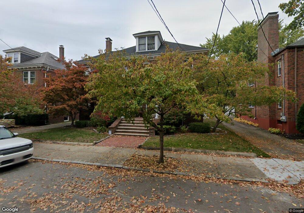
61 Pershing Rd Jamaica Plain, MA 02130
Jamaica Plain NeighborhoodEstimated Value: $1,631,000 - $2,195,704
4
Beds
3
Baths
3,696
Sq Ft
$535/Sq Ft
Est. Value
About This Home
This home is located at 61 Pershing Rd, Jamaica Plain, MA 02130 and is currently estimated at $1,976,426, approximately $534 per square foot. 61 Pershing Rd is a home located in Suffolk County with nearby schools including Roxbury Preparatory Charter School, Nativity Preparatory School, and Meridian Academy.
Ownership History
Date
Name
Owned For
Owner Type
Purchase Details
Closed on
Apr 29, 2024
Sold by
Hanifin John W and Hanifin Nancy N
Bought by
Nancy N Hanifin T N and Nancy Hanifin
Current Estimated Value
Purchase Details
Closed on
May 3, 1991
Sold by
Munn Charles S
Bought by
Hanifin John W and Hanifin Nancy N-Hanifin
Create a Home Valuation Report for This Property
The Home Valuation Report is an in-depth analysis detailing your home's value as well as a comparison with similar homes in the area
Home Values in the Area
Average Home Value in this Area
Purchase History
| Date | Buyer | Sale Price | Title Company |
|---|---|---|---|
| Nancy N Hanifin T N | -- | None Available | |
| Nancy N Hanifin T N | -- | None Available | |
| Hanifin John W | $285,000 | -- | |
| Hanifin John W | $285,000 | -- |
Source: Public Records
Mortgage History
| Date | Status | Borrower | Loan Amount |
|---|---|---|---|
| Previous Owner | Hanifin John W | $465,750 | |
| Previous Owner | Hanifin John W | $496,500 |
Source: Public Records
Tax History
| Year | Tax Paid | Tax Assessment Tax Assessment Total Assessment is a certain percentage of the fair market value that is determined by local assessors to be the total taxable value of land and additions on the property. | Land | Improvement |
|---|---|---|---|---|
| 2025 | $22,538 | $1,946,300 | $625,600 | $1,320,700 |
| 2024 | $21,229 | $1,947,600 | $504,000 | $1,443,600 |
| 2023 | $19,371 | $1,803,600 | $466,700 | $1,336,900 |
| 2022 | $18,003 | $1,654,700 | $428,200 | $1,226,500 |
| 2021 | $17,656 | $1,654,700 | $428,200 | $1,226,500 |
| 2020 | $15,985 | $1,513,700 | $434,700 | $1,079,000 |
| 2019 | $15,044 | $1,427,300 | $340,000 | $1,087,300 |
| 2018 | $13,599 | $1,297,600 | $340,000 | $957,600 |
| 2017 | $13,742 | $1,297,600 | $340,000 | $957,600 |
| 2016 | $12,631 | $1,148,300 | $340,000 | $808,300 |
| 2015 | $12,613 | $1,041,500 | $226,100 | $815,400 |
| 2014 | $12,127 | $964,000 | $226,100 | $737,900 |
Source: Public Records
Map
Nearby Homes
- 36-38 Moraine St
- 79-81 Moraine St
- 24-26 Moraine St Unit 24
- 26 Beaufort Rd Unit 2
- 139 Perkins St Unit TH139
- 9 Oakview Terrace
- 32 Robinwood Ave Unit 7
- 8 Perkins St Unit 10
- 14 Castleton St Unit 1
- 48 Robinwood Ave Unit W2
- 33 Pond St Unit 919
- 28 Boylston St
- 343 S Huntington Ave Unit 7
- 390 Centre St
- 25 Cranston St Unit 2
- 11-13 Parley Ave Unit 11B
- 90 Bynner St Unit 7
- 122 Day St Unit 3
- 11 Mark St Unit 2
- 77 Spring Park Ave Unit 2
- 65 Pershing Rd
- 57 Pershing Rd
- 57 Pershing Rd Unit 1
- 57 Pershing Rd Unit 2
- 73 Pershing Rd
- 70 Moraine St
- 70 Moraine St Unit 1
- 53 Pershing Rd
- 64 Moraine St
- 64 Moraine St Unit 1
- 64 Moraine St Unit 2
- 60 Moraine St
- 74 Moraine St Unit 2
- 74 Moraine St
- 74 Moraine St Unit 1
- 58 Pershing Rd
- 62 Pershing Rd
- 76 Moraine St Unit 78
- 49 Pershing Rd
- 66 Pershing Rd
Your Personal Tour Guide
Ask me questions while you tour the home.