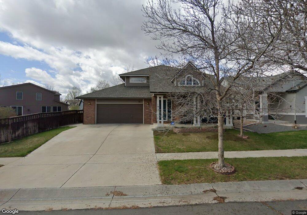
61 Pheasant Ave Brighton, CO 80601
Estimated Value: $519,000 - $559,000
5
Beds
4
Baths
2,880
Sq Ft
$186/Sq Ft
Est. Value
About This Home
This home is located at 61 Pheasant Ave, Brighton, CO 80601 and is currently estimated at $535,980, approximately $186 per square foot. 61 Pheasant Ave is a home located in Adams County with nearby schools including Pennock Elementary School, Overland Trail Middle School, and Brighton High School.
Ownership History
Date
Name
Owned For
Owner Type
Purchase Details
Closed on
Jun 22, 2020
Sold by
Mangel Leah M and Mangel Randy R
Bought by
Tieszen Ashleigh Joy and Tieszen Wilson Roger
Current Estimated Value
Home Financials for this Owner
Home Financials are based on the most recent Mortgage that was taken out on this home.
Original Mortgage
$438,867
Outstanding Balance
$385,566
Interest Rate
3.2%
Mortgage Type
VA
Estimated Equity
$150,414
Purchase Details
Closed on
Sep 28, 2001
Sold by
Grein Construction Inc
Bought by
Mangel Randy R and Mangel Leah M
Home Financials for this Owner
Home Financials are based on the most recent Mortgage that was taken out on this home.
Original Mortgage
$195,380
Interest Rate
6.88%
Create a Home Valuation Report for This Property
The Home Valuation Report is an in-depth analysis detailing your home's value as well as a comparison with similar homes in the area
Home Values in the Area
Average Home Value in this Area
Purchase History
| Date | Buyer | Sale Price | Title Company |
|---|---|---|---|
| Tieszen Ashleigh Joy | $429,000 | Equitable Title Agency Llc | |
| Mangel Randy R | $244,233 | -- |
Source: Public Records
Mortgage History
| Date | Status | Borrower | Loan Amount |
|---|---|---|---|
| Open | Tieszen Ashleigh Joy | $438,867 | |
| Previous Owner | Mangel Randy R | $195,380 |
Source: Public Records
Tax History
| Year | Tax Paid | Tax Assessment Tax Assessment Total Assessment is a certain percentage of the fair market value that is determined by local assessors to be the total taxable value of land and additions on the property. | Land | Improvement |
|---|---|---|---|---|
| 2025 | $5,971 | $36,520 | $6,800 | $29,720 |
| 2024 | $5,971 | $33,560 | $6,250 | $27,310 |
| 2023 | $5,948 | $38,630 | $6,360 | $32,270 |
| 2022 | $4,851 | $28,000 | $6,530 | $21,470 |
| 2021 | $4,677 | $28,000 | $6,530 | $21,470 |
| 2020 | $4,119 | $25,660 | $6,220 | $19,440 |
| 2019 | $4,125 | $25,660 | $6,220 | $19,440 |
| 2018 | $3,715 | $23,070 | $6,480 | $16,590 |
| 2017 | $3,719 | $23,070 | $6,480 | $16,590 |
| 2016 | $2,774 | $17,780 | $3,660 | $14,120 |
| 2015 | $2,762 | $17,780 | $3,660 | $14,120 |
| 2014 | $2,283 | $14,810 | $2,630 | $12,180 |
Source: Public Records
Map
Nearby Homes
- 59 Paloma Ave
- 5292 Goldfinch St
- 45 Gaviota Ave
- 115 Gaviota Ave
- 132 Pelican Ave
- 191 Golden Eagle Pkwy
- 12 Golden Eagle Pkwy Unit 12
- 164 Apache Plume St
- 282 Tall Spruce Cir
- 5386 Golden Eagle Pkwy
- 5124 Chicory Cir
- 329 Apache Plume St
- 4788 Singletree Ln
- 4776 Singletree Ln
- 5154 Chicory Cir
- 4827 Mount Shavano St
- 4828 Mount Cameron Dr
- 5254 Sagebrush St
- 5192 Delphinium Cir
- 5019 Thistle Dr
- 41 Pheasant Ave
- 5283 Killdeer St
- 5273 Killdeer St
- 5293 Killdeer St
- 5263 Killdeer St
- 31 Pheasant Ave
- 50 Pheasant Ave
- 60 Pheasant Ave
- 40 Pheasant Ave
- 5315 Killdeer St
- 5261 Killdeer St
- 21 Pheasant Ave
- 30 Pheasant Ave
- 5335 Killdeer St
- 20 Pheasant Ave
- 5253 Killdeer St
- 69 Paloma Ave
- 49 Paloma Ave
- 5282 Goldfinch St
- 5272 Goldfinch St
Your Personal Tour Guide
Ask me questions while you tour the home.