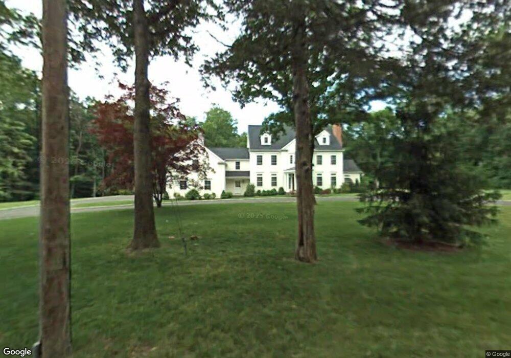
61 Pocconock Trail New Canaan, CT 06840
Estimated Value: $2,025,000 - $4,250,000
6
Beds
7
Baths
5,724
Sq Ft
$601/Sq Ft
Est. Value
About This Home
This home is located at 61 Pocconock Trail, New Canaan, CT 06840 and is currently estimated at $3,437,825, approximately $600 per square foot. 61 Pocconock Trail is a home located in Fairfield County with nearby schools including East Elementary School, Saxe Middle School, and New Canaan High School.
Ownership History
Date
Name
Owned For
Owner Type
Purchase Details
Closed on
Aug 30, 2024
Sold by
Chen Hua
Bought by
Ross Daniel
Current Estimated Value
Purchase Details
Closed on
Apr 3, 2007
Sold by
61 Pocconock Llc
Bought by
Ross Daniel and Chen Hua
Home Financials for this Owner
Home Financials are based on the most recent Mortgage that was taken out on this home.
Original Mortgage
$940,000
Interest Rate
5.87%
Create a Home Valuation Report for This Property
The Home Valuation Report is an in-depth analysis detailing your home's value as well as a comparison with similar homes in the area
Home Values in the Area
Average Home Value in this Area
Purchase History
| Date | Buyer | Sale Price | Title Company |
|---|---|---|---|
| Ross Daniel | -- | None Available | |
| Ross Daniel | -- | None Available | |
| Ross Daniel | $3,200,000 | -- | |
| Ross Daniel | $3,200,000 | -- |
Source: Public Records
Mortgage History
| Date | Status | Borrower | Loan Amount |
|---|---|---|---|
| Previous Owner | Ross Daniel | $250,000 | |
| Previous Owner | Ross Daniel | $940,000 | |
| Previous Owner | Ross Daniel | $1,500,000 |
Source: Public Records
Tax History Compared to Growth
Tax History
| Year | Tax Paid | Tax Assessment Tax Assessment Total Assessment is a certain percentage of the fair market value that is determined by local assessors to be the total taxable value of land and additions on the property. | Land | Improvement |
|---|---|---|---|---|
| 2025 | $36,801 | $2,205,000 | $660,450 | $1,544,550 |
| 2024 | $35,589 | $2,205,000 | $660,450 | $1,544,550 |
| 2023 | $30,548 | $1,612,870 | $599,830 | $1,013,040 |
| 2022 | $29,628 | $1,612,870 | $599,830 | $1,013,040 |
| 2021 | $29,290 | $1,612,870 | $599,830 | $1,013,040 |
| 2020 | $29,290 | $1,612,870 | $599,830 | $1,013,040 |
| 2019 | $29,419 | $1,612,870 | $599,830 | $1,013,040 |
| 2018 | $32,174 | $1,897,070 | $590,100 | $1,306,970 |
| 2017 | $31,624 | $1,897,070 | $590,100 | $1,306,970 |
| 2016 | $30,941 | $1,897,070 | $590,100 | $1,306,970 |
| 2015 | $31,415 | $1,897,070 | $590,100 | $1,306,970 |
| 2014 | $29,480 | $1,897,070 | $590,100 | $1,306,970 |
Source: Public Records
Map
Nearby Homes
- 48 Silver Ridge Rd
- 59 Snowberry Ln
- 515 Carter St
- 63 Middle Ridge Rd
- 152 Long Lots Rd
- 339 Old Norwalk Rd
- 106A Comstock Hill Ave
- 4 Fullmar Ln
- 255 Silvermine Ave
- 230 New Canaan Ave Unit 2
- 184 Marvin Ridge Rd
- 234 Marvin Ridge Rd
- 12 Lincoln Dr
- 250 Carter St
- 9 Singing Woods Rd
- 158L Carter St
- 38 Fitch Ln
- 18 Singing Woods Rd
- 36 Styles Ln
- 216 White Oak Shade Rd
- 95 Buttery Rd
- 58 Pocconock Trail
- 43 Pocconock Trail
- 91 Pocconock Trail
- 670 Carter St
- 86 Pocconock Trail
- 32 Pocconock Trail
- 49 Betsys Ln
- 93 Buttery Rd
- 674 Carter St
- 39 Betsys Ln
- 59 Betsys Ln
- 104 Pocconock Trail
- 107 Pocconock Trail
- 668 Carter St
- 73 Betsys Ln
- 79 Buttery Rd
- 11 Betsys Ln
- 654 Carter St
- 89 Betsys Ln