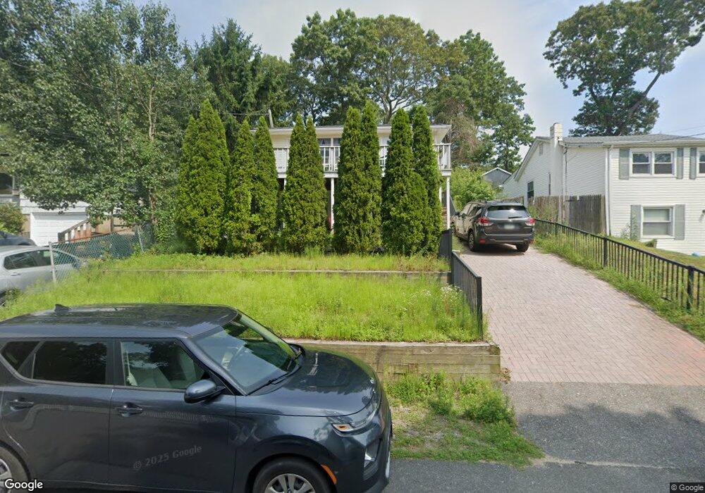
61 Port Washington Rd Sound Beach, NY 11789
Estimated Value: $401,000 - $470,036
3
Beds
1
Bath
1,100
Sq Ft
$400/Sq Ft
Est. Value
About This Home
This home is located at 61 Port Washington Rd, Sound Beach, NY 11789 and is currently estimated at $439,509, approximately $399 per square foot. 61 Port Washington Rd is a home located in Suffolk County with nearby schools including Frank J. Carasiti Elementary School, Joseph A Edgar Imtermediate School, and Rocky Point Middle School.
Ownership History
Date
Name
Owned For
Owner Type
Purchase Details
Closed on
Mar 15, 2010
Sold by
Fotis Deirdre Flynn
Bought by
Flynn Deirdre A
Current Estimated Value
Home Financials for this Owner
Home Financials are based on the most recent Mortgage that was taken out on this home.
Original Mortgage
$197,395
Interest Rate
4.5%
Mortgage Type
FHA
Purchase Details
Closed on
Jul 7, 2000
Sold by
Drizis Eraklis and Drizis Maria
Bought by
Fotis Deirdre Flynn
Home Financials for this Owner
Home Financials are based on the most recent Mortgage that was taken out on this home.
Original Mortgage
$98,000
Interest Rate
8.28%
Create a Home Valuation Report for This Property
The Home Valuation Report is an in-depth analysis detailing your home's value as well as a comparison with similar homes in the area
Home Values in the Area
Average Home Value in this Area
Purchase History
| Date | Buyer | Sale Price | Title Company |
|---|---|---|---|
| Flynn Deirdre A | -- | -- | |
| Fotis Deirdre Flynn | $109,000 | Safe Harbor Title Agency |
Source: Public Records
Mortgage History
| Date | Status | Borrower | Loan Amount |
|---|---|---|---|
| Closed | Flynn Deirdre A | $197,395 | |
| Previous Owner | Fotis Deirdre Flynn | $98,000 |
Source: Public Records
Tax History Compared to Growth
Tax History
| Year | Tax Paid | Tax Assessment Tax Assessment Total Assessment is a certain percentage of the fair market value that is determined by local assessors to be the total taxable value of land and additions on the property. | Land | Improvement |
|---|---|---|---|---|
| 2024 | $7,347 | $1,831 | $80 | $1,751 |
| 2023 | $7,347 | $1,831 | $80 | $1,751 |
| 2022 | $6,455 | $1,831 | $80 | $1,751 |
| 2021 | $6,455 | $1,831 | $80 | $1,751 |
| 2020 | $6,705 | $1,831 | $80 | $1,751 |
| 2019 | $6,705 | $0 | $0 | $0 |
| 2018 | $6,275 | $1,831 | $80 | $1,751 |
| 2017 | $6,275 | $1,831 | $80 | $1,751 |
| 2016 | $6,171 | $1,831 | $80 | $1,751 |
| 2015 | -- | $1,831 | $80 | $1,751 |
| 2014 | -- | $1,831 | $80 | $1,751 |
Source: Public Records
Map
Nearby Homes
- 56 Hewlett Dr
- 10 Sunnyside Dr
- 24 Malverne Rd
- 5 Franklin Rd
- 11 Estate Ct
- 15 Woodhaven Dr
- 20 Whitestone Rd Unit 1486
- 14 Whitestone Rd
- 22 Babylon Dr
- 31 Whitestone Rd
- 65 Tyler Ave
- 6 Sound Beach Blvd
- 61 Brookhaven Dr
- 39 Northport Rd
- 93 Tyler Ave
- 5 Laurel Rd
- 443 N Country Rd
- 10 Hunter Ave
- 5 Kew Dr
- 55 Patchogue Dr
- 67 Port Washington Rd
- 57 Port Washington Rd
- 14 Richmond Hill Rd
- 18 Richmond Hill Rd
- 66 Port Washington Rd
- 36 Richmond Hill Rd
- 73 Port Washington Rd
- 32 Richmond Hill Rd
- 72 Port Washington Rd
- 53 Port Washington Rd
- 23 Pinelawn Rd
- 43 Richmond Hill Rd
- 35 Pinelawn Rd
- 41 Richmond Hill Rd
- 66 Plandome Rd
- 19 Pinelawn Rd
- 66 Plandome Rd
- 45 Malba Dr
- 7 Plandome Rd
- 30 Richmond Hill Rd