
Seller's Agent in 2026
Sarah Vo
Charlton Realty
(508) 642-3589
9 in this area
29 Total Sales
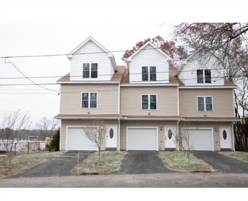


Located at 61 Progressive st, Worcester, this single-family residence presents a wonderful opportunity to establish roots in a thriving community. Constructed in 2025, this home offers the perfect foundation for a life well-lived. This residence offers a comfortable amount of space to personalize and make your own. The layout includes three bedrooms and two full bathrooms, providing a practical arrangement for everyday living. Imagine the possibilities for creating cozy and inviting spaces that reflect your unique style and preferences within these dimensions. The property includes a two-car garage, offering shelter for vehicles and additional storage capacity. Close to many amenities.
| Date | Type | Sale Price | Title Company |
|---|---|---|---|
| Quit Claim Deed | $482,945 | -- | |
| Quit Claim Deed | $162,000 | -- | |
| Quit Claim Deed | $162,000 | -- |
| Date | Status | Loan Amount | Loan Type |
|---|---|---|---|
| Open | $386,356 | New Conventional |
| Date | Event | Price | List to Sale | Price per Sq Ft |
|---|---|---|---|---|
| 01/02/2026 01/02/26 | Sold | $482,945 | +0.8% | $291 / Sq Ft |
| 12/02/2025 12/02/25 | Pending | -- | -- | -- |
| 12/02/2025 12/02/25 | For Sale | $479,000 | -- | $288 / Sq Ft |
| Year | Tax Paid | Tax Assessment Tax Assessment Total Assessment is a certain percentage of the fair market value that is determined by local assessors to be the total taxable value of land and additions on the property. | Land | Improvement |
|---|---|---|---|---|
| 2025 | $1,566 | $118,700 | $118,700 | $0 |
| 2024 | $5,690 | $413,800 | $118,700 | $295,100 |
| 2023 | $5,175 | $360,900 | $103,200 | $257,700 |
| 2022 | $5,176 | $340,300 | $82,600 | $257,700 |
| 2021 | $4,433 | $272,300 | $66,100 | $206,200 |
| 2020 | $3,954 | $232,600 | $66,100 | $166,500 |
| 2019 | $3,937 | $218,700 | $59,500 | $159,200 |
| 2018 | $4,054 | $214,400 | $59,500 | $154,900 |
| 2017 | $4,077 | $212,100 | $59,500 | $152,600 |
| 2016 | $3,916 | $190,000 | $43,700 | $146,300 |
| 2015 | $3,813 | $190,000 | $43,700 | $146,300 |
| 2014 | $3,713 | $190,000 | $43,700 | $146,300 |
Seller's Agent in 2026
Sarah Vo
Charlton Realty
(508) 642-3589
9 in this area
29 Total Sales
Buyer's Agent in 2026
Otis Tat
Excelsior Realty
(508) 736-2735
8 in this area
125 Total Sales
Source: MLS Property Information Network (MLS PIN)
MLS Number: 73459157
APN: WORC-000034-000012-000030
Disclaimer: Certain information contained herein is derived from information provided by parties other than Homes.com. All information provided is deemed reliable, but is not guaranteed to be accurate and should be independently verified.
![]() The property listing data and information, or the Images, set forth herein were provided to MLS Property Information Network, Inc. from third party sources, including sellers, lessors and public records, and were compiled by MLS Property Information Network, Inc. The property listing data and information, and the Images, are for the personal, non-commercial use of consumers having a good faith interest in purchasing or leasing listed properties of the type displayed to them and may not be used for any purpose other than to identify prospective properties which such consumers may have a good faith interest in purchasing or leasing. MLS Property Information Network, Inc. and its subscribers disclaim any and all representations and warranties as to the accuracy of the property listing data and information, or as to the accuracy of any of the Images, set forth herein.
The property listing data and information, or the Images, set forth herein were provided to MLS Property Information Network, Inc. from third party sources, including sellers, lessors and public records, and were compiled by MLS Property Information Network, Inc. The property listing data and information, and the Images, are for the personal, non-commercial use of consumers having a good faith interest in purchasing or leasing listed properties of the type displayed to them and may not be used for any purpose other than to identify prospective properties which such consumers may have a good faith interest in purchasing or leasing. MLS Property Information Network, Inc. and its subscribers disclaim any and all representations and warranties as to the accuracy of the property listing data and information, or as to the accuracy of any of the Images, set forth herein.
Ask me questions while you tour the home.