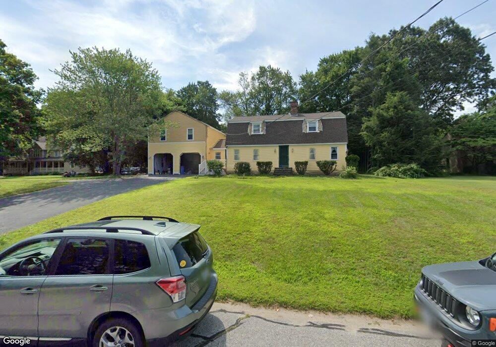
61 Red Gate Rd Cumberland, RI 02864
Ashton NeighborhoodEstimated Value: $632,000 - $834,000
4
Beds
2
Baths
2,242
Sq Ft
$330/Sq Ft
Est. Value
About This Home
This home is located at 61 Red Gate Rd, Cumberland, RI 02864 and is currently estimated at $739,332, approximately $329 per square foot. 61 Red Gate Rd is a home located in Providence County with nearby schools including Ashton Elementary School, Joseph L. McCourt Middle School, and Cumberland High School.
Ownership History
Date
Name
Owned For
Owner Type
Purchase Details
Closed on
Sep 14, 1995
Sold by
Crozier Robert S and Crozier Rosemary
Bought by
Rock Joseph W and Rock Cheryl
Current Estimated Value
Create a Home Valuation Report for This Property
The Home Valuation Report is an in-depth analysis detailing your home's value as well as a comparison with similar homes in the area
Home Values in the Area
Average Home Value in this Area
Purchase History
| Date | Buyer | Sale Price | Title Company |
|---|---|---|---|
| Rock Joseph W | $189,000 | -- |
Source: Public Records
Mortgage History
| Date | Status | Borrower | Loan Amount |
|---|---|---|---|
| Open | Rock Joseph W | $300,000 | |
| Closed | Rock Joseph W | $100,000 | |
| Closed | Rock Joseph W | $139,735 | |
| Closed | Rock Joseph W | $176,600 |
Source: Public Records
Tax History
| Year | Tax Paid | Tax Assessment Tax Assessment Total Assessment is a certain percentage of the fair market value that is determined by local assessors to be the total taxable value of land and additions on the property. | Land | Improvement |
|---|---|---|---|---|
| 2025 | $7,015 | $571,700 | $136,700 | $435,000 |
| 2024 | $6,832 | $571,700 | $136,700 | $435,000 |
| 2023 | $6,643 | $571,700 | $136,700 | $435,000 |
| 2022 | $6,398 | $426,800 | $105,700 | $321,100 |
| 2021 | $6,291 | $426,800 | $105,700 | $321,100 |
| 2020 | $6,112 | $426,800 | $105,700 | $321,100 |
| 2019 | $6,557 | $412,900 | $124,100 | $288,800 |
| 2018 | $6,367 | $412,900 | $124,100 | $288,800 |
| 2017 | $6,280 | $412,900 | $124,100 | $288,800 |
| 2016 | $6,677 | $390,900 | $124,900 | $266,000 |
| 2015 | $6,677 | $390,900 | $124,900 | $266,000 |
| 2014 | $6,677 | $390,900 | $124,900 | $266,000 |
| 2013 | $5,817 | $368,600 | $115,700 | $252,900 |
Source: Public Records
Map
Nearby Homes
- 1 Barway Ln
- 1251 Mendon Rd
- 3 Barrett St
- 21 A St
- 97 Angell Rd
- 200 Old Mendon Rd
- 7 Hidden Valley Ln
- 0 Narragansett Rd
- 24 Narragansett Ave
- 18 Narragansett Ave
- 25 Chestnut St
- 98 Iroquois Rd
- 473 River Rd
- 85 Colonial Ave
- 20 Ferncrest Dr
- 164 Scott Rd
- 51 Pequot Ave
- 43 Massachusetts Ave
- 107 Old River Rd Unit 11
- 34 Dexter Rock Rd
- 59 Red Gate Rd
- 65 Red Gate Rd
- 2 Stone Bridge Dr
- 56 Red Gate Rd
- 1 Stone Bridge Dr
- 3 Stone Bridge Dr
- 54 Red Gate Rd
- 57 Red Gate Rd
- 55 Red Gate Rd
- 4 Stone Bridge Dr
- 5 Stone Bridge Dr
- 50 Red Gate Rd
- 51 Red Gate Rd
- 48 Red Gate Rd
- 6 Stone Bridge Dr
- 7 Stone Bridge Dr
- 47 Red Gate Rd
- 20 Valley Stream Dr
- 22 Valley Stream Dr
- 44 Red Gate Rd