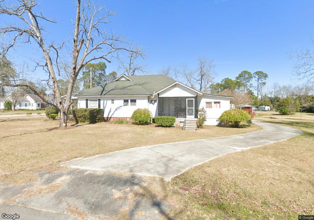
61 S First Ave Mc Rae, GA 31055
Estimated Value: $161,000 - $229,000
Studio
3
Baths
2,409
Sq Ft
$79/Sq Ft
Est. Value
About This Home
This home is located at 61 S First Ave, Mc Rae, GA 31055 and is currently estimated at $189,214, approximately $78 per square foot. 61 S First Ave is a home located in Telfair County with nearby schools including Telfair County Elementary School, Telfair County Middle School, and Telfair County High School.
Ownership History
Date
Name
Owned For
Owner Type
Purchase Details
Closed on
Feb 17, 2022
Sold by
Dennis Emily A
Bought by
Wesley Michael
Current Estimated Value
Home Financials for this Owner
Home Financials are based on the most recent Mortgage that was taken out on this home.
Original Mortgage
$92,181
Outstanding Balance
$19,819
Interest Rate
3.69%
Mortgage Type
Cash
Estimated Equity
$169,395
Create a Home Valuation Report for This Property
The Home Valuation Report is an in-depth analysis detailing your home's value as well as a comparison with similar homes in the area
Home Values in the Area
Average Home Value in this Area
Purchase History
| Date | Buyer | Sale Price | Title Company |
|---|---|---|---|
| Wesley Michael | $75,000 | -- |
Source: Public Records
Mortgage History
| Date | Status | Borrower | Loan Amount |
|---|---|---|---|
| Open | Wesley Michael | $92,181 |
Source: Public Records
Tax History
| Year | Tax Paid | Tax Assessment Tax Assessment Total Assessment is a certain percentage of the fair market value that is determined by local assessors to be the total taxable value of land and additions on the property. | Land | Improvement |
|---|---|---|---|---|
| 2025 | $2,457 | $70,643 | $7,378 | $63,265 |
| 2024 | $2,510 | $63,647 | $5,902 | $57,745 |
| 2023 | $1,154 | $60,887 | $5,902 | $54,985 |
| 2022 | $1,623 | $54,513 | $5,902 | $48,611 |
| 2021 | $1,203 | $38,454 | $5,902 | $32,552 |
| 2020 | $1,139 | $35,806 | $5,902 | $29,904 |
| 2019 | $1,145 | $35,806 | $5,902 | $29,904 |
| 2018 | $1,543 | $35,806 | $5,902 | $29,904 |
| 2017 | $1,103 | $34,620 | $5,902 | $28,718 |
| 2016 | $1,103 | $34,620 | $5,902 | $28,718 |
| 2015 | -- | $34,620 | $5,902 | $28,718 |
| 2014 | -- | $33,000 | $3,486 | $29,514 |
| 2013 | -- | $32,999 | $3,486 | $29,513 |
Source: Public Records
Map
Nearby Homes
- 39 W Graham St
- 78 S Second Ave
- 26 S Sixth Ave
- 136 S Third Ave
- 27 E Bruce St
- 61 W Bruce St
- 131 Huckabee St
- 117 Fifth Ave
- 85 E Brewton St
- 0 Bonaire St Unit 10647239
- 0 Bonaire St Unit 23852
- 95 W Willow Creek Ln
- 53 Bonaire Extension
- 177 W Brewton St
- 427 N 3rd Ave
- 210 W Graham St
- 11 Zanders Ave
- 0 Center Ave Unit 10648464
- 0 Center Ave Unit 23896
- 39 13th St
Your Personal Tour Guide
Ask me questions while you tour the home.