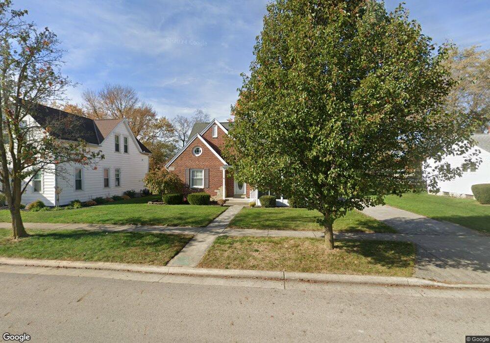
61 S Frankfort St Minster, OH 45865
Estimated Value: $280,000 - $398,000
3
Beds
2
Baths
1,869
Sq Ft
$180/Sq Ft
Est. Value
About This Home
This home is located at 61 S Frankfort St, Minster, OH 45865 and is currently estimated at $335,967, approximately $179 per square foot. 61 S Frankfort St is a home located in Auglaize County with nearby schools including Minster Elementary School and Minster Junior/Senior High School.
Ownership History
Date
Name
Owned For
Owner Type
Purchase Details
Closed on
Oct 8, 2019
Sold by
Ahrns Janice M and Ahrns Thomas J
Bought by
Tebbe Joel M
Current Estimated Value
Home Financials for this Owner
Home Financials are based on the most recent Mortgage that was taken out on this home.
Original Mortgage
$174,000
Outstanding Balance
$152,119
Interest Rate
3.4%
Mortgage Type
Future Advance Clause Open End Mortgage
Estimated Equity
$183,848
Purchase Details
Closed on
Mar 28, 2002
Sold by
Ahrns Richard A
Bought by
Ahrns Thomas J
Create a Home Valuation Report for This Property
The Home Valuation Report is an in-depth analysis detailing your home's value as well as a comparison with similar homes in the area
Home Values in the Area
Average Home Value in this Area
Purchase History
| Date | Buyer | Sale Price | Title Company |
|---|---|---|---|
| Tebbe Joel M | $217,500 | None Available | |
| Ahrns Thomas J | -- | -- |
Source: Public Records
Mortgage History
| Date | Status | Borrower | Loan Amount |
|---|---|---|---|
| Open | Tebbe Joel M | $174,000 |
Source: Public Records
Tax History Compared to Growth
Tax History
| Year | Tax Paid | Tax Assessment Tax Assessment Total Assessment is a certain percentage of the fair market value that is determined by local assessors to be the total taxable value of land and additions on the property. | Land | Improvement |
|---|---|---|---|---|
| 2024 | $5,637 | $81,140 | $15,740 | $65,400 |
| 2023 | $2,749 | $81,140 | $15,740 | $65,400 |
| 2022 | $2,435 | $66,720 | $14,440 | $52,280 |
| 2021 | $2,487 | $66,720 | $14,440 | $52,280 |
| 2020 | $2,538 | $66,728 | $14,445 | $52,283 |
| 2019 | $1,408 | $54,800 | $11,872 | $42,928 |
| 2018 | $1,884 | $54,800 | $11,872 | $42,928 |
| 2017 | $1,748 | $54,800 | $11,872 | $42,928 |
| 2016 | $1,443 | $45,837 | $10,770 | $35,067 |
| 2015 | $1,419 | $45,837 | $10,770 | $35,067 |
| 2014 | $1,420 | $45,837 | $10,770 | $35,067 |
| 2013 | $1,489 | $45,837 | $10,770 | $35,067 |
Source: Public Records
Map
Nearby Homes
- 47 N Frankfort St
- 193 N Paris St
- 17 Stonegate Dr
- 0 Stonegate Dr Unit 21 10544857
- 0 Stonegate Dr Unit 14 10544847
- 36 Shania Place Unit 23
- 27 Shania Place Unit 26
- 19 Shania Place Unit 33
- 28 Shania Place Unit 33
- 11 Shania Place Unit 28
- 561 S Walnut St Unit Lot3
- 12600 E Shelby Rd
- 12244 Short Dr Unit Condo Unit 10
- 129 Janice Dr
- 323 Margaret St
- 319 Margaret St
- 316 Margaret St
- 312 Margaret St
- 130 Janice Dr
- 416 E Plum St
- 69 S Frankfort St
- 53 S Frankfort St
- 45 S Frankfort St
- 77 S Frankfort St
- 85 S Frankfort St
- 48 S Frankfort St
- 37 S Frankfort St
- 70 S Frankfort St
- 70 S Cleveland St
- 40 S Frankfort St
- 146 W 3rd St
- 93 S Frankfort St
- 29 S Frankfort St
- 40 N Frankfort St
- 78 S Frankfort St
- 78 S Cleveland St
- 42 S Frankfort St
- 30 S Frankfort St
- 94 S Frankfort St