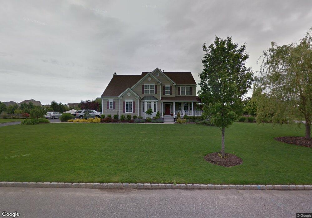
61 Saint Andrews Path Wading River, NY 11792
Estimated Value: $1,035,488 - $1,304,000
4
Beds
4
Baths
2,939
Sq Ft
$384/Sq Ft
Est. Value
About This Home
This home is located at 61 Saint Andrews Path, Wading River, NY 11792 and is currently estimated at $1,127,372, approximately $383 per square foot. 61 Saint Andrews Path is a home located in Suffolk County with nearby schools including Wading River School, Miller Avenue School, and Albert G Prodell Middle School.
Ownership History
Date
Name
Owned For
Owner Type
Purchase Details
Closed on
Nov 8, 2013
Sold by
Rich Mark
Bought by
Isgro Dino and Isgro Jennifer M
Current Estimated Value
Home Financials for this Owner
Home Financials are based on the most recent Mortgage that was taken out on this home.
Original Mortgage
$417,000
Interest Rate
4.25%
Mortgage Type
New Conventional
Purchase Details
Closed on
Apr 1, 2003
Sold by
Birchwood At Wading River Llc
Bought by
Rich Mark
Create a Home Valuation Report for This Property
The Home Valuation Report is an in-depth analysis detailing your home's value as well as a comparison with similar homes in the area
Home Values in the Area
Average Home Value in this Area
Purchase History
| Date | Buyer | Sale Price | Title Company |
|---|---|---|---|
| Isgro Dino | $612,250 | -- | |
| Rich Mark | $409,900 | Omni Title Age |
Source: Public Records
Mortgage History
| Date | Status | Borrower | Loan Amount |
|---|---|---|---|
| Open | Isgro Dino | $72,800 | |
| Previous Owner | Isgro Dino | $417,000 |
Source: Public Records
Tax History
| Year | Tax Paid | Tax Assessment Tax Assessment Total Assessment is a certain percentage of the fair market value that is determined by local assessors to be the total taxable value of land and additions on the property. | Land | Improvement |
|---|---|---|---|---|
| 2024 | $19,419 | $78,500 | $12,700 | $65,800 |
| 2023 | $19,419 | $78,500 | $12,700 | $65,800 |
| 2022 | $16,034 | $78,500 | $12,700 | $65,800 |
| 2021 | $16,034 | $78,500 | $12,700 | $65,800 |
| 2020 | $17,427 | $78,500 | $12,700 | $65,800 |
| 2019 | $17,427 | $0 | $0 | $0 |
| 2018 | -- | $78,500 | $12,700 | $65,800 |
| 2017 | $17,023 | $78,500 | $12,700 | $65,800 |
| 2016 | $16,309 | $78,500 | $12,700 | $65,800 |
| 2015 | -- | $78,500 | $12,700 | $65,800 |
| 2014 | -- | $78,500 | $12,700 | $65,800 |
Source: Public Records
Map
Nearby Homes
- 98 Calverton Ct
- 265 Hidden Acres Path
- 1430 Wading River Manor Rd
- 63 Lakeside Trail
- 15 Corchaug Trail
- 0 Corchaug Trail Unit KEY847995
- 126 Wauwepex Trail
- 97 Lakeside Trail
- 55 Newcomb Trail
- 244 Lakeside Trail
- 9 S Pond Trail
- 234 Lakeside Trail
- 180 Lakeside Trail
- 215 Lakeside Trail
- 658 Sound Ave Unit F-16
- 1944 Wading River Manor Rd
- 49 Overhill Rd
- 658 Sound Ave
- 658 Sound Ave Unit E5
- 43 Farm Rd N
- 49 Maidstone Ln (Calverton Ct) Ct
- 51 Saint Andrews Path
- 3 Taconic Ct
- 5 Taconic Ct
- 54 Maidstone Ln
- 60 Saint Andrews Path
- 44 Maidstone Ln
- 50 Saint Andrews Path
- 7 Taconic Ct
- 64 Maidstone Ln
- 41 Saint Andrews Path
- 35 Maidstone Ln
- 2 Taconic Ct
- 34 Maidstone Ln
- 74 Maidstone Ln
- 9 Inverness Ct
- 3 Indianwood Ct
- 5 Indianwood Ct
- 4 Taconic Ct
- 6 Taconic Ct
Your Personal Tour Guide
Ask me questions while you tour the home.