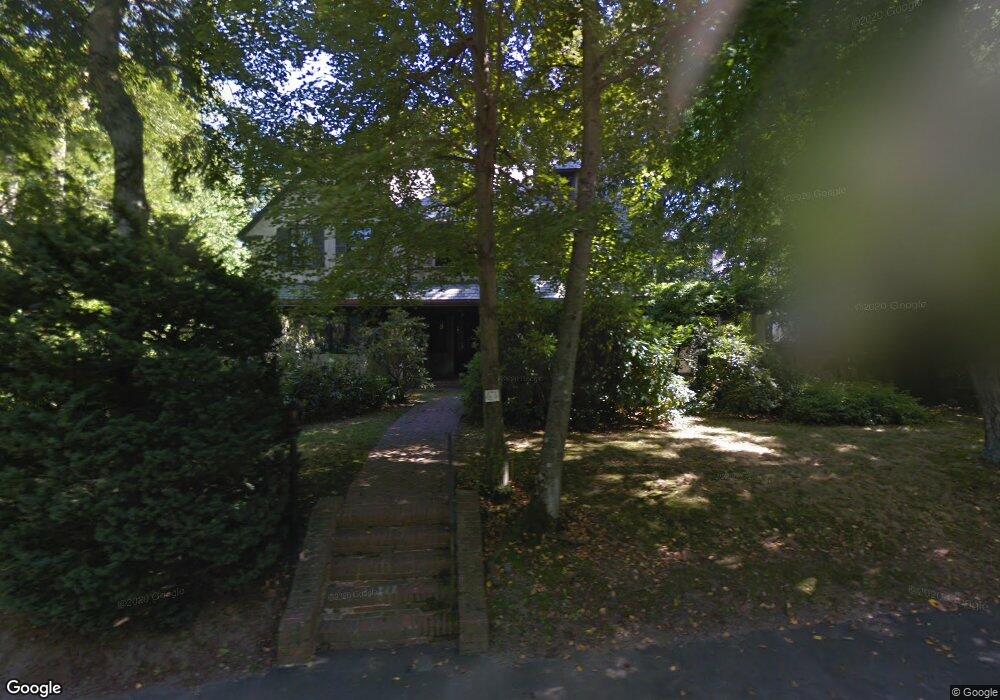
61 Spooner Rd Chestnut Hill, MA 02467
Chestnut Hill NeighborhoodEstimated Value: $3,697,000 - $4,850,000
5
Beds
4
Baths
4,164
Sq Ft
$1,008/Sq Ft
Est. Value
About This Home
This home is located at 61 Spooner Rd, Chestnut Hill, MA 02467 and is currently estimated at $4,196,084, approximately $1,007 per square foot. 61 Spooner Rd is a home located in Norfolk County with nearby schools including Heath Elementary School, Brookline High School, and Brimmer & May School.
Ownership History
Date
Name
Owned For
Owner Type
Purchase Details
Closed on
May 26, 2017
Sold by
Fogg George P and Fogg Jane T
Bought by
61 Spooner Road Nt
Current Estimated Value
Purchase Details
Closed on
Aug 13, 2014
Sold by
Fogg 3Rd George P
Bought by
Fogg 3Rd George P and Fogg Jane T
Purchase Details
Closed on
Mar 7, 2014
Sold by
Fogg Frances K Est
Bought by
Fogg 3Rd George P
Purchase Details
Closed on
Oct 17, 1979
Bought by
Fogg George P and Todd Jane
Create a Home Valuation Report for This Property
The Home Valuation Report is an in-depth analysis detailing your home's value as well as a comparison with similar homes in the area
Home Values in the Area
Average Home Value in this Area
Purchase History
| Date | Buyer | Sale Price | Title Company |
|---|---|---|---|
| 61 Spooner Road Nt | -- | -- | |
| Fogg 3Rd George P | -- | -- | |
| Fogg 3Rd George P | -- | -- | |
| Fogg George P | -- | -- |
Source: Public Records
Tax History
| Year | Tax Paid | Tax Assessment Tax Assessment Total Assessment is a certain percentage of the fair market value that is determined by local assessors to be the total taxable value of land and additions on the property. | Land | Improvement |
|---|---|---|---|---|
| 2025 | $44,783 | $4,537,300 | $2,137,100 | $2,400,200 |
| 2024 | $42,712 | $4,371,800 | $2,054,800 | $2,317,000 |
| 2023 | $37,344 | $3,745,600 | $1,468,100 | $2,277,500 |
| 2022 | $36,350 | $3,567,200 | $1,398,200 | $2,169,000 |
| 2021 | $33,614 | $3,430,000 | $1,344,400 | $2,085,600 |
| 2020 | $30,975 | $3,277,800 | $1,222,100 | $2,055,700 |
| 2019 | $22,253 | $2,374,900 | $1,163,900 | $1,211,000 |
| 2018 | $20,383 | $2,154,600 | $1,192,600 | $962,000 |
| 2017 | $20,083 | $2,032,700 | $1,125,100 | $907,600 |
| 2016 | $19,795 | $1,899,700 | $1,051,500 | $848,200 |
| 2015 | $18,938 | $1,773,200 | $982,700 | $790,500 |
| 2014 | $18,731 | $1,644,500 | $893,400 | $751,100 |
Source: Public Records
Map
Nearby Homes
- 142 Crafts Rd
- 1014 Boylston St
- 2420 Beacon St Unit 401
- 476 Heath St
- 130 Cabot St
- 394 Hammond St
- 88 Cutler Ln
- 6 Sutherland Rd Unit 41
- 0 Glenoe Rd
- 41 Orkney Rd
- 4 Chiswick Rd Unit 34
- 31 Orkney Rd Unit 54
- 3 Glenoe Rd
- 5 Braemore Rd Unit 10
- 17 Strathmore Rd Unit 2
- 1945 Commonwealth Ave Unit 4
- 26 Chiswick Rd Unit 6
- 114 Strathmore Rd Unit 102
- 65 Strathmore Rd Unit 49
- 2021 Commonwealth Ave Unit B