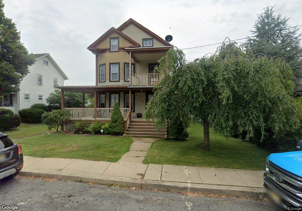
61 State St Washington, NJ 07882
Estimated Value: $332,964 - $363,000
3
Beds
1
Bath
2,342
Sq Ft
$150/Sq Ft
Est. Value
About This Home
This home is located at 61 State St, Washington, NJ 07882 and is currently estimated at $350,241, approximately $149 per square foot. 61 State St is a home located in Warren County with nearby schools including Taylor Street Elementary School, Washington Memorial Elementary School, and Warren Hills Regional Middle School.
Ownership History
Date
Name
Owned For
Owner Type
Purchase Details
Closed on
Apr 11, 2003
Sold by
Mastro Peter and Mastro Maureen
Bought by
Rizza Joseph D
Current Estimated Value
Home Financials for this Owner
Home Financials are based on the most recent Mortgage that was taken out on this home.
Original Mortgage
$128,000
Outstanding Balance
$55,714
Interest Rate
5.93%
Estimated Equity
$294,527
Purchase Details
Closed on
Nov 30, 2001
Sold by
Swenson Gary Allan and Swenson Matthew Nels
Bought by
Mastro Peter and Mastro Maureen
Home Financials for this Owner
Home Financials are based on the most recent Mortgage that was taken out on this home.
Original Mortgage
$102,600
Interest Rate
6.66%
Purchase Details
Closed on
May 17, 2001
Sold by
Swenson Bradford Allen
Bought by
Swenson Gary Allan
Purchase Details
Closed on
Jul 26, 1999
Sold by
Moore Franklin H
Bought by
Swenson Bradford Allen and Swenson Matthew Nels
Create a Home Valuation Report for This Property
The Home Valuation Report is an in-depth analysis detailing your home's value as well as a comparison with similar homes in the area
Home Values in the Area
Average Home Value in this Area
Purchase History
| Date | Buyer | Sale Price | Title Company |
|---|---|---|---|
| Rizza Joseph D | $160,000 | Commonwealth Land Title Ins | |
| Mastro Peter | $108,000 | -- | |
| Swenson Gary Allan | $23,912 | -- | |
| Swenson Bradford Allen | -- | -- |
Source: Public Records
Mortgage History
| Date | Status | Borrower | Loan Amount |
|---|---|---|---|
| Open | Rizza Joseph D | $128,000 | |
| Previous Owner | Mastro Peter | $102,600 |
Source: Public Records
Tax History
| Year | Tax Paid | Tax Assessment Tax Assessment Total Assessment is a certain percentage of the fair market value that is determined by local assessors to be the total taxable value of land and additions on the property. | Land | Improvement |
|---|---|---|---|---|
| 2025 | $8,981 | $160,800 | $49,800 | $111,000 |
| 2024 | $8,309 | $160,800 | $49,800 | $111,000 |
Source: Public Records
Map
Nearby Homes
- 194 W Washington Ave
- 193 W Washington Ave Unit 195
- 37 W Washington Ave
- 225 W Washington Ave
- 50 N Lincoln Ave
- 80 Lenape Trail
- 137 Belvidere Ave
- 88 Lenape Trail
- 79 Lenape Trail
- 37 Carlton Ave
- 135 Broad St
- 46 Taylor St
- 26 Vannatta St
- 0000 Harmony Lopat Line
- 283 Route 31
- 340 N Prospect St
- 96 Park Ave
- 9 Heather Hills Rd
- 60 Flower Ave
- 2 Presidential Dr
- 63 State St
- 49 State St
- 47 State St
- 59 State St
- 45 State St
- 172 W Washington Ave
- 8 Grand Ave
- 174 W Washington Ave
- 60 State St
- 43 State St
- 64 State St
- 58 State St
- 180 W Washington Ave
- 10 Grand Ave
- 14 Grand Ave
- 14 Grand Ave Unit 2
- 52 State St
- 170 W Washington Ave
- 170 W Washington Ave Unit A
- 160 W Washington Ave
Your Personal Tour Guide
Ask me questions while you tour the home.