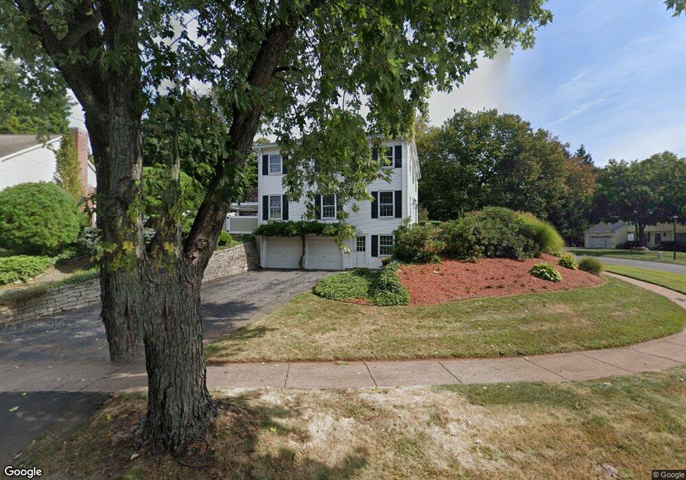
61 Sulgrave Rd West Hartford, CT 06107
Estimated Value: $787,000 - $872,000
4
Beds
3
Baths
2,813
Sq Ft
$297/Sq Ft
Est. Value
About This Home
This home is located at 61 Sulgrave Rd, West Hartford, CT 06107 and is currently estimated at $834,636, approximately $296 per square foot. 61 Sulgrave Rd is a home located in Hartford County with nearby schools including Duffy School, Sedgwick Middle School, and Conard High School.
Ownership History
Date
Name
Owned For
Owner Type
Purchase Details
Closed on
Aug 17, 1999
Sold by
Beaudry George R Est
Bought by
Gustafson Michael J and Gustafson Margaret M
Current Estimated Value
Home Financials for this Owner
Home Financials are based on the most recent Mortgage that was taken out on this home.
Original Mortgage
$239,920
Interest Rate
7.65%
Purchase Details
Closed on
Nov 23, 1987
Sold by
Harris Linda R
Bought by
Eidson Andrew L
Home Financials for this Owner
Home Financials are based on the most recent Mortgage that was taken out on this home.
Original Mortgage
$110,000
Interest Rate
11.22%
Create a Home Valuation Report for This Property
The Home Valuation Report is an in-depth analysis detailing your home's value as well as a comparison with similar homes in the area
Home Values in the Area
Average Home Value in this Area
Purchase History
| Date | Buyer | Sale Price | Title Company |
|---|---|---|---|
| Gustafson Michael J | $299,900 | -- | |
| Eidson Andrew L | $150,000 | -- |
Source: Public Records
Mortgage History
| Date | Status | Borrower | Loan Amount |
|---|---|---|---|
| Open | Eidson Andrew L | $290,000 | |
| Closed | Eidson Andrew L | $300,700 | |
| Closed | Eidson Andrew L | $239,920 | |
| Previous Owner | Eidson Andrew L | $110,000 |
Source: Public Records
Tax History Compared to Growth
Tax History
| Year | Tax Paid | Tax Assessment Tax Assessment Total Assessment is a certain percentage of the fair market value that is determined by local assessors to be the total taxable value of land and additions on the property. | Land | Improvement |
|---|---|---|---|---|
| 2025 | $17,250 | $385,210 | $124,600 | $260,610 |
| 2024 | $16,314 | $385,210 | $124,600 | $260,610 |
| 2023 | $15,763 | $385,210 | $124,600 | $260,610 |
| 2022 | $15,670 | $385,210 | $124,600 | $260,610 |
| 2021 | $14,648 | $345,310 | $128,240 | $217,070 |
| 2020 | $14,159 | $338,730 | $119,910 | $218,820 |
| 2019 | $14,159 | $338,730 | $119,910 | $218,820 |
| 2018 | $13,139 | $320,460 | $119,910 | $200,550 |
| 2017 | $13,152 | $320,460 | $119,910 | $200,550 |
| 2016 | $12,155 | $307,650 | $91,630 | $216,020 |
| 2015 | $11,786 | $307,650 | $91,630 | $216,020 |
| 2014 | $11,133 | $297,920 | $91,630 | $206,290 |
Source: Public Records
Map
Nearby Homes
- 26 Pheasant Hill Dr
- 126 Westminster Dr
- 88 Spring Ln
- 63 Rumford St
- 50 Tunxis Rd
- 51 Lemay St
- 1925 Boulevard
- 632 Park Rd
- 6 Greenhurst Rd
- 42 Fairwood Farms Dr
- 29 Fairwood Farms Dr
- 117 Tunxis Rd
- 69 Fairwood Farms Dr
- 236 Ridgewood Rd
- 26 Garland Rd
- 34 Sandhurst Dr
- 1640 Boulevard
- 14 Hedwig Ct
- 7 Buena Vista Rd
- 61 Waterside Ln
- 54 Westminster Dr
- 50 Westminster Dr
- 60 Sulgrave Rd
- 49 Sulgrave Rd
- 55 Westminster Dr
- 59 Westminster Dr
- 51 Westminster Dr
- 64 Westminster Dr
- 65 Westminster Dr
- 43 Sulgrave Rd
- 46 Westminster Dr
- 54 Sulgrave Rd
- 47 Westminster Dr
- 28 Pine Brook Ln
- 24 Pine Brook Ln
- 52 Sulgrave Rd
- 37 Sulgrave Rd
- 68 Westminster Dr
- 43 Westminster Dr