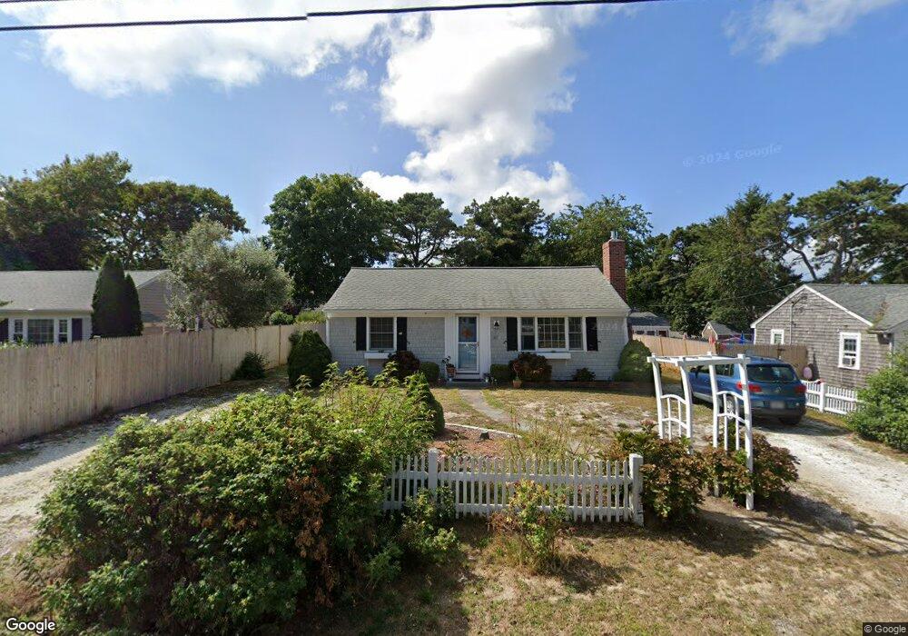
61 Susan Ruth Rd Dennis Port, MA 02639
Dennis Port NeighborhoodEstimated Value: $562,000 - $673,000
3
Beds
1
Bath
984
Sq Ft
$632/Sq Ft
Est. Value
About This Home
This home is located at 61 Susan Ruth Rd, Dennis Port, MA 02639 and is currently estimated at $621,680, approximately $631 per square foot. 61 Susan Ruth Rd is a home located in Barnstable County with nearby schools including Dennis-Yarmouth Regional High School and St. Pius X. School.
Ownership History
Date
Name
Owned For
Owner Type
Purchase Details
Closed on
Jan 11, 2008
Sold by
Chester-Cestaro Virginia
Bought by
61 Susan Ruth Road Rt
Current Estimated Value
Purchase Details
Closed on
Dec 20, 2006
Sold by
Saidy Deborah V
Bought by
Chseter-Cestaro Virginia
Purchase Details
Closed on
May 1, 2006
Sold by
Viets Miriam W
Bought by
Saidy Deborah
Create a Home Valuation Report for This Property
The Home Valuation Report is an in-depth analysis detailing your home's value as well as a comparison with similar homes in the area
Home Values in the Area
Average Home Value in this Area
Purchase History
| Date | Buyer | Sale Price | Title Company |
|---|---|---|---|
| 61 Susan Ruth Road Rt | -- | -- | |
| Chseter-Cestaro Virginia | $284,000 | -- | |
| Saidy Deborah | -- | -- |
Source: Public Records
Tax History Compared to Growth
Tax History
| Year | Tax Paid | Tax Assessment Tax Assessment Total Assessment is a certain percentage of the fair market value that is determined by local assessors to be the total taxable value of land and additions on the property. | Land | Improvement |
|---|---|---|---|---|
| 2025 | $2,640 | $609,600 | $283,900 | $325,700 |
| 2024 | $2,478 | $564,500 | $273,000 | $291,500 |
| 2023 | $2,397 | $513,300 | $248,200 | $265,100 |
| 2022 | $2,185 | $390,200 | $195,600 | $194,600 |
| 2021 | $2,065 | $342,500 | $191,800 | $150,700 |
| 2020 | $3,476 | $328,500 | $191,800 | $136,700 |
| 2019 | $5,673 | $325,600 | $204,200 | $121,400 |
| 2018 | $3,223 | $306,100 | $194,400 | $111,700 |
| 2017 | $1,766 | $287,100 | $179,000 | $108,100 |
| 2016 | $1,705 | $261,100 | $168,800 | $92,300 |
| 2015 | $1,671 | $261,100 | $168,800 | $92,300 |
| 2014 | $1,593 | $250,900 | $158,600 | $92,300 |
Source: Public Records
Map
Nearby Homes
- 64 Beaten Rd
- 112 Old Wharf Rd Unit E4
- 112 Old Wharf Rd Unit E1
- 37 Ocean Dr Unit 2
- 120 Old Wharf Rd Unit 11
- 154 Old Wharf Rd Unit 26
- 154 Old Wharf Rd Unit 14
- 217 Old Wharf Rd Unit 64
- 241 Old Wharf Rd Unit 82
- 241 Old Wharf Rd Unit 127
- 241 Old Wharf Rd Unit 90
- 262 Old Wharf Rd Unit 67
- 262 Old Wharf Rd Unit 5
- 262 Old Wharf Rd Unit 5
- 262 Old Wharf Rd Unit 20
- 262 Old Wharf Rd Unit 87
- 80 Michaels Ave
- 6 Baker Way
- 37 Beach Hills Rd
- 31 Easy St
- 65 Susan Ruth Rd
- 69 Susan Ruth Rd
- 54 Ocean Dr
- 52 Ocean Dr
- 55 Susan Ruth Rd
- 59 Susan Ruth Rd
- 69 Beaten Rd Unit 13
- 69 Beaten Rd Unit 8
- 69 Beaten Rd Unit 4
- 69 Beaten Rd Unit 12
- 69 Beaten Rd Unit 5
- 69 Beaten Rd Unit 15
- 69 Beaten Rd Unit 14
- 69 Beaten Rd Unit 10
- 69 Beaten Rd Unit 1
- 69 Beaten Rd Unit 6
- 69 Beaten Rd Unit 3
- 69 Beaten Rd Unit 11
- 69 Beaten Rd Unit 2
- 69 Beaten Rd Unit 7