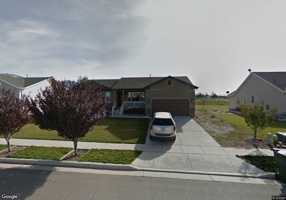
61 W 2100 N Tooele, UT 84074
Estimated Value: $449,000 - $521,000
--
Bed
--
Bath
3,096
Sq Ft
$158/Sq Ft
Est. Value
About This Home
This home is located at 61 W 2100 N, Tooele, UT 84074 and is currently estimated at $489,279, approximately $158 per square foot. 61 W 2100 N is a home located in Tooele County with nearby schools including Overlake Elementary School, Clarke N. Johnsen Junior High School, and Stansbury High School.
Ownership History
Date
Name
Owned For
Owner Type
Purchase Details
Closed on
May 26, 2022
Sold by
Michael Swanson
Bought by
Swanson Michael Brent
Current Estimated Value
Home Financials for this Owner
Home Financials are based on the most recent Mortgage that was taken out on this home.
Original Mortgage
$172,792
Outstanding Balance
$163,926
Interest Rate
5.1%
Mortgage Type
New Conventional
Estimated Equity
$325,353
Purchase Details
Closed on
May 2, 2022
Sold by
Roberts Brooke L
Bought by
Swanson Michael
Home Financials for this Owner
Home Financials are based on the most recent Mortgage that was taken out on this home.
Original Mortgage
$172,792
Outstanding Balance
$163,926
Interest Rate
5.1%
Mortgage Type
New Conventional
Estimated Equity
$325,353
Purchase Details
Closed on
Apr 29, 2022
Sold by
Roberts Brooke L
Bought by
Roberts Brooke L
Home Financials for this Owner
Home Financials are based on the most recent Mortgage that was taken out on this home.
Original Mortgage
$172,792
Outstanding Balance
$163,926
Interest Rate
5.1%
Mortgage Type
New Conventional
Estimated Equity
$325,353
Purchase Details
Closed on
Feb 20, 2018
Sold by
Roberts Brooke L
Bought by
Roberts Brooke L and Daybell Matthew Bryan
Purchase Details
Closed on
Feb 12, 2007
Sold by
Roberts Rett
Bought by
Roberts Rett and Roberts Brooke L
Home Financials for this Owner
Home Financials are based on the most recent Mortgage that was taken out on this home.
Original Mortgage
$32,250
Interest Rate
6.19%
Mortgage Type
Future Advance Clause Open End Mortgage
Purchase Details
Closed on
Jan 26, 2007
Sold by
Roberts Rett and Roberts Brooke
Bought by
Robets Rett
Home Financials for this Owner
Home Financials are based on the most recent Mortgage that was taken out on this home.
Original Mortgage
$32,250
Interest Rate
6.19%
Mortgage Type
Future Advance Clause Open End Mortgage
Purchase Details
Closed on
Apr 17, 2006
Sold by
Hallmark Homes And Development
Bought by
Roberts Rett and Roberts Brooke
Home Financials for this Owner
Home Financials are based on the most recent Mortgage that was taken out on this home.
Original Mortgage
$143,150
Interest Rate
6.2%
Mortgage Type
New Conventional
Create a Home Valuation Report for This Property
The Home Valuation Report is an in-depth analysis detailing your home's value as well as a comparison with similar homes in the area
Home Values in the Area
Average Home Value in this Area
Purchase History
| Date | Buyer | Sale Price | Title Company |
|---|---|---|---|
| Swanson Michael Brent | -- | New Title Company Name | |
| Swanson Michael | -- | National Title | |
| Roberts Brooke L | -- | National Title | |
| Roberts Brooke L | -- | Access Title Company | |
| Roberts Rett | -- | Merrill Title Co | |
| Robets Rett | -- | Merrill Title Company | |
| Roberts Rett | -- | Merrill Title Co |
Source: Public Records
Mortgage History
| Date | Status | Borrower | Loan Amount |
|---|---|---|---|
| Open | Swanson Michael | $172,792 | |
| Previous Owner | Roberts Rett | $32,250 | |
| Previous Owner | Robets Rett | $172,000 | |
| Previous Owner | Roberts Rett | $143,150 |
Source: Public Records
Tax History Compared to Growth
Tax History
| Year | Tax Paid | Tax Assessment Tax Assessment Total Assessment is a certain percentage of the fair market value that is determined by local assessors to be the total taxable value of land and additions on the property. | Land | Improvement |
|---|---|---|---|---|
| 2025 | $2,826 | $414,102 | $108,750 | $305,352 |
| 2024 | $3,084 | $228,063 | $59,813 | $168,250 |
| 2023 | $3,084 | $239,818 | $56,955 | $182,863 |
| 2022 | $2,539 | $209,809 | $69,768 | $140,041 |
| 2021 | $2,498 | $171,601 | $22,928 | $148,673 |
| 2020 | $2,339 | $283,040 | $41,688 | $241,352 |
| 2019 | $2,267 | $271,547 | $41,688 | $229,859 |
| 2018 | $2,061 | $234,796 | $40,000 | $194,796 |
| 2017 | $1,647 | $222,052 | $40,000 | $182,052 |
| 2016 | $1,459 | $108,552 | $16,500 | $92,052 |
| 2015 | $1,459 | $103,453 | $0 | $0 |
| 2014 | -- | $103,453 | $0 | $0 |
Source: Public Records
Map
Nearby Homes
- 2057 N Loxley Dr
- 2065 N Loxley Dr
- 2117 N 170 W
- 2155 N 170 W
- 81 W 1930 N
- 69 1930 N
- 1909 N 70 W
- 1893 N 70 W
- 1893 N 70 W Unit 620
- 1885 N 70 W Unit 619
- 1877 N 70 W Unit 618
- 1861 N 70 W Unit 616
- Drysdale Twinhomes Plan at Drysdale Twinhomes
- 535 W 2030 N Unit 23
- 228 W 2370 N
- 1778 Brett St
- 2098 N 425 W Unit 240
- 2098 N 425 W
- 1913 N 370 W
- 2157 N 425 W Unit 233
- 49 W 2100 N
- 71 W 2100 N
- 37 W 2100 N
- 83 W 2100 N
- 2113 N 50 W
- 2114 N 90 W
- 25 W 2100 N
- 95 W 2100 N
- 2116 N 50 W
- 2127 N 50 W
- 2124 N 90 W
- 2128 N 50 W
- 11 W 2100 N
- 107 W 2100 N
- 2065 N Loxley Dr Unit 37980821
- 2065 N Loxley Dr Unit 37980751
- 2065 N Loxley Dr Unit 37980742
- 2065 N Loxley Dr Unit 37980722
- 2065 N Loxley Dr Unit 37980702
- 2065 N Loxley Dr Unit 37316430