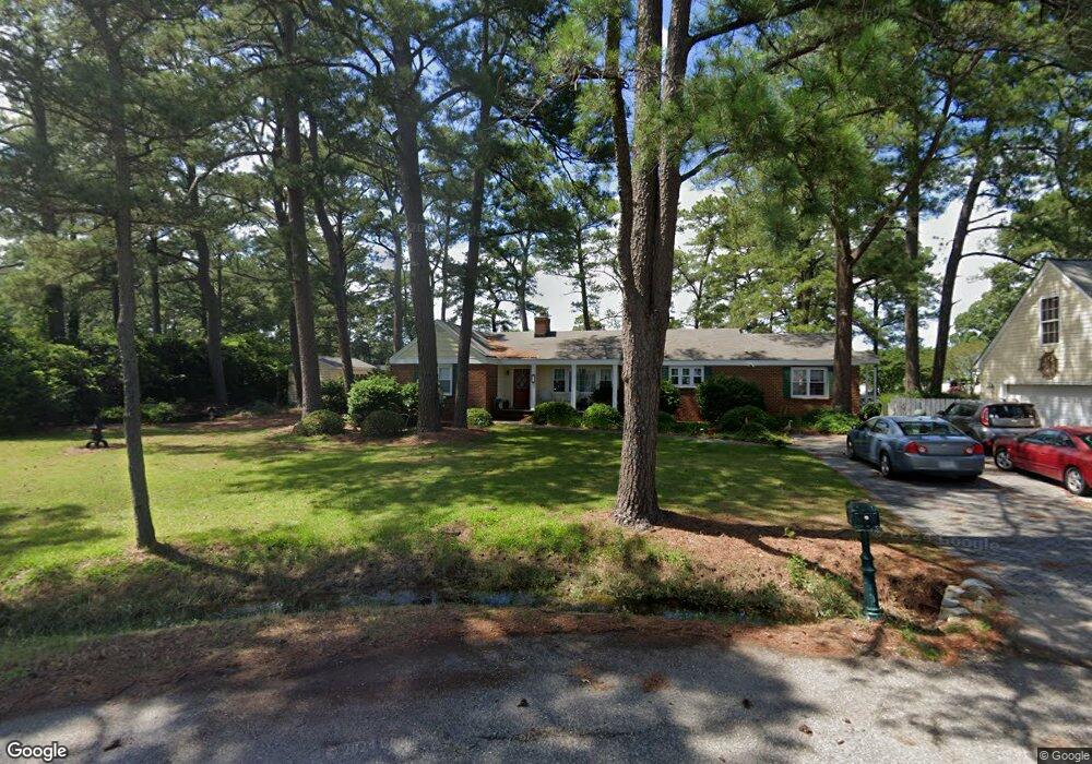
61 W Sandy Point Rd Poquoson, VA 23662
Poquoson Shores NeighborhoodEstimated Value: $624,000 - $839,000
3
Beds
4
Baths
2,556
Sq Ft
$277/Sq Ft
Est. Value
About This Home
This home is located at 61 W Sandy Point Rd, Poquoson, VA 23662 and is currently estimated at $707,278, approximately $276 per square foot. 61 W Sandy Point Rd is a home located in Poquoson City with nearby schools including Emmanuel Lutheran School and Summit Christian Academy - Upper School.
Ownership History
Date
Name
Owned For
Owner Type
Purchase Details
Closed on
Jul 20, 2020
Sold by
Craig Robert S
Bought by
Craig Robert S and The Robert S Craig Revocable Trust
Current Estimated Value
Create a Home Valuation Report for This Property
The Home Valuation Report is an in-depth analysis detailing your home's value as well as a comparison with similar homes in the area
Home Values in the Area
Average Home Value in this Area
Purchase History
| Date | Buyer | Sale Price | Title Company |
|---|---|---|---|
| Craig Robert S | -- | None Available |
Source: Public Records
Tax History Compared to Growth
Tax History
| Year | Tax Paid | Tax Assessment Tax Assessment Total Assessment is a certain percentage of the fair market value that is determined by local assessors to be the total taxable value of land and additions on the property. | Land | Improvement |
|---|---|---|---|---|
| 2024 | $6,557 | $575,200 | $273,600 | $301,600 |
| 2023 | $6,385 | $575,200 | $273,600 | $301,600 |
| 2022 | $5,914 | $523,400 | $273,600 | $249,800 |
| 2021 | $5,914 | $523,400 | $273,600 | $249,800 |
| 2020 | $0 | $501,100 | $273,600 | $227,500 |
| 2019 | -- | $501,100 | $273,600 | $227,500 |
| 2018 | -- | $494,600 | $273,600 | $221,000 |
| 2017 | -- | $471,800 | $273,600 | $198,200 |
| 2016 | -- | $471,800 | $273,600 | $198,200 |
| 2015 | -- | $471,800 | $273,600 | $198,200 |
| 2013 | -- | $471,800 | $273,600 | $198,200 |
Source: Public Records
Map
Nearby Homes
- 15+AC Browns Neck Rd
- 41 W Sandy Point Rd
- 1 Phillips Rd
- 28 Pasture Rd
- 105 Rens Rd Unit 30
- 105 Rens Rd Unit 2
- 105 Rens Rd Unit 74
- 105 Rens Rd Unit Lot 48
- 35 River Rd
- 29 River Rd
- 8 Wornom Farm Rd
- 102 Blue Crab Dr
- 11 Valmoore Dr
- 108 Rens Rd
- 6 Lessies Dr
- 62 Rens Rd
- 11 Dorothy Dr
- 21 Rens Rd
- 40 Valmoore Dr
- 718C Poquoson Ave
- 59 W Sandy Point Rd
- 59 W Sandy Point Rd
- 6 E Sandy Point Rd
- 4 E Sandy Point Rd
- 8 E Sandy Point Rd
- 14 W Sandy Point Rd
- 12 W Sandy Point Rd
- 53 W Sandy Point Rd
- 10 E Sandy Point Rd
- 10 W Sandy Point Rd
- 2 E Sandy Point Rd
- 57 W Sandy Point Rd
- 12 E Sandy Point Rd
- 8 W Sandy Point Rd
- 1 E Sandy Point Rd
- 7 E Sandy Point Rd
- 91 Browns Neck Rd
- 89 Browns Neck Rd
- 93 Browns Neck Rd
- 3 E Sandy Point Rd