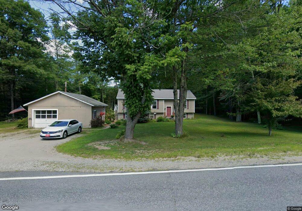
61 Weston Rd Turner, ME 04282
Estimated Value: $288,000 - $493,000
Studio
--
Bath
1,104
Sq Ft
$329/Sq Ft
Est. Value
About This Home
This home is located at 61 Weston Rd, Turner, ME 04282 and is currently estimated at $362,866, approximately $328 per square foot. 61 Weston Rd is a home located in Androscoggin County with nearby schools including Tripp Middle School, Leavitt Area High School, and Calvary Christian Academy.
Ownership History
Date
Name
Owned For
Owner Type
Purchase Details
Closed on
Jun 17, 2008
Sold by
Sweetser Frank L
Bought by
Roy Shawn A
Current Estimated Value
Home Financials for this Owner
Home Financials are based on the most recent Mortgage that was taken out on this home.
Original Mortgage
$140,250
Outstanding Balance
$92,834
Interest Rate
6.13%
Mortgage Type
FHA
Estimated Equity
$270,032
Create a Home Valuation Report for This Property
The Home Valuation Report is an in-depth analysis detailing your home's value as well as a comparison with similar homes in the area
Home Values in the Area
Average Home Value in this Area
Purchase History
| Date | Buyer | Sale Price | Title Company |
|---|---|---|---|
| Roy Shawn A | -- | -- |
Source: Public Records
Mortgage History
| Date | Status | Borrower | Loan Amount |
|---|---|---|---|
| Open | Roy Shawn A | $140,250 |
Source: Public Records
Tax History
| Year | Tax Paid | Tax Assessment Tax Assessment Total Assessment is a certain percentage of the fair market value that is determined by local assessors to be the total taxable value of land and additions on the property. | Land | Improvement |
|---|---|---|---|---|
| 2025 | $2,602 | $191,300 | $51,000 | $140,300 |
| 2024 | $2,439 | $191,300 | $51,000 | $140,300 |
| 2023 | $2,401 | $191,300 | $51,000 | $140,300 |
| 2022 | $2,181 | $191,300 | $51,000 | $140,300 |
| 2021 | $2,181 | $191,300 | $51,000 | $140,300 |
| 2020 | $2,141 | $119,600 | $27,200 | $92,400 |
| 2019 | $2,153 | $119,600 | $27,200 | $92,400 |
| 2018 | $2,123 | $119,600 | $27,200 | $92,400 |
| 2016 | $2,016 | $119,600 | $27,200 | $92,400 |
| 2015 | $1,902 | $119,600 | $27,200 | $92,400 |
| 2014 | $1,878 | $119,600 | $27,200 | $92,400 |
| 2013 | $1,792 | $119,600 | $27,200 | $92,400 |
Source: Public Records
Map
Nearby Homes
- 0 Auburn Rd Unit 1648743
- 28-1 Auburn Rd
- Lot 21 Auburn Rd
- 33-028 Auburn Rd
- 00000 Auburn Rd
- 50 Magnum Dr
- 15 Seaward Rd
- 51 School House Hill Rd
- 440 Mountainside Dr
- 23 Shire Ln
- 14 Shire
- 562 Lower St
- 60 Back Bryant Rd
- 78 Sunset Blvd
- 42 Center Bridge Rd
- 8-3 Turner St
- 17 Aspen Way
- 346 N Parish Rd
- 183 Pleasant Pond Rd
- 5 Deer Run
Your Personal Tour Guide
Ask me questions while you tour the home.