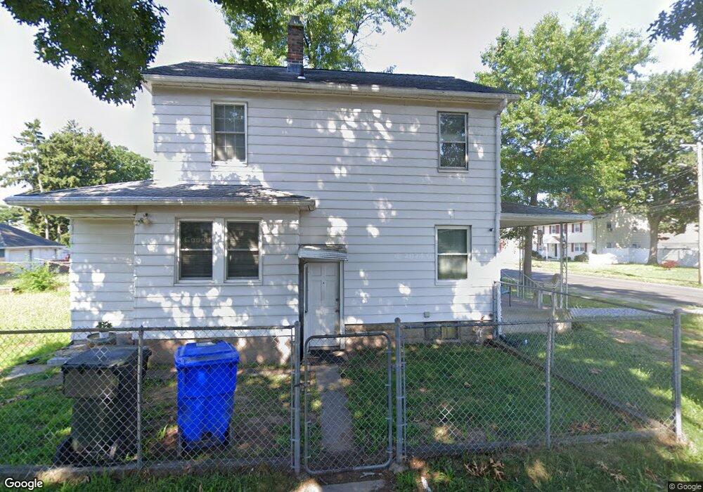
61 Whiting Rd East Hartford, CT 06118
Estimated Value: $264,283 - $282,000
3
Beds
2
Baths
1,284
Sq Ft
$212/Sq Ft
Est. Value
About This Home
This home is located at 61 Whiting Rd, East Hartford, CT 06118 and is currently estimated at $272,071, approximately $211 per square foot. 61 Whiting Rd is a home located in Hartford County with nearby schools including East Hartford Middle School, East Hartford High School, and Grace Academy Hartford.
Ownership History
Date
Name
Owned For
Owner Type
Purchase Details
Closed on
Jan 13, 2011
Sold by
Conary Jerrolyn L
Bought by
Caballero Angel and Gomez-Alicea Sasha
Current Estimated Value
Home Financials for this Owner
Home Financials are based on the most recent Mortgage that was taken out on this home.
Original Mortgage
$124,700
Outstanding Balance
$81,231
Interest Rate
3.87%
Mortgage Type
FHA
Estimated Equity
$190,840
Create a Home Valuation Report for This Property
The Home Valuation Report is an in-depth analysis detailing your home's value as well as a comparison with similar homes in the area
Home Values in the Area
Average Home Value in this Area
Purchase History
| Date | Buyer | Sale Price | Title Company |
|---|---|---|---|
| Caballero Angel | $128,000 | -- |
Source: Public Records
Mortgage History
| Date | Status | Borrower | Loan Amount |
|---|---|---|---|
| Open | Caballero Angel | $16,500 | |
| Open | Caballero Angel | $124,700 | |
| Closed | Caballero Angel | $11,750 | |
| Previous Owner | Caballero Angel | $60,000 |
Source: Public Records
Tax History Compared to Growth
Tax History
| Year | Tax Paid | Tax Assessment Tax Assessment Total Assessment is a certain percentage of the fair market value that is determined by local assessors to be the total taxable value of land and additions on the property. | Land | Improvement |
|---|---|---|---|---|
| 2025 | $5,196 | $113,210 | $35,420 | $77,790 |
| 2024 | $4,981 | $113,210 | $35,420 | $77,790 |
| 2023 | $4,816 | $113,210 | $35,420 | $77,790 |
| 2022 | $4,642 | $113,210 | $35,420 | $77,790 |
| 2021 | $4,058 | $82,220 | $25,260 | $56,960 |
| 2020 | $4,104 | $82,220 | $25,260 | $56,960 |
| 2019 | $4,038 | $82,220 | $25,260 | $56,960 |
| 2018 | $3,919 | $82,220 | $25,260 | $56,960 |
| 2017 | $3,868 | $82,220 | $25,260 | $56,960 |
| 2016 | $3,626 | $79,060 | $22,100 | $56,960 |
| 2015 | $3,626 | $79,060 | $22,100 | $56,960 |
| 2014 | $3,589 | $79,060 | $22,100 | $56,960 |
Source: Public Records
Map
Nearby Homes
- 24 Whiting Rd
- 67 Sisson St Unit 69
- 441 Main St Unit 404
- 16 Whitney St
- 49 Willys St
- 61 Central Ave Unit 63
- 31 High St Unit 8204
- 50 Garvan St
- 41 Bissell St
- 47 Elm St
- 88 Governor St Unit 90
- 115 Governor St
- 642 Silver Ln
- 210 Brewer St
- 85R Olmsted St
- 98 Olmsted St
- 247 Main St
- 347 Prospect St Unit 349
- 246 Main St
- 52 Burnside Ave
- 57 Whiting Rd
- 67 Whiting Rd
- 55 Whiting Rd Unit 57
- 51 Whiting Rd Unit 53
- 71 Whiting Rd
- 54 Pratt St
- 50 Pratt St Unit 2
- 50 Pratt St
- 60 Pratt St Unit 62
- 47 Whiting Rd
- 46 Pratt St
- 75 Whiting Rd Unit 77
- 60 Whiting Rd
- 52 Whiting Rd Unit 54
- 72 Whiting Rd
- 40 Pratt St
- 64 Pratt St Unit 66
- 46 Whiting Rd Unit 48
- 41 Whiting Rd Unit 43
- 70 Pratt St