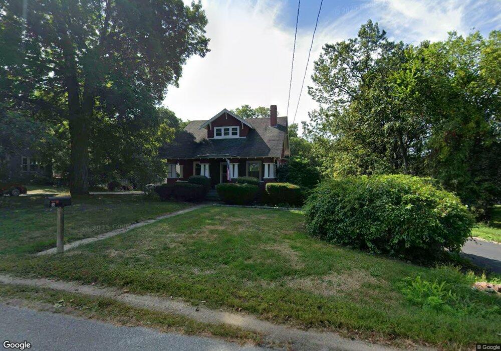
61 Wilder Rd Leominster, MA 01453
Estimated Value: $410,000 - $488,000
3
Beds
1
Bath
1,106
Sq Ft
$393/Sq Ft
Est. Value
About This Home
This home is located at 61 Wilder Rd, Leominster, MA 01453 and is currently estimated at $435,198, approximately $393 per square foot. 61 Wilder Rd is a home located in Worcester County with nearby schools including Leominster High School, St Bernards Elementary School, and St. Leo School.
Ownership History
Date
Name
Owned For
Owner Type
Purchase Details
Closed on
Mar 31, 1987
Sold by
Nagle Cheryl E
Bought by
Roumas J A
Current Estimated Value
Home Financials for this Owner
Home Financials are based on the most recent Mortgage that was taken out on this home.
Original Mortgage
$95,900
Interest Rate
9.03%
Mortgage Type
Purchase Money Mortgage
Create a Home Valuation Report for This Property
The Home Valuation Report is an in-depth analysis detailing your home's value as well as a comparison with similar homes in the area
Home Values in the Area
Average Home Value in this Area
Purchase History
| Date | Buyer | Sale Price | Title Company |
|---|---|---|---|
| Roumas J A | $119,900 | -- |
Source: Public Records
Mortgage History
| Date | Status | Borrower | Loan Amount |
|---|---|---|---|
| Open | Roumas J A | $15,000 | |
| Closed | Roumas J A | $95,900 |
Source: Public Records
Tax History Compared to Growth
Tax History
| Year | Tax Paid | Tax Assessment Tax Assessment Total Assessment is a certain percentage of the fair market value that is determined by local assessors to be the total taxable value of land and additions on the property. | Land | Improvement |
|---|---|---|---|---|
| 2025 | $5,633 | $401,500 | $140,100 | $261,400 |
| 2024 | $5,322 | $366,800 | $133,400 | $233,400 |
| 2023 | $5,175 | $333,000 | $116,000 | $217,000 |
| 2022 | $5,014 | $302,800 | $100,900 | $201,900 |
| 2021 | $4,872 | $268,700 | $78,500 | $190,200 |
| 2020 | $4,709 | $261,900 | $78,500 | $183,400 |
| 2019 | $621 | $246,700 | $74,700 | $172,000 |
| 2018 | $4,260 | $220,400 | $72,500 | $147,900 |
| 2017 | $594 | $211,800 | $67,700 | $144,100 |
| 2016 | $3,973 | $202,900 | $67,700 | $135,200 |
| 2015 | $3,845 | $197,800 | $67,700 | $130,100 |
| 2014 | $3,784 | $200,300 | $75,000 | $125,300 |
Source: Public Records
Map
Nearby Homes
- 1479 Main St
- 24 North St
- 4 Lincoln St
- 23-25 Kimball St
- 313 Lincoln St
- 452 Hollis Rd
- 24 Causeway Terrace
- 1084 Main St
- 200-365 Hollis Rd
- 270 Day St
- 11 Dale Ave
- 291 Joslin St
- 5 Ramgren Rd
- 3 Rennie St
- 146-148 Kilburn St
- 17 Fernwood Dr Unit G
- 36 Fox Meadow Rd Unit A
- 17 Fernwood Dr Unit D
- 51 Fox Meadow Rd Unit C
- 48 Fox Meadow Rd Unit G