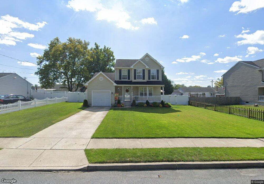
610 10th Ave Lindenwold, NJ 08021
Estimated Value: $294,026 - $397,000
--
Bed
--
Bath
1,360
Sq Ft
$254/Sq Ft
Est. Value
About This Home
This home is located at 610 10th Ave, Lindenwold, NJ 08021 and is currently estimated at $345,507, approximately $254 per square foot. 610 10th Ave is a home located in Camden County with nearby schools including Memorial Middle School, Lindenwold High School, and Saint John Paul II Regional School.
Ownership History
Date
Name
Owned For
Owner Type
Purchase Details
Closed on
Aug 19, 2005
Sold by
Castle Development Svcs Inc
Bought by
Volpe James and Volpe Jane
Current Estimated Value
Home Financials for this Owner
Home Financials are based on the most recent Mortgage that was taken out on this home.
Original Mortgage
$183,480
Interest Rate
5.85%
Create a Home Valuation Report for This Property
The Home Valuation Report is an in-depth analysis detailing your home's value as well as a comparison with similar homes in the area
Home Values in the Area
Average Home Value in this Area
Purchase History
| Date | Buyer | Sale Price | Title Company |
|---|---|---|---|
| Volpe James | $237,850 | -- |
Source: Public Records
Mortgage History
| Date | Status | Borrower | Loan Amount |
|---|---|---|---|
| Previous Owner | Volpe James | $183,480 |
Source: Public Records
Tax History Compared to Growth
Tax History
| Year | Tax Paid | Tax Assessment Tax Assessment Total Assessment is a certain percentage of the fair market value that is determined by local assessors to be the total taxable value of land and additions on the property. | Land | Improvement |
|---|---|---|---|---|
| 2025 | $9,331 | $188,700 | $37,500 | $151,200 |
| 2024 | $9,382 | $188,700 | $37,500 | $151,200 |
| 2023 | $9,382 | $188,700 | $37,500 | $151,200 |
| 2022 | $9,373 | $188,700 | $37,500 | $151,200 |
| 2021 | $9,631 | $188,700 | $37,500 | $151,200 |
| 2020 | $9,575 | $188,700 | $37,500 | $151,200 |
| 2019 | $9,660 | $188,700 | $37,500 | $151,200 |
| 2018 | $9,635 | $188,700 | $37,500 | $151,200 |
| 2017 | $9,346 | $188,700 | $37,500 | $151,200 |
| 2016 | $9,137 | $188,700 | $37,500 | $151,200 |
| 2015 | $8,752 | $188,700 | $37,500 | $151,200 |
| 2014 | $8,371 | $188,700 | $37,500 | $151,200 |
Source: Public Records
Map
Nearby Homes
- 1802 Greenwood Dr
- 1908 Greenwood Dr Unit C1908
- 609 8th Ave
- 2005 Greenwood Dr
- 2004 Greenwood Dr
- 524 8th Ave
- 2210 Greenwood Dr
- 2209 Greenwood Dr
- 2702 Greenwood Dr
- 531 6th Ave
- 2703 Greenwood Dr
- 2502 Greenwood Dr
- 441 8th Ave
- 104 Timber Creek Rd
- 809 Jaguar Rd
- 605 4th Ave
- 409 9th Ave
- 610 Timber Creek Rd
- 207 Timber Creek Rd
- 37 Chiswick Dr
- 608 10th Ave
- 619 Chews Landing Rd
- 615 Chews Landing Rd
- 604 10th Ave
- 615 10th Ave
- 619 10th Ave
- 609 10th Ave
- 605 10th Ave
- 625 10th Ave
- 584 Chews Landing Rd
- 1408 Homesite Ave
- 624 9th Ave
- 635 10th Ave
- 604 9th Ave
- 601 10th Ave
- 634 9th Ave
- 600 9th Ave
- 582-598 Chews Landing Rd
- 1401 Homesite Ave
- 642 9th Ave