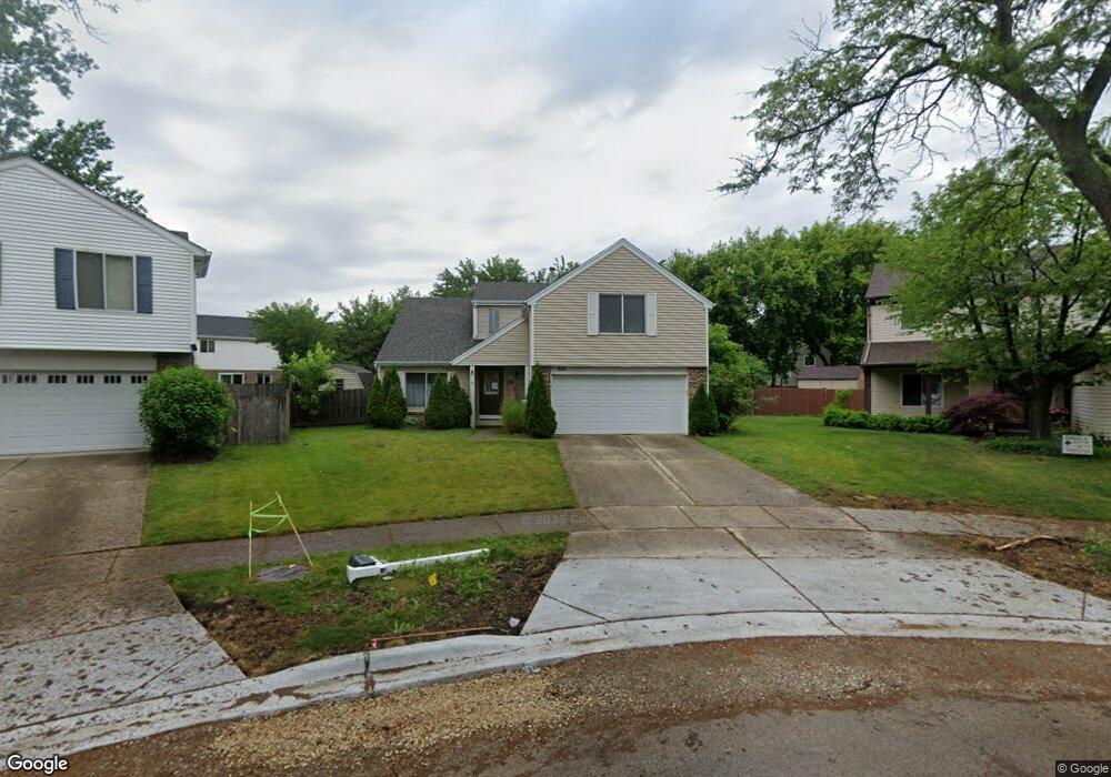
610 Armstrong Ct N Buffalo Grove, IL 60089
Estimated Value: $516,000 - $551,000
4
Beds
3
Baths
2,223
Sq Ft
$238/Sq Ft
Est. Value
About This Home
This home is located at 610 Armstrong Ct N, Buffalo Grove, IL 60089 and is currently estimated at $529,899, approximately $238 per square foot. 610 Armstrong Ct N is a home located in Lake County with nearby schools including Meridian Middle School, Earl Pritchett School, and Aptakisic Junior High School.
Ownership History
Date
Name
Owned For
Owner Type
Purchase Details
Closed on
Apr 22, 2019
Sold by
Chirayil John and Chirayil Teresa
Bought by
Chirayil John and Chirayil Nisha T
Current Estimated Value
Purchase Details
Closed on
Nov 23, 2011
Sold by
Ulrich Laurie S
Bought by
Chirayil John
Home Financials for this Owner
Home Financials are based on the most recent Mortgage that was taken out on this home.
Original Mortgage
$172,800
Outstanding Balance
$118,344
Interest Rate
4.11%
Mortgage Type
New Conventional
Estimated Equity
$411,555
Purchase Details
Closed on
Nov 7, 1997
Sold by
Ulrich Andrew H
Bought by
Ulrich Laurie S
Purchase Details
Closed on
Nov 7, 1994
Sold by
Ulrich Andrew H and Ulrich Laurie S
Bought by
Ulrich Laurie S
Create a Home Valuation Report for This Property
The Home Valuation Report is an in-depth analysis detailing your home's value as well as a comparison with similar homes in the area
Home Values in the Area
Average Home Value in this Area
Purchase History
| Date | Buyer | Sale Price | Title Company |
|---|---|---|---|
| Chirayil John | -- | Attorney | |
| Chirayil John | $216,000 | None Available | |
| Ulrich Laurie S | -- | -- | |
| Ulrich Laurie S | -- | -- |
Source: Public Records
Mortgage History
| Date | Status | Borrower | Loan Amount |
|---|---|---|---|
| Open | Chirayil John | $172,800 |
Source: Public Records
Tax History Compared to Growth
Tax History
| Year | Tax Paid | Tax Assessment Tax Assessment Total Assessment is a certain percentage of the fair market value that is determined by local assessors to be the total taxable value of land and additions on the property. | Land | Improvement |
|---|---|---|---|---|
| 2024 | $11,848 | $130,397 | $32,628 | $97,769 |
| 2023 | $11,421 | $123,039 | $30,787 | $92,252 |
| 2022 | $11,421 | $122,897 | $30,667 | $92,230 |
| 2021 | $11,015 | $121,572 | $30,336 | $91,236 |
| 2020 | $10,800 | $121,986 | $30,439 | $91,547 |
| 2019 | $11,054 | $121,537 | $30,327 | $91,210 |
| 2018 | $11,016 | $120,771 | $32,970 | $87,801 |
| 2017 | $10,878 | $117,952 | $32,200 | $85,752 |
| 2016 | $10,521 | $112,948 | $30,834 | $82,114 |
| 2015 | $10,346 | $105,628 | $28,836 | $76,792 |
| 2014 | $6,868 | $69,342 | $30,969 | $38,373 |
| 2012 | $6,638 | $69,481 | $31,031 | $38,450 |
Source: Public Records
Map
Nearby Homes
- 353 Le Parc Cir Unit 186
- 220 Osage Ln
- 409 Hazelwood Terrace
- 434 Dogwood Terrace
- 1062 Driftwood Ct Unit 1
- 215 Woodstone Dr
- 211 Woodstone Dr
- 463 Raphael Ave
- 1324 Alpine Ct Unit 104
- 20698 N Eugene Ave
- 20665 N Weiland Rd
- 543 Wynn Ct Unit 3
- 550 Greystone Ln Unit A2
- 588 Fairway View Dr Unit 2E
- 104 Steeple Dr Unit C
- 128 Woodstone Dr
- 126 Woodstone Dr Unit 14
- 412 Bluebird Ln Unit 412
- 20772 N William Ave
- 886 Swan Ln Unit 82-5
- 612 Armstrong Ct N
- 608 Armstrong Ct N
- 115 Lilac Ln
- 111 Lilac Ln
- 119 Lilac Ln
- 606 Armstrong Ct N
- 123 Lilac Ln
- 614 Armstrong Ct N Unit 1
- 129 Lilac Ln
- 107 Lilac Ln
- 131 Lilac Ln
- 604 Armstrong Ct N
- 616 Armstrong Ct N
- 133 Lilac Ln
- 105 Lilac Ln
- 618 Armstrong Ct N
- 135 Lilac Ln
- 103 Lilac Ln
- 114 Lilac Ln
- 112 Lilac Ln Unit 1