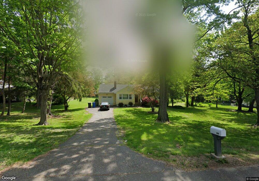
610 Daniels Farm Rd Trumbull, CT 06611
Daniel Farm District NeighborhoodEstimated Value: $576,000 - $747,000
3
Beds
2
Baths
1,172
Sq Ft
$538/Sq Ft
Est. Value
About This Home
This home is located at 610 Daniels Farm Rd, Trumbull, CT 06611 and is currently estimated at $630,470, approximately $537 per square foot. 610 Daniels Farm Rd is a home located in Fairfield County with nearby schools including Daniels Farm School, Hillcrest Middle School, and Trumbull High School.
Ownership History
Date
Name
Owned For
Owner Type
Purchase Details
Closed on
Sep 24, 2021
Sold by
Spera Evelyn B
Bought by
Singh Sanjay K and Singh Nidhi Archita
Current Estimated Value
Home Financials for this Owner
Home Financials are based on the most recent Mortgage that was taken out on this home.
Original Mortgage
$390,000
Outstanding Balance
$354,871
Interest Rate
2.8%
Mortgage Type
Purchase Money Mortgage
Estimated Equity
$275,599
Purchase Details
Closed on
Jul 8, 2014
Sold by
Pataky Mark and Benamati Melissa
Bought by
Pataky Meredith
Home Financials for this Owner
Home Financials are based on the most recent Mortgage that was taken out on this home.
Original Mortgage
$397,500
Interest Rate
4.14%
Mortgage Type
Reverse Mortgage Home Equity Conversion Mortgage
Create a Home Valuation Report for This Property
The Home Valuation Report is an in-depth analysis detailing your home's value as well as a comparison with similar homes in the area
Home Values in the Area
Average Home Value in this Area
Purchase History
| Date | Buyer | Sale Price | Title Company |
|---|---|---|---|
| Singh Sanjay K | $576,000 | None Available | |
| Pataky Meredith | -- | -- | |
| Pataky Meredith | -- | -- |
Source: Public Records
Mortgage History
| Date | Status | Borrower | Loan Amount |
|---|---|---|---|
| Open | Singh Sanjay K | $390,000 | |
| Previous Owner | Pataky Meredith | $397,500 |
Source: Public Records
Tax History Compared to Growth
Tax History
| Year | Tax Paid | Tax Assessment Tax Assessment Total Assessment is a certain percentage of the fair market value that is determined by local assessors to be the total taxable value of land and additions on the property. | Land | Improvement |
|---|---|---|---|---|
| 2025 | $7,554 | $204,610 | $131,880 | $72,730 |
| 2024 | $7,348 | $204,610 | $131,880 | $72,730 |
| 2023 | $7,229 | $204,610 | $131,880 | $72,730 |
| 2022 | $7,113 | $204,610 | $131,880 | $72,730 |
| 2021 | $6,551 | $179,270 | $119,980 | $59,290 |
| 2020 | $6,427 | $179,270 | $119,980 | $59,290 |
| 2018 | $6,268 | $179,270 | $119,980 | $59,290 |
| 2017 | $6,142 | $179,270 | $119,980 | $59,290 |
| 2016 | $6,018 | $179,270 | $119,980 | $59,290 |
| 2015 | $6,286 | $185,100 | $125,800 | $59,300 |
| 2014 | $6,151 | $185,100 | $125,800 | $59,300 |
Source: Public Records
Map
Nearby Homes
- 184 Putting Green Rd
- 75 Roosevelt Dr
- 93 Putting Green Rd N
- 50 Hemlock Trail
- 57 Gray Rock Rd
- 33 Enclave Dr Unit 33
- Lot 31 Valley View Rd
- 244 Strobel Rd
- 17 Rainbow Dr
- 11 Laurel St
- 58 Daniels Farm Rd
- 0 Main St
- 0 Pinewood Trail
- 119 Lewis Rd
- 7 Manor Dr
- 121 Lewis Rd
- 118 Greenbrier Rd
- 3 Pam Bar Dr
- 253 Mayfield Dr Unit 253
- 283 Mayfield Dr
- 622 Daniels Farm Rd
- 594 Daniels Farm Rd
- 15 Mayflower Dr
- 23 Mayflower Dr
- 650 Daniels Farm Rd
- 9 Heatherfield Dr
- 25 Strobel Rd
- 584 Daniels Farm Rd
- 31 Mayflower Dr
- 6 Heatherfield Dr
- 9 Mayflower Dr
- 6 Meadow Wood Rd
- 654 Daniels Farm Rd
- 16 Mayflower Dr
- 39 Mayflower Dr
- 14 Heatherfield Dr
- 653 Daniels Farm Rd
- 9 Old Orchard Ln
- 29 Strobel Rd
- 32 Mayflower Dr